ISS061-E-101311

| NASA Photo ID | ISS061-E-101311 |
| Focal Length | 800mm |
| Date taken | 2019.12.28 |
| Time taken | 18:43:26 GMT |
720 x 480 pixels 720 x 480 pixels 5568 x 3712 pixels 640 x 427 pixels
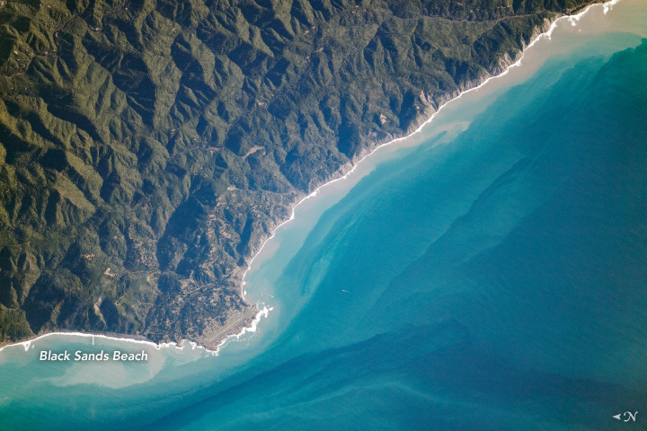
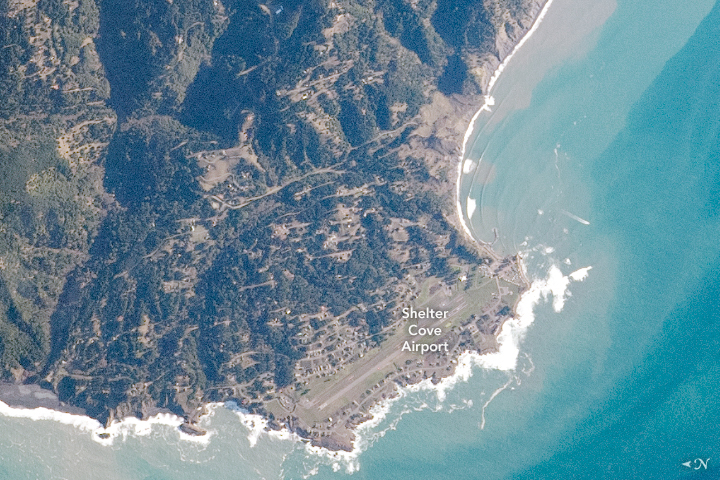
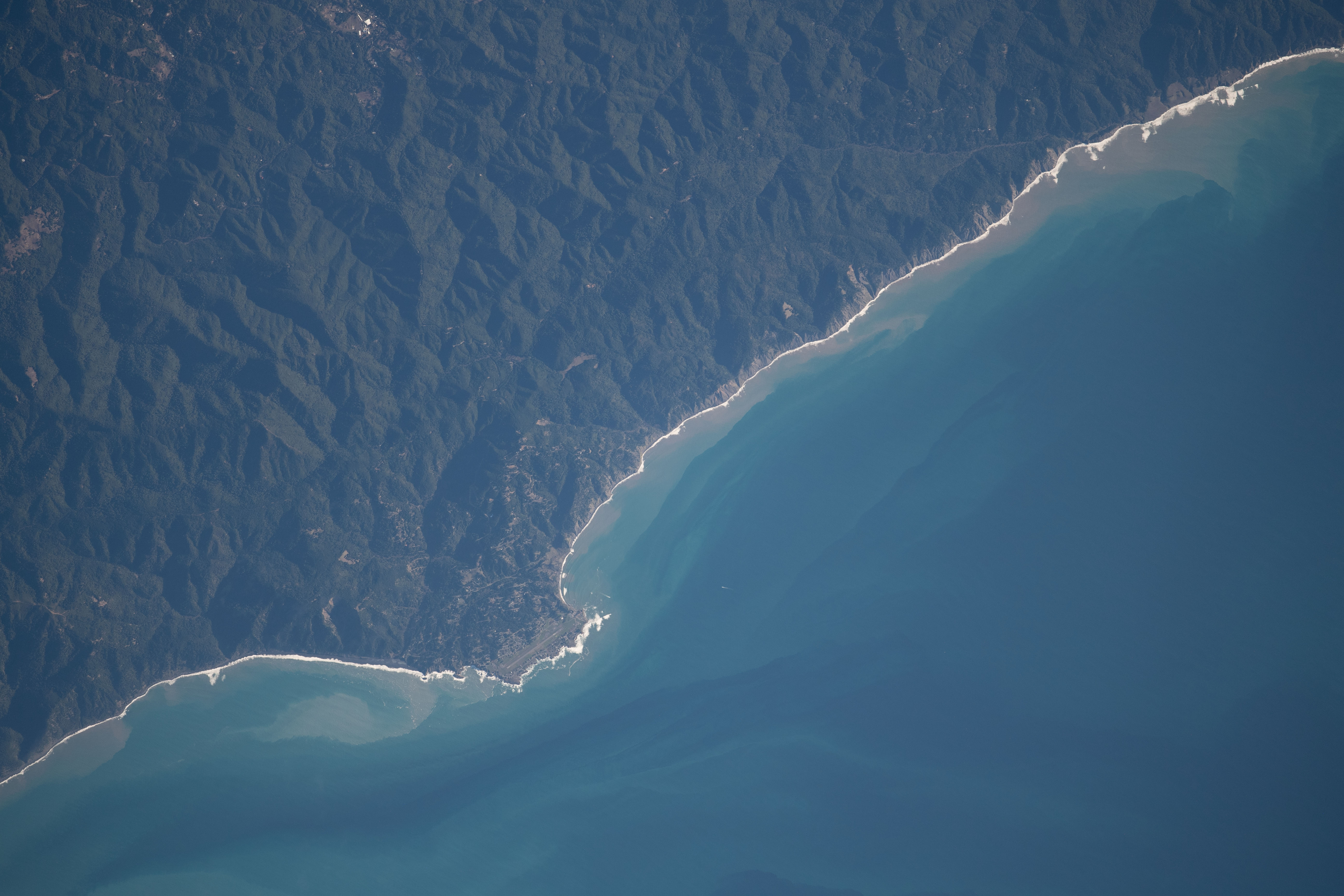


Photo center point: 40.0° N, 124.0° W
Photo center point by machine learning:
Country or Geographic Name: | USA-CALIFORNIA |
Features: | BLACK SANDS BEACH, AIRPORT, SHELTER COVE, COAST |
| Features Found Using Machine Learning: | |
Cloud Cover Percentage: | 10 (1-10)% |
Sun Elevation Angle: | 21° |
Sun Azimuth: | 155° |
Camera: | Nikon D5 Electronic Still Camera |
Focal Length: | 800mm |
Camera Tilt: | 32 degrees |
Format: | 5568E: 5568 x 3712 pixel CMOS sensor, 35.9 x 23.9 mm, total pixels: 21.33 million, Nikon FX format |
Film Exposure: | |
| Additional Information | |
| Width | Height | Annotated | Cropped | Purpose | Links |
|---|---|---|---|---|---|
| 720 pixels | 480 pixels | Yes | Yes | NASA's Earth Observatory web site | Download Image |
| 720 pixels | 480 pixels | Yes | Yes | NASA's Earth Observatory web site | Download Image |
| 5568 pixels | 3712 pixels | No | No | Download Image | |
| 640 pixels | 427 pixels | No | No | Download Image |
When it came to planning State Route 1 in California, builders concluded that constructing a highway along the steep, rugged terrain of the northern coast would be too costly and difficult. The mountains and steep cliffs in what is now Sinkyone Wilderness State Park - named for the Native American tribe that once occupied the land - prevented the highway from reaching coastal communities, leaving many of them relatively isolated and accessible only by narrow winding roads, air travel, or sea.
Due to this challenging access, much of the region has been termed "California's Lost Coast." While flying over the Pacific Ocean, an astronaut onboard the International Space Station (ISS) took this photograph of Shelter Cove, a small hamlet in that land of secluded hideaways. The short, light-toned lines of roadways are the most prominent visual feature of the town, apart from the small airstrip of Shelter Cove Airport.
North of Shelter Cove (north is to the left in the photo), the coast is lined with black sand beaches that get their coloring from altered igneous and sedimentary rocks that are exposed nearby. Black Sands Beach is the start of one of the many trailheads within the King Range Conservation Area. The trail follows the coastline and is only accessible during low tide. The conservation area spans more than 275 square kilometers (68,000 acres) and in 1970 was declared the first national conservation area in the United States.
