< ISS025-E-10008 >
| NASA Photo ID | ISS025-E-10008 |
| Focal Length | 16mm |
| Date taken | 2010.10.29 |
| Time taken | 07:15:34 GMT |
Cloud masks available for this image:
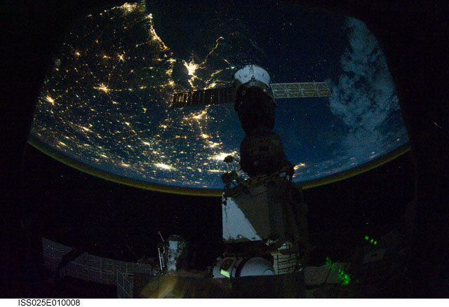
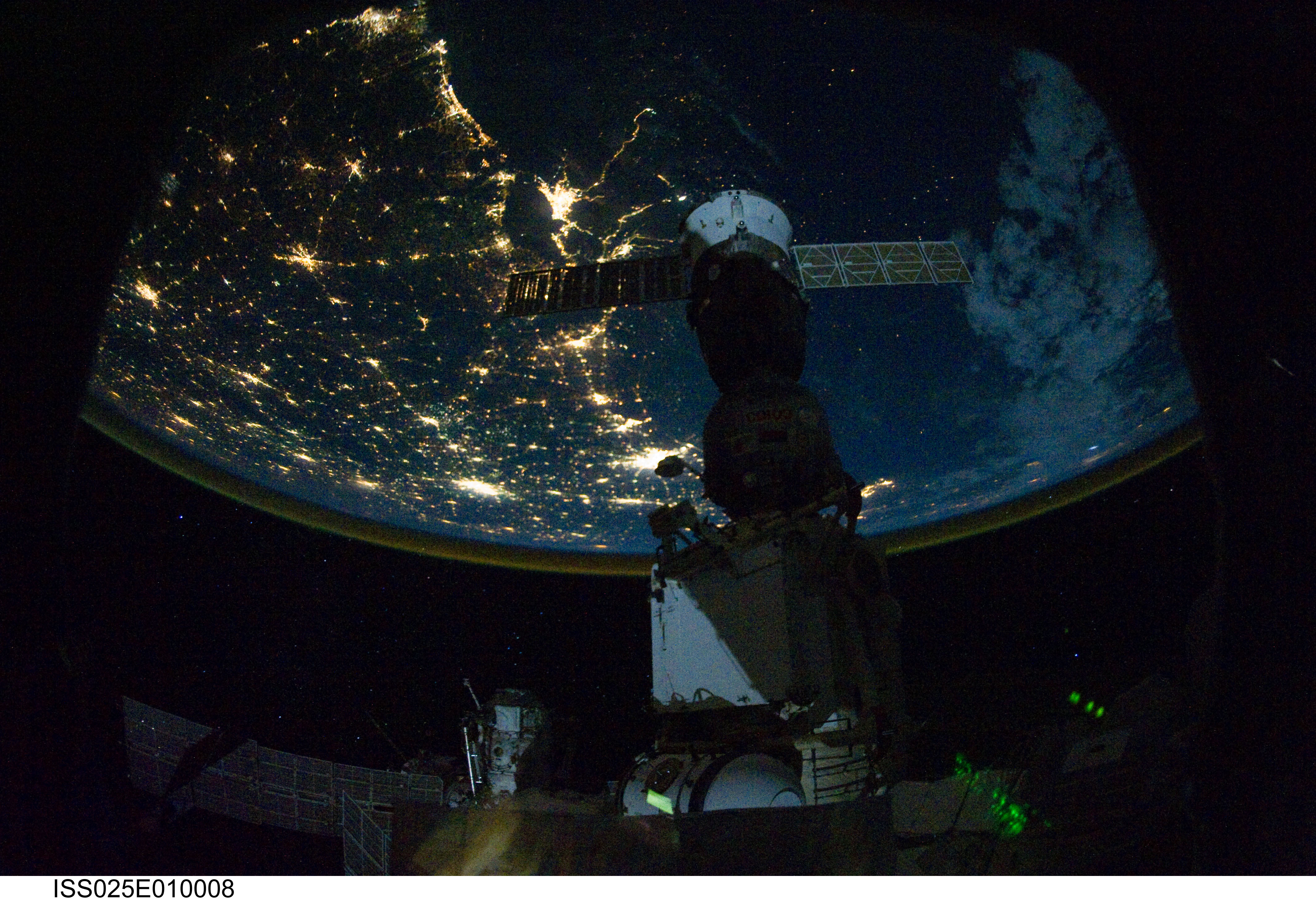
Spacecraft nadir point: 25.3° N, 83.8° W
Photo center point: 30.5° N, 91.0° W
Photo center point by machine learning:
Photo center point: 30.5° N, 91.0° W
Photo center point by machine learning:
Nadir to Photo Center: Northwest
Spacecraft Altitude: 186 nautical miles (344km)
Country or Geographic Name: | USA-LOUISIANA |
Features: | NEW ORLEANS (TOP), GULF COAST, AT NIGHT |
| Features Found Using Machine Learning: | PAN- |
Cloud Cover Percentage: | 10 (1-10)% |
Sun Elevation Angle: | -60° |
Sun Azimuth: | 72° |
Camera: | Nikon D3S Electronic Still Camera |
Focal Length: | 16mm |
Camera Tilt: | High Oblique |
Format: | 4256E: 4256 x 2832 pixel CMOS sensor, 36.0mm x 23.9mm, total pixels: 12.87 million, Nikon FX format |
Film Exposure: | |
| Additional Information | |
| Width | Height | Annotated | Cropped | Purpose | Links |
|---|---|---|---|---|---|
| 4256 pixels | 2913 pixels | No | No | Download Image | |
| 640 pixels | 438 pixels | No | No | Download Image |
Download Packaged File
Download a Google Earth KML for this Image
View photo footprint information
No GeoTIFF is available for this photo.Image Caption: ISS025-E-010008 (29 Oct. 2010) --- From 220 miles above Earth, one of the Expedition 25 crew members onboard the International Space Station shot this night time image of the northern Gulf coast. Mobile Bay and the city of Mobile (top left, beneath one of the solar panels of a docked Russian Soyuz spacecraft), New Orleans and Houston are visible as the view ?moves? southeastward. The Interstate Highway 20 cities of Jackson, Shreveport, Dallas and Fort Worth are also visible further inland. The view extends northward (left) to Little Rock and Oklahoma City.
