< STS095-716-10 >
| NASA Photo ID | STS095-716-10 |
| Focal Length | 250mm |
| Date taken | 1998.11.02 |
| Time taken | 17:16:37 GMT |
Resolutions offered for this image:
5700 x 5900 pixels 483 x 500 pixels 1307 x 1301 pixels 400 x 398 pixels
5700 x 5900 pixels 483 x 500 pixels 1307 x 1301 pixels 400 x 398 pixels

Cloud masks available for this image:
Spacecraft nadir point: 26.6° N, 101.7° W
Photo center point: 29.5° N, 98.5° W
Photo center point by machine learning:
Photo center point: 29.5° N, 98.5° W
Photo center point by machine learning:
Nadir to Photo Center: Northeast
Spacecraft Altitude: 294 nautical miles (544km)
Country or Geographic Name: | USA-TEXAS |
Features: | SAN ANTONIO |
| Features Found Using Machine Learning: | |
Cloud Cover Percentage: | 5 (1-10)% |
Sun Elevation Angle: | 45° |
Sun Azimuth: | 154° |
Camera: | Hasselblad |
Focal Length: | 250mm |
Camera Tilt: | 41 degrees |
Format: | 5069: Kodak Elite 100S, E6 Reversal, Replaces Lumiere, Warmer in tone vs. Lumiere |
Film Exposure: | Under Exposed |
| Additional Information | |
| Width | Height | Annotated | Cropped | Purpose | Links |
|---|---|---|---|---|---|
| 5700 pixels | 5900 pixels | No | No | Download Image Download Color Calibration Image for this Image |
|
| 483 pixels | 500 pixels | No | No | Download Image Download Color Calibration Image for this Image |
|
| 1307 pixels | 1301 pixels | No | No | Download Image | |
| 400 pixels | 398 pixels | No | No | Photographic Highlights | Download Image |
Download Packaged File
Download a Google Earth KML for this Image
View photo footprint information
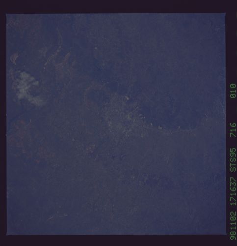
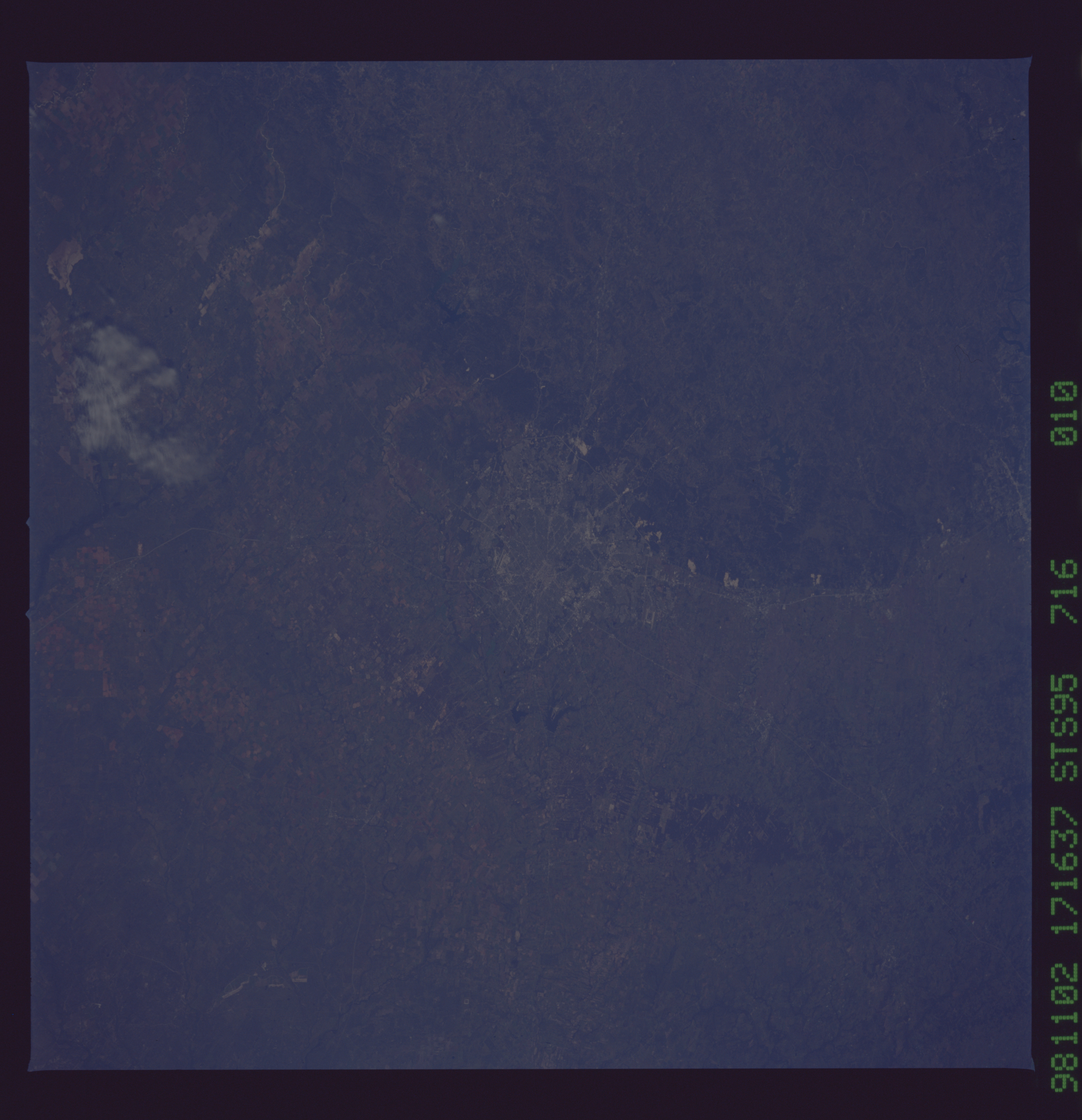
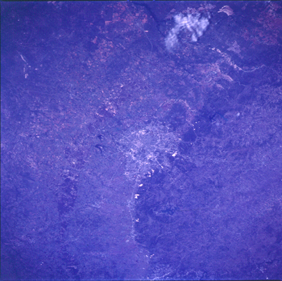
No GeoTIFF is available for this photo.Image Caption: The San Antonio Area is one of the fastest growing areas in Texas. It is on
the edge of the of the Balcones escarpment which forms the eastern edge of the
Edwards Plateau. This city of over a million people derives all of its water
from the limestone aquifer in the plateau. This series of photographs shows the
quarries along the edge of the plateau to the North of San Antonio. They are
the white areas in the darker green edge along Highway 281. To the South near
Pearsall irrigated fields are visible. Pearsall is recognizable by the bypass
of Interstate Highway 35 around the town. Other prominent features are the "L"
shaped Lake Medina West of the city and Canyon Lake to the North. East of the
city is a darker area of vegetation that denotes a band of sandy soils. The
area supports conifers rather than the prairie-scrub of the surrounding soils.
