
Geographic Region: USA-VIRGINIA
Feature: APPALACHIANS, WINCHESTER
|
Geographic Region: USA-VIRGINIA Feature: APPALACHIANS, WINCHESTER |
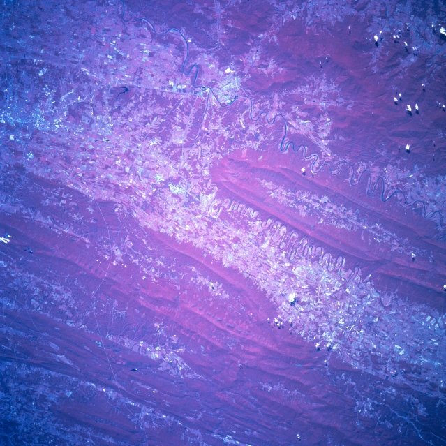 |
| STS078-760-008 Shenandoah River Valley, Virginia, USA June 1996 The northeast-southwest trending Shenandoah Valley, located in northern Virginia, is clearly visible in this color infrared image (red colors represent green vegetation). The two dramatically meandering rivers, North Fork and South Fork of the Shenandoah River (dark lines), merge into one channel at Front Royal (left middle). The location of Winchester is a barely discernible cluster of light colored features near the northeast corner of the picture. The very thin, light-colored lines that cross the folded Appalachian Mountains near the bottom of the picture are power line right-of-ways. Some of the parallel, heavily wooded mountain ridges of the Appalachians in the northwest quadrant are located in West Virginia. |
| Images: | All Available Images Low-Resolution 379k |
|
| Mission: | STS078 |
|
| Roll - Frame: | 760 - 8 |
|
| Geographical Name: | USA-VIRGINIA |
|
| Features: | APPALACHIANS, WINCHESTER |
|
| Center Lat x Lon: | 39.0N x 78.5W |
|
| Film Exposure: | N | N=Normal exposure, U=Under exposed, O=Over exposed, F=out of Focus |
| Percentage of Cloud Cover-CLDP: | 0 |
|
| Camera:: | HB |
|
| Camera Tilt: | 18 | LO=Low Oblique, HO=High Oblique, NV=Near Vertical |
| Camera Focal Length: | 250 |
|
| Nadir to Photo Center Direction: | NW | The direction from the nadir to the center point, N=North, S=South, E=East, W=West |
| Stereo?: | N | Y=Yes there is an adjacent picture of the same area, N=No there isn't |
| Orbit Number: | 129 |
|
| Date: | 19960628 | YYYYMMDD |
| Time: | 143927 | GMT HHMMSS |
| Nadir Lat: | 38.5N |
Latitude of suborbital point of spacecraft |
| Nadir Lon: | 77.9W |
Longitude of suborbital point of spacecraft |
| Sun Azimuth: | 103 | Clockwise angle in degrees from north to the sun measured at the nadir point |
| Space Craft Altitude: | 143 | nautical miles |
| Sun Elevation: | 54 | Angle in degrees between the horizon and the sun, measured at the nadir point |
| Land Views: | MOUNTAIN, VALLEY, FOREST |
|
| Water Views: | RIVER |
|
| Atmosphere Views: | |
|
| Man Made Views: | |
|
| City Views: | |
|
Photo is not associated with any sequences | ||
| NASA Home Page |
JSC Home Page |
JSC Digital Image Collection |
Earth Science & Remote Sensing |
|
This service is provided by the International Space Station program and the JSC Earth Science & Remote Sensing Unit, ARES Division, Exploration Integration Science Directorate.

|