
Geographic Region: USA-TEXAS
Feature: LUBBOCK, AGRICULTURE, LAKES
|
Geographic Region: USA-TEXAS Feature: LUBBOCK, AGRICULTURE, LAKES |
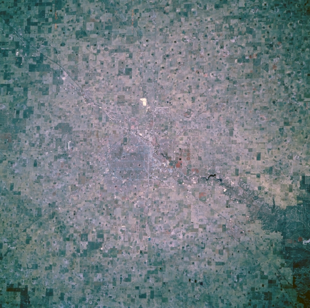 |
| STS073-744-124 Lubbock, Texas, U.S.A. October 1995 This near-vertical, color infrared photograph shows the high plains of the Texas panhandle and Lubbock, a trade center for the surrounding cotton and grain growing region. Barely discernible are runways of Lubbock International Airport to the north and Reese Air Force Base to the west. The high plains of Texas are extremely flat except for some undulations due to generally east-flowing streams. A unique feature of the region is the large number of surface ponds--water fills these nonvegetated, round, flat areas after rainstorms; the water then evaporates or sinks into the ground to recharge the underlying Ogallala Aquifer. |
| Images: | All Available Images Low-Resolution 360k |
|
| Mission: | STS073 |
|
| Roll - Frame: | 744 - 124 |
|
| Geographical Name: | USA-TEXAS |
|
| Features: | LUBBOCK, AGRICULTURE, LAKES |
|
| Center Lat x Lon: | 33.5N x 102W |
|
| Film Exposure: | N | N=Normal exposure, U=Under exposed, O=Over exposed, F=out of Focus |
| Percentage of Cloud Cover-CLDP: | 0 |
|
| Camera:: | HB |
|
| Camera Tilt: | 27 | LO=Low Oblique, HO=High Oblique, NV=Near Vertical |
| Camera Focal Length: | 250 |
|
| Nadir to Photo Center Direction: | W | The direction from the nadir to the center point, N=North, S=South, E=East, W=West |
| Stereo?: | N | Y=Yes there is an adjacent picture of the same area, N=No there isn't |
| Orbit Number: | 132 |
|
| Date: | 19951028 | YYYYMMDD |
| Time: | 164539 | GMT HHMMSS |
| Nadir Lat: | 33.3N |
Latitude of suborbital point of spacecraft |
| Nadir Lon: | 100.8W |
Longitude of suborbital point of spacecraft |
| Sun Azimuth: | 148 | Clockwise angle in degrees from north to the sun measured at the nadir point |
| Space Craft Altitude: | 143 | nautical miles |
| Sun Elevation: | 38 | Angle in degrees between the horizon and the sun, measured at the nadir point |
| Land Views: | PLAIN |
|
| Water Views: | RIVER |
|
| Atmosphere Views: | |
|
| Man Made Views: | URBAN AREA, HIGHWAY, AIRPORT, AGRICULTURE |
|
| City Views: | |
|
Photo is not associated with any sequences | ||
| NASA Home Page |
JSC Home Page |
JSC Digital Image Collection |
Earth Science & Remote Sensing |
|
This service is provided by the International Space Station program and the JSC Earth Science & Remote Sensing Unit, ARES Division, Exploration Integration Science Directorate.

|