
Geographic Region: USA-ARIZONA
Feature: TUCSON,MTS.,MINE,RIVER
|
Geographic Region: USA-ARIZONA Feature: TUCSON,MTS.,MINE,RIVER |
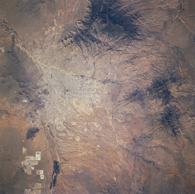 |
| STS073-740-062 Tucson Area, Arizona, U.S.A. October 1995 Tucson, near the center of the photograph, is an excellent example of topography helping shape the development of a city. The city's westward expansion has been affected by the Santa Cruz River, which flows northward toward Phoenix, and, more significantly, by the Tucson Mountains. South of Tucson, numerous drainage channels fan out in an alluvial arrangement that is not conducive to urban development. To the northeast and east, the Mount Lemmon Mountains provide a formidable barrier to development--Mount Lemmon, northeast of the city, rises 9157 feet (2791 meters) above sea level, and Mount Mica, east of the city, climbs 8666 feet (2641 meters) above sea level. The Tanque Verde Wash is the highly reflective drainage channel near the northern edge of the city. Large open-pit copper mines and their spoil banks are clearly visible south of the city and west of the Santa Cruz River. The northwest-southeast-oriented runways of Davis-Monthan Air Force Base and Tucson International Airport are barely visible in southern Tucson. |
| Images: | All Available Images Low-Resolution 351k |
|
| Mission: | STS073 |
|
| Roll - Frame: | 740 - 62 |
|
| Geographical Name: | USA-ARIZONA |
|
| Features: | TUCSON,MTS.,MINE,RIVER |
|
| Center Lat x Lon: | 32.0N x 111W |
|
| Film Exposure: | N | N=Normal exposure, U=Under exposed, O=Over exposed, F=out of Focus |
| Percentage of Cloud Cover-CLDP: | 0 |
|
| Camera:: | HB |
|
| Camera Tilt: | 32 | LO=Low Oblique, HO=High Oblique, NV=Near Vertical |
| Camera Focal Length: | 250 |
|
| Nadir to Photo Center Direction: | W | The direction from the nadir to the center point, N=North, S=South, E=East, W=West |
| Stereo?: | Y | Y=Yes there is an adjacent picture of the same area, N=No there isn't |
| Orbit Number: | 53 |
|
| Date: | 19951023 | YYYYMMDD |
| Time: | 200634 | GMT HHMMSS |
| Nadir Lat: | 31.9N |
Latitude of suborbital point of spacecraft |
| Nadir Lon: | 109.5W |
Longitude of suborbital point of spacecraft |
| Sun Azimuth: | 202 | Clockwise angle in degrees from north to the sun measured at the nadir point |
| Space Craft Altitude: | 146 | nautical miles |
| Sun Elevation: | 44 | Angle in degrees between the horizon and the sun, measured at the nadir point |
| Land Views: | DESERT, MOUNTAIN |
|
| Water Views: | RIVER |
|
| Atmosphere Views: | |
|
| Man Made Views: | URBAN AREA, MINING |
|
| City Views: | |
|
Photo is not associated with any sequences | ||
| NASA Home Page |
JSC Home Page |
JSC Digital Image Collection |
Earth Science & Remote Sensing |
|
This service is provided by the International Space Station program and the JSC Earth Science & Remote Sensing Unit, ARES Division, Exploration Integration Science Directorate.

|