
Geographic Region: USA-TEXAS
Feature: AMARILLO,RED R.,RES.,AGR
|
Geographic Region: USA-TEXAS Feature: AMARILLO,RED R.,RES.,AGR |
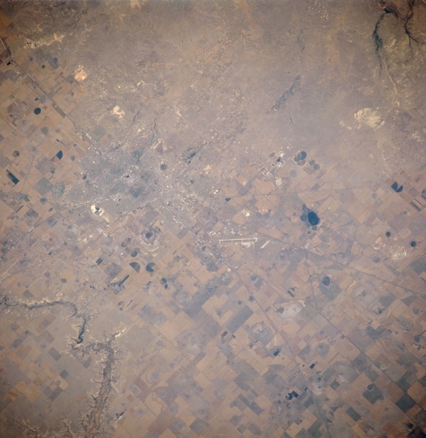 |
| NM21-765-016 Amarillo, Texas, U.S.A Spring 1996 Visible in this photograph is some of the urban infrastructure--airport, highways, street patterns, central business district--of Amarillo, the largest city in the Texas panhandle. The only deviation from the flat and featureless Texas high plains is the southeast-flowing Prairie Dog Town Fork of the Red River, which has created picturesque Palo Duro Canyon. The majority of fluvial erosion occurred during a much wetter geological time; however, erosion still results from downpours in this semiarid climate. Most of the countryside surrounding Amarillo, except for the north and northwest, evidences widespread agriculture. |
| Images: | All Available Images Low-Resolution 299k |
|
| Mission: | NM21 |
|
| Roll - Frame: | 765 - 16 |
|
| Geographical Name: | USA-TEXAS |
|
| Features: | AMARILLO,RED R.,RES.,AGR |
|
| Center Lat x Lon: | 35.0N x 102W |
|
| Film Exposure: | N | N=Normal exposure, U=Under exposed, O=Over exposed, F=out of Focus |
| Percentage of Cloud Cover-CLDP: | 0 |
|
| Camera:: | HB |
|
| Camera Tilt: | 27 | LO=Low Oblique, HO=High Oblique, NV=Near Vertical |
| Camera Focal Length: | 250 |
|
| Nadir to Photo Center Direction: | NW | The direction from the nadir to the center point, N=North, S=South, E=East, W=West |
| Stereo?: | Y | Y=Yes there is an adjacent picture of the same area, N=No there isn't |
| Orbit Number: | 999 |
|
| Date: | 19960703 | YYYYMMDD |
| Time: | 164857 | GMT HHMMSS |
| Nadir Lat: | 33.5N |
Latitude of suborbital point of spacecraft |
| Nadir Lon: | 101W |
Longitude of suborbital point of spacecraft |
| Sun Azimuth: | 104 | Clockwise angle in degrees from north to the sun measured at the nadir point |
| Space Craft Altitude: | 209 | nautical miles |
| Sun Elevation: | 62 | Angle in degrees between the horizon and the sun, measured at the nadir point |
| Land Views: | PLAIN |
|
| Water Views: | |
|
| Atmosphere Views: | |
|
| Man Made Views: | URBAN AREA, AGRICULTURE, AIRPORT |
|
| City Views: | AMARILLO |
|
Photo is not associated with any sequences | ||
| NASA Home Page |
JSC Home Page |
JSC Digital Image Collection |
Earth Science & Remote Sensing |
|
This service is provided by the International Space Station program and the JSC Earth Science & Remote Sensing Unit, ARES Division, Exploration Integration Science Directorate.

|