Mountains
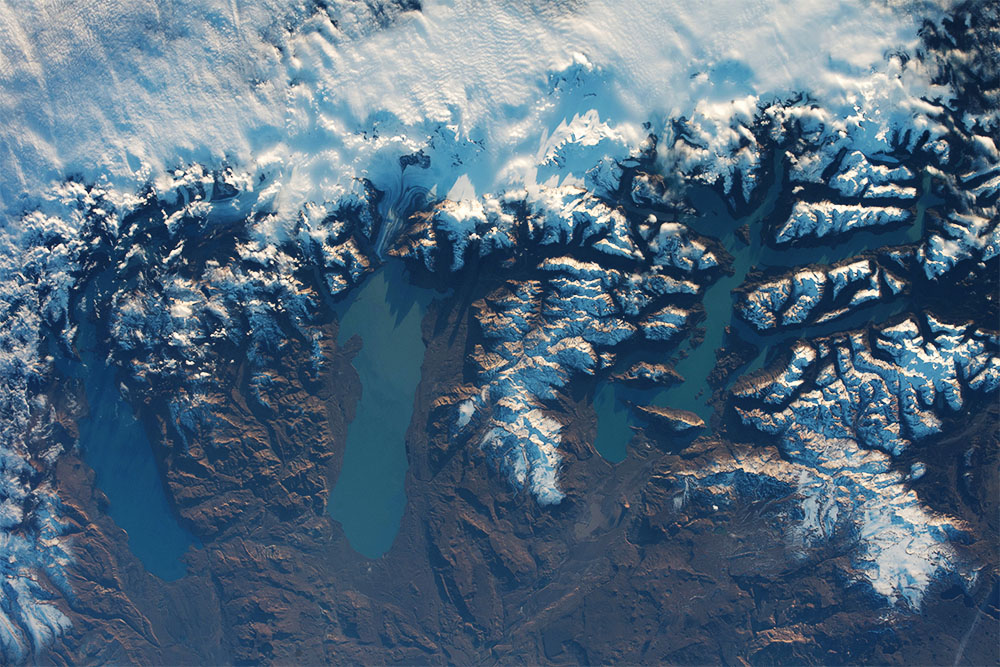
The Southern Patagonia Icefield, located in the Andes Mountains of Chile, has dramatic elevation changes from mountain peaks to the adjacent lake surfaces in Argentina. Some of the highest peaks pictures here are over 10,000 ft (>3000 m) high, while the lakes rest at about 550 ft (176 m) above sea level. From image left to right, the massive lakes seen are Argentino Lake, Viedma Lake, and O’Higgins/San Martin Lake. The Viedma glacier, feeding into Viedma Lake, is clearly visible in this shot while other glaciers are obscured by cloud cover. These lakes have noticeable color differences due lake depth, sediment content, and more.
To explore more images of glaciers taken by astronauts in space, visit our Glacier Collections page.
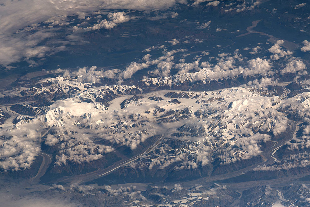
In this image is the rugged mountain terrain of the Yukon Territory, Canada along the Alaskan border. Some of the highest peaks here are over 15,000 ft high (4,500 m), rising above the clouds. Long valleys are carved out by existing glaciers which feed meltwater to braided rivers. The Yukon Territory has a subarctic climate and its rocky landscape is home to just over 35,000 people. Beyond these mountains, are greener landscapes susceptible to wildfires.
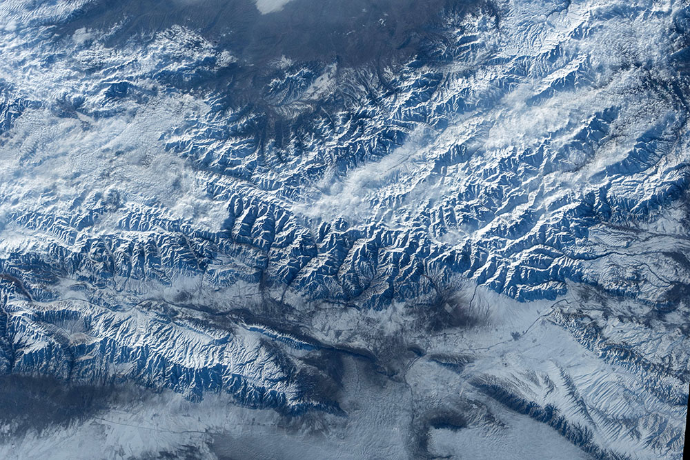
The Tien Shan Mountains stretch over 1000 mi (1600 km) across central Asia. This composite image shows a small slice of the range in eastern Kyrgystan near the Kazakhstan border. The tallest peaks in this image are over 13,000 ft (4000 m) high, with a relief of over 6000 ft (1800 m) from the surrounding flatter topography. The snow covered mountains and cloud filled valleys are make for cool-toned white, grey, and blue scene. Read more about the Tien Shan Mountains here.
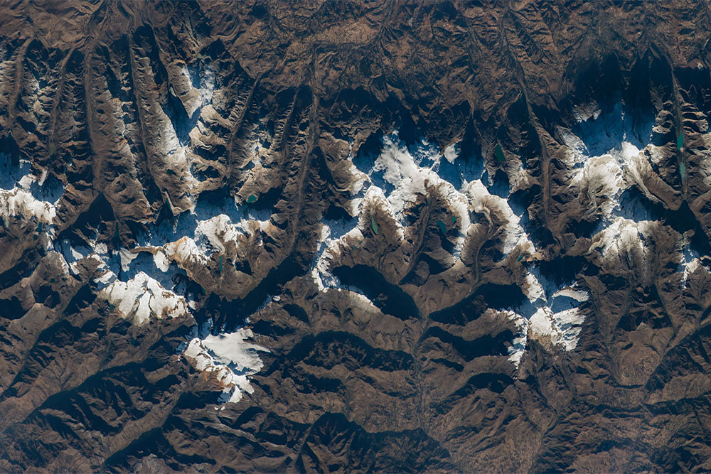
The Cordillera Blanca, or white range in Spanish, is a part of the Peruvian Andes Mountains. The Andes Range hug the west coast of South America. Nestled in these mountain peaks are numerous glaciers and teal-colored tarn lakes. Often these lakes are parallel with valleys that glaciers have previously eroded and carved out. This picture encompasses much of Huascarán National Park in Peru, where the highest peaks reach over 20,000 ft (~6000 m). Read more about the Andes here.
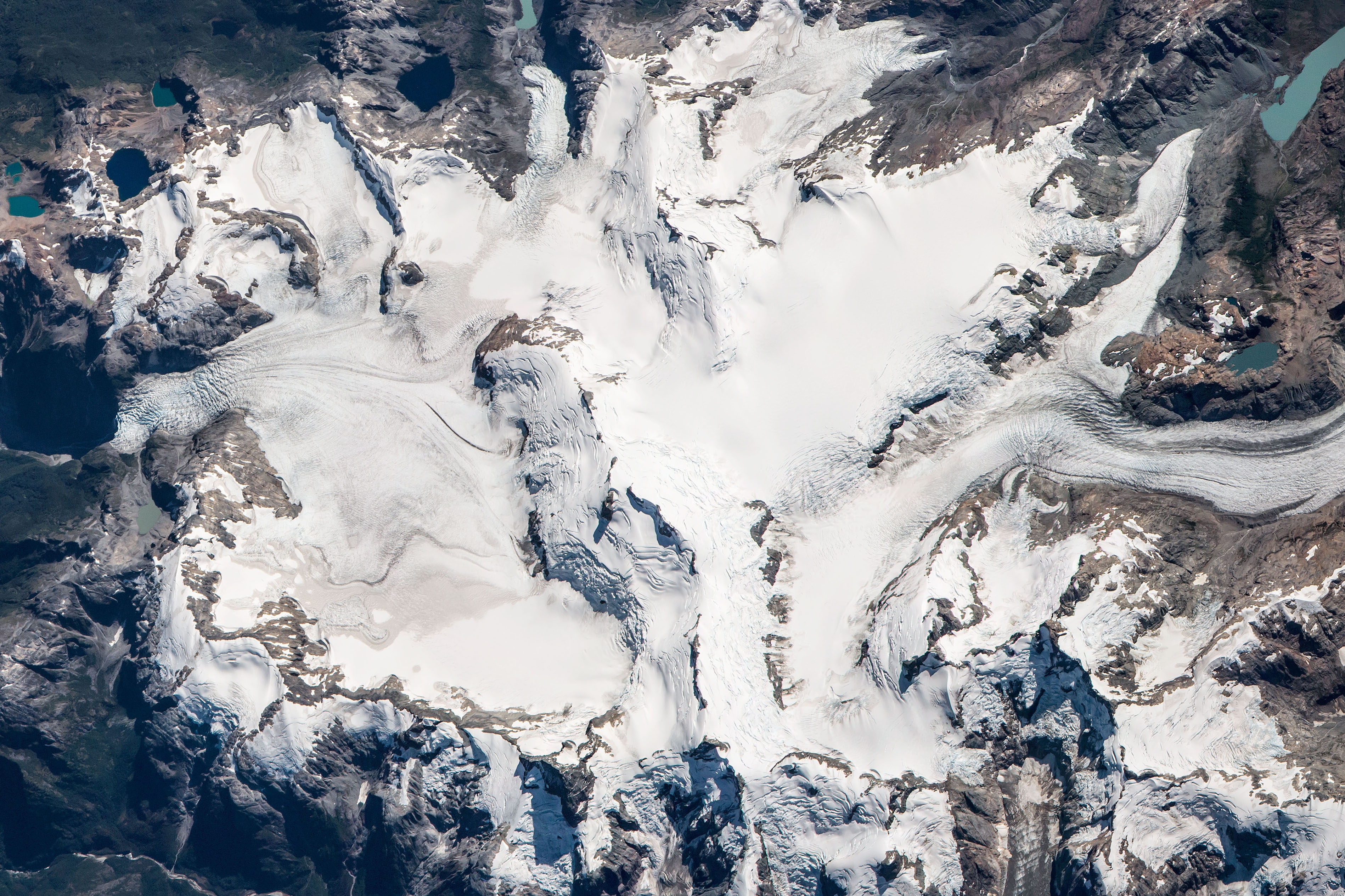
This image is of Nevado Queulat of Queulat National Park in Chile. It is one of many peaks making up the Patagonian Andes along the West coast of South America. Glaciers and tarn lakes surround the Nevado, or snowy peak. Glaciers form at high altitudes as snow accumulates and compacts over many years, turning into ice. Some glaciers slowly move downhill under the weight of added snow. This heavy block of ice erodes rocky material beneath the glacier and can carve out cirques, which may later fill with water and become a tarn lake or pond. Glacial tarns can vary in color from milky turquoise to sapphire blue, or also be very clear. Read more about Chilean mountains and glaciers here.