STS61C-43-47
| NASA Photo ID | STS61C-43-47 |
| Focal Length | 250mm |
| Date taken | 1986.01.16 |
| Time taken | 08:44:13 GMT |


Cloud masks available for this image:
Spacecraft nadir point: 19.1° N, 11.9° W
Photo center point: 19.0° N, 12.0° W
Photo center point by machine learning:
Photo center point: 19.0° N, 12.0° W
Photo center point by machine learning:
Nadir to Photo Center: Southwest
Spacecraft Altitude: 185 nautical miles (343km)
Country or Geographic Name: | MAURITANIA |
Features: | PLATEAU--ESCARPMENT |
| Features Found Using Machine Learning: | |
Cloud Cover Percentage: | 30 (26-50)% |
Sun Elevation Angle: | 16° |
Sun Azimuth: | 119° |
Camera: | Hasselblad |
Focal Length: | 250mm |
Camera Tilt: | 3 degrees |
Format: | 5017: Kodak, natural color positive, Ektachrome, X Professional, ASA 64, standard base |
Film Exposure: | Normal |
| Additional Information | |
| Width | Height | Annotated | Cropped | Purpose | Links |
|---|---|---|---|---|---|
| 5700 pixels | 5900 pixels | No | No | Download Image | |
| 500 pixels | 518 pixels | No | No | Download Image | |
| 640 pixels | 480 pixels | No | No | Download Image |
Download Packaged File
Download a Google Earth KML for this Image
View photo footprint information
Download a GeoTIFF for this photo
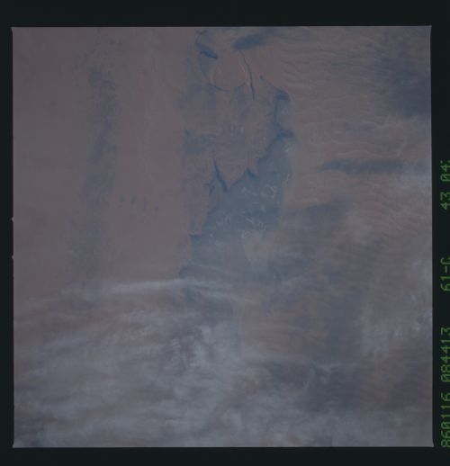
Image Caption: Ancient River Beds
The long, thin playa lake pictured here marks an ancient river
bed, remnant from a time in the past when the climate was wetter
and rivers flowed freely. Now water collects in the low basins
only when rainfalls are extremely heavy. (61C-43-47)
The long, thin playa lake pictured here marks an ancient river
bed, remnant from a time in the past when the climate was wetter
and rivers flowed freely. Now water collects in the low basins
only when rainfalls are extremely heavy. (61C-43-47)
