STS61C-37-42
| NASA Photo ID | STS61C-37-42 |
| Focal Length | 250mm |
| Date taken | 1986.01.13 |
| Time taken | 12:50:41 GMT |
Resolutions offered for this image:
5312 x 5312 pixels 640 x 640 pixels 5700 x 5900 pixels 500 x 518 pixels 640 x 480 pixels
5312 x 5312 pixels 640 x 640 pixels 5700 x 5900 pixels 500 x 518 pixels 640 x 480 pixels

Cloud masks available for this image:
Spacecraft nadir point: 21.4° S, 35.5° E
Photo center point: 20.0° S, 35.0° E
Photo center point by machine learning:
Photo center point: 20.0° S, 35.0° E
Photo center point by machine learning:
Nadir to Photo Center: North
Spacecraft Altitude: 176 nautical miles (326km)
Country or Geographic Name: | MOZAMBIQUE |
Features: | RIO PUNGOE, RIO BUZI, COAST |
| Features Found Using Machine Learning: | |
Cloud Cover Percentage: | 10 (1-10)% |
Sun Elevation Angle: | 47° |
Sun Azimuth: | 261° |
Camera: | Hasselblad |
Focal Length: | 250mm |
Camera Tilt: | 27 degrees |
Format: | 5017: Kodak, natural color positive, Ektachrome, X Professional, ASA 64, standard base |
Film Exposure: | Normal |
| Additional Information | |
| Width | Height | Annotated | Cropped | Purpose | Links |
|---|---|---|---|---|---|
| 5312 pixels | 5312 pixels | No | No | Earth From Space collection | Download Image |
| 640 pixels | 640 pixels | No | No | Earth From Space collection | Download Image |
| 5700 pixels | 5900 pixels | No | No | Download Image | |
| 500 pixels | 518 pixels | No | No | Download Image | |
| 640 pixels | 480 pixels | No | No | Download Image |
Download Packaged File
Download a Google Earth KML for this Image
View photo footprint information
Download a GeoTIFF for this photo
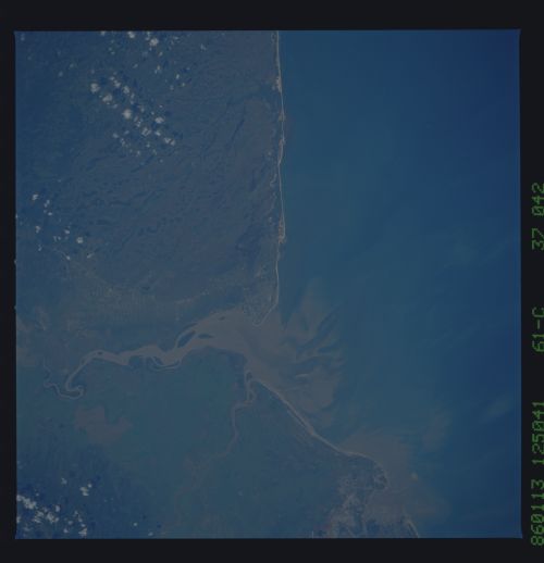
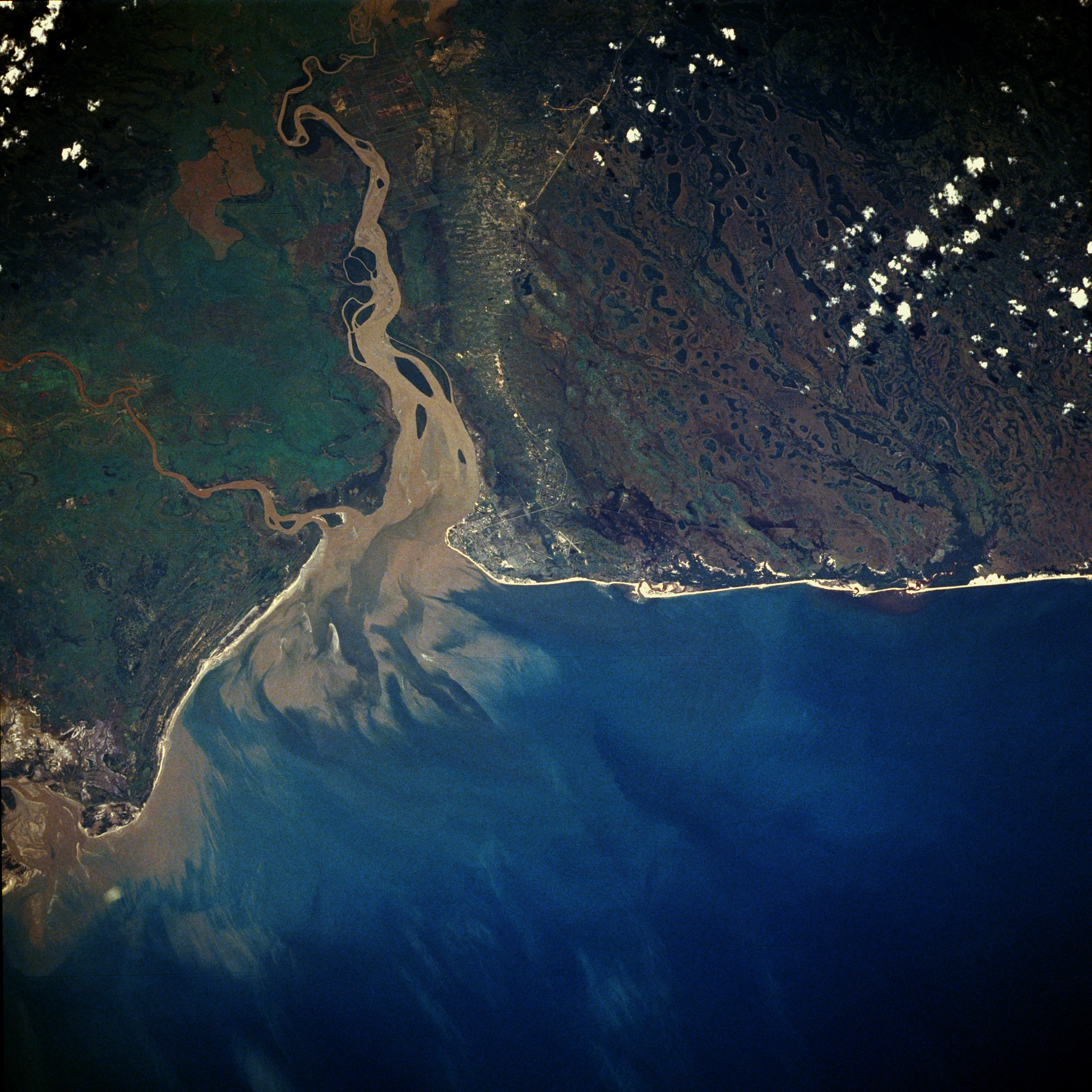
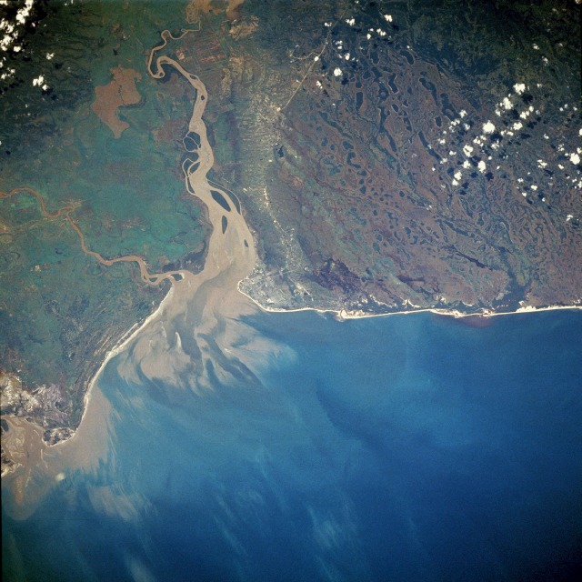
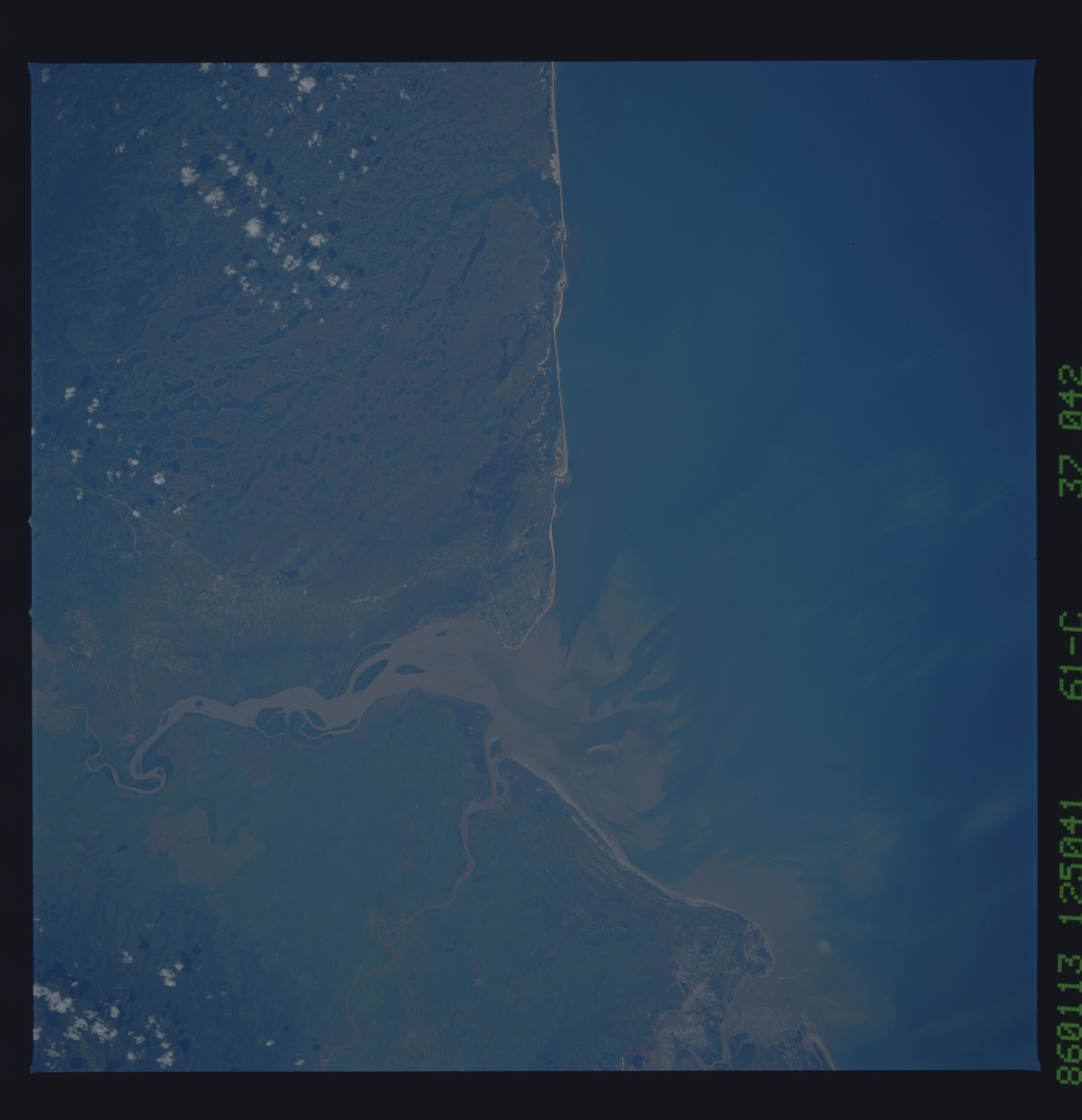
Image Caption: STS61C-37-0042 Beira, Mozambique January 1986
Beira, a beach resort and a major commercial city for this region, is visible at the center of this near-vertical photograph. The city, with a population of more than 370 000, has a good railroad system that helps promote this city as a terminus for external trade for the two landlocked countries of Malawi and Zimbabwe. The large sediment plume that enters the Mozambique Channel south of Beira shows that a substantial quantity of suspended waterborne materials is being carried by the Pungüe River--and to a lesser extent by the smaller Buzi River. The landscape both north and south of the Pungüe River is relatively flat and drains poorly. Many lakes and the older interconnected stream channels north of the city have created a large area of swamps and marshes.
Beira, a beach resort and a major commercial city for this region, is visible at the center of this near-vertical photograph. The city, with a population of more than 370 000, has a good railroad system that helps promote this city as a terminus for external trade for the two landlocked countries of Malawi and Zimbabwe. The large sediment plume that enters the Mozambique Channel south of Beira shows that a substantial quantity of suspended waterborne materials is being carried by the Pungüe River--and to a lesser extent by the smaller Buzi River. The landscape both north and south of the Pungüe River is relatively flat and drains poorly. Many lakes and the older interconnected stream channels north of the city have created a large area of swamps and marshes.
