STS61C-36-29

| NASA Photo ID | STS61C-36-29 |
| Focal Length | 250mm |
| Date taken | 1986.01.15 |
| Time taken | 14:38:18 GMT |
Resolutions offered for this image:
4096 x 4096 pixels 640 x 640 pixels 5700 x 5900 pixels 500 x 518 pixels 640 x 480 pixels
4096 x 4096 pixels 640 x 640 pixels 5700 x 5900 pixels 500 x 518 pixels 640 x 480 pixels
Cloud masks available for this image:
Spacecraft nadir point: 8.0° N, 69.8° W
Photo center point: 6.0° N, 67.5° W
Photo center point by machine learning:
Photo center point: 6.0° N, 67.5° W
Photo center point by machine learning:
Nadir to Photo Center: Southeast
Spacecraft Altitude: 181 nautical miles (335km)
Country or Geographic Name: | VENEZUELA |
Features: | RIO ORINOCO, RIO META |
| Features Found Using Machine Learning: | |
Cloud Cover Percentage: | 10 (1-10)% |
Sun Elevation Angle: | 46° |
Sun Azimuth: | 132° |
Camera: | Hasselblad |
Focal Length: | 250mm |
Camera Tilt: | 45 degrees |
Format: | 5017: Kodak, natural color positive, Ektachrome, X Professional, ASA 64, standard base |
Film Exposure: | Normal |
| Additional Information | |
| Width | Height | Annotated | Cropped | Purpose | Links |
|---|---|---|---|---|---|
| 4096 pixels | 4096 pixels | No | No | Earth From Space collection | Download Image |
| 640 pixels | 640 pixels | No | No | Earth From Space collection | Download Image |
| 5700 pixels | 5900 pixels | No | No | Download Image | |
| 500 pixels | 518 pixels | No | No | Download Image | |
| 640 pixels | 480 pixels | No | No | Download Image |
Download Packaged File
Download a Google Earth KML for this Image
View photo footprint information
Download a GeoTIFF for this photo
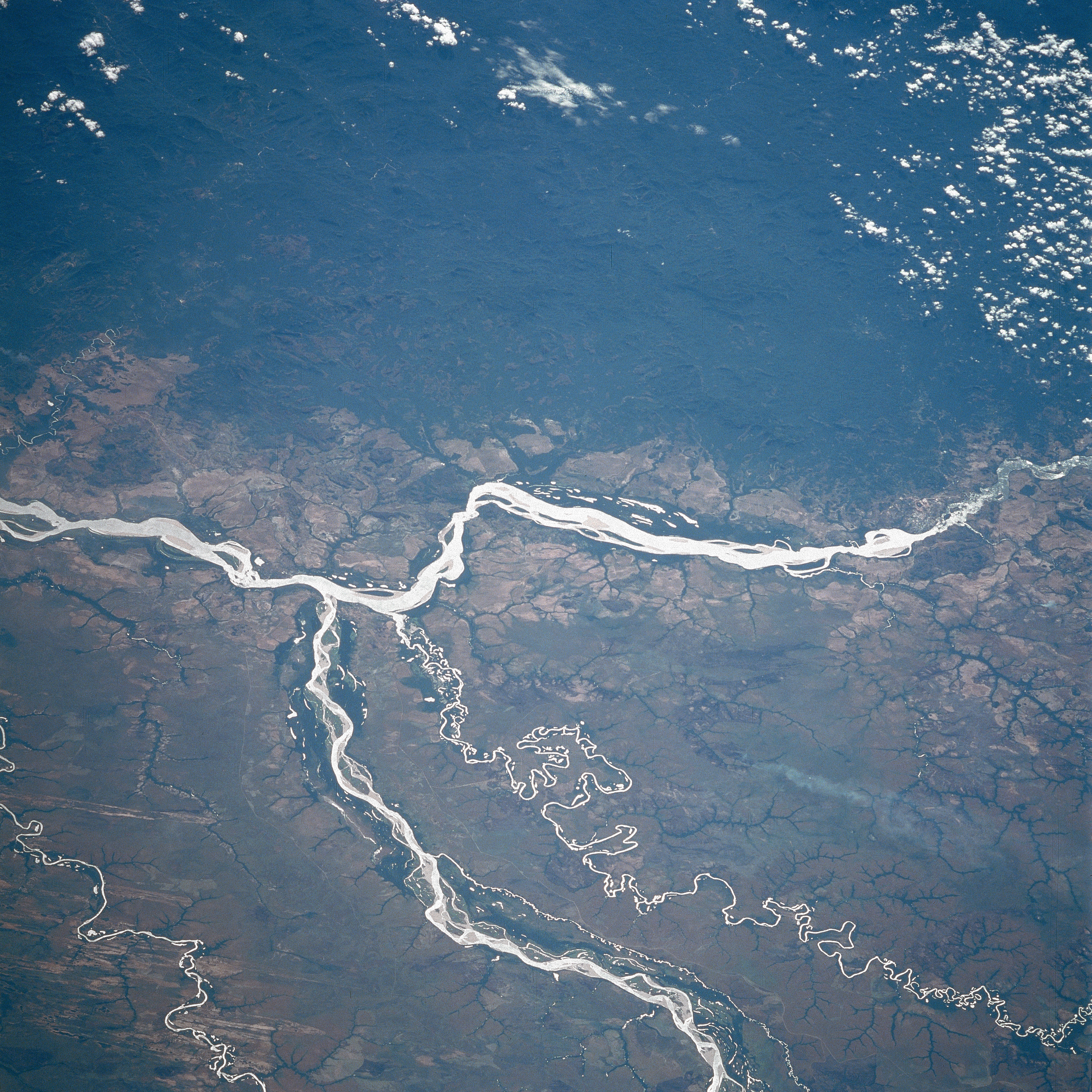
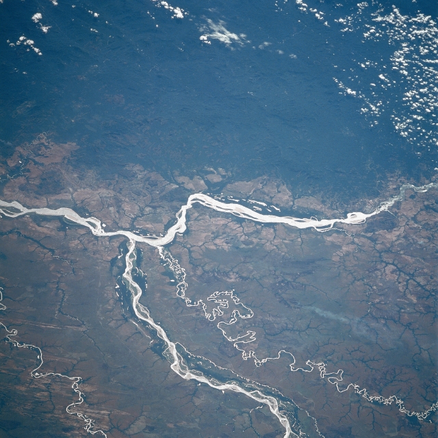
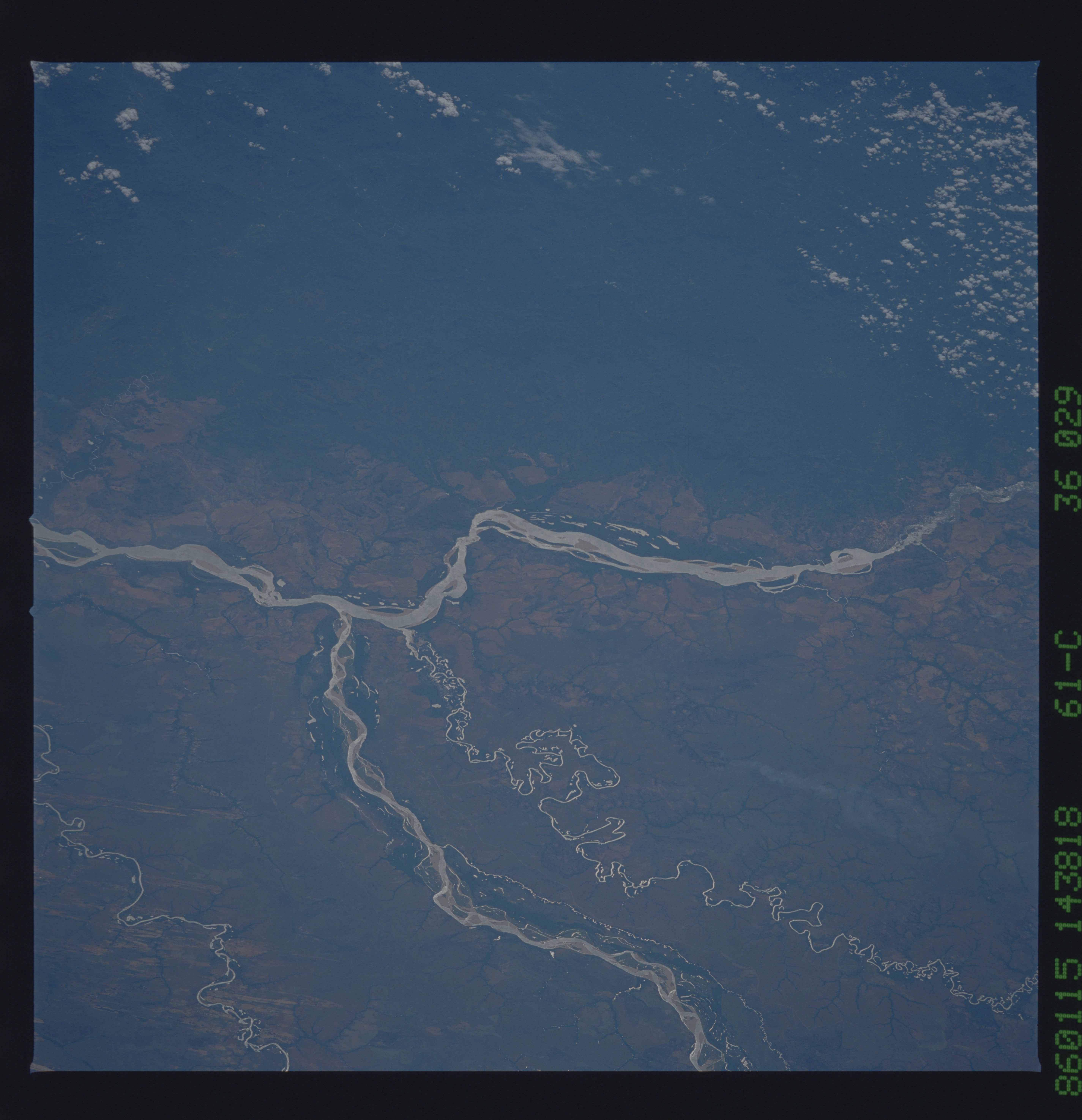
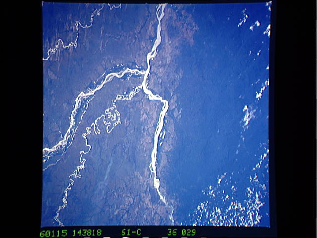
Image Caption: STS61C-36-0029 Orinoco, Meta Rivers, Colombia and Venezuela January 1986
The Orinoco, South America's second longest river extends from right to left across this southeast-looking view. With its headwaters not located until the early 1950's, the river now is estimated to be between 1500 and 1700 miles (2415 to 2735 km) long, making it the eighth longest river in the world. In this scene, the Orinoco skirts the heavily forested Paraguaza Range (upper portion of the image) of the western Guiana Highlands. Entering the scene near the bottom center, the Meta River joins the Orinoco just to the left of center of the image and forms part of the border between Colombia (right or south of the river) and Venezuela (left or north of the river). The small-meandering Bita River is also visible just to the south (right) of the Meta River. A large smoke plume is noticeable to the south (right) of the Bita River.
The Orinoco, South America's second longest river extends from right to left across this southeast-looking view. With its headwaters not located until the early 1950's, the river now is estimated to be between 1500 and 1700 miles (2415 to 2735 km) long, making it the eighth longest river in the world. In this scene, the Orinoco skirts the heavily forested Paraguaza Range (upper portion of the image) of the western Guiana Highlands. Entering the scene near the bottom center, the Meta River joins the Orinoco just to the left of center of the image and forms part of the border between Colombia (right or south of the river) and Venezuela (left or north of the river). The small-meandering Bita River is also visible just to the south (right) of the Meta River. A large smoke plume is noticeable to the south (right) of the Bita River.
