STS61B-52-43
| NASA Photo ID | STS61B-52-43 |
| Focal Length | 250mm |
| Date taken | 1985.12.02 |
| Time taken | 20:59:44 GMT |
Resolutions offered for this image:
3904 x 3904 pixels 639 x 639 pixels 5700 x 5900 pixels 500 x 518 pixels 640 x 480 pixels
3904 x 3904 pixels 639 x 639 pixels 5700 x 5900 pixels 500 x 518 pixels 640 x 480 pixels


Cloud masks available for this image:
Spacecraft nadir point: 26.9° N, 97.6° W
Photo center point: 27.5° N, 98.0° W
Photo center point by machine learning:
Photo center point: 27.5° N, 98.0° W
Photo center point by machine learning:
Nadir to Photo Center: Northwest
Spacecraft Altitude: 173 nautical miles (320km)
Country or Geographic Name: | USA-TEXAS |
Features: | KINGSVILLE |
| Features Found Using Machine Learning: | |
Cloud Cover Percentage: | 5 (1-10)% |
Sun Elevation Angle: | 27° |
Sun Azimuth: | 222° |
Camera: | Hasselblad |
Focal Length: | 250mm |
Camera Tilt: | 14 degrees |
Format: | 2443: Kodak Aerochrome 2443, color IR, thin base, EA-5 process thru June 1999, E-6 process afterward |
Film Exposure: | Normal |
| Additional Information | |
| Width | Height | Annotated | Cropped | Purpose | Links |
|---|---|---|---|---|---|
| 3904 pixels | 3904 pixels | No | No | Earth From Space collection | Download Image |
| 639 pixels | 639 pixels | No | No | Earth From Space collection | Download Image |
| 5700 pixels | 5900 pixels | No | No | Download Image | |
| 500 pixels | 518 pixels | No | No | Download Image | |
| 640 pixels | 480 pixels | No | No | Download Image |
Download Packaged File
Download a Google Earth KML for this Image
View photo footprint information
Download a GeoTIFF for this photo
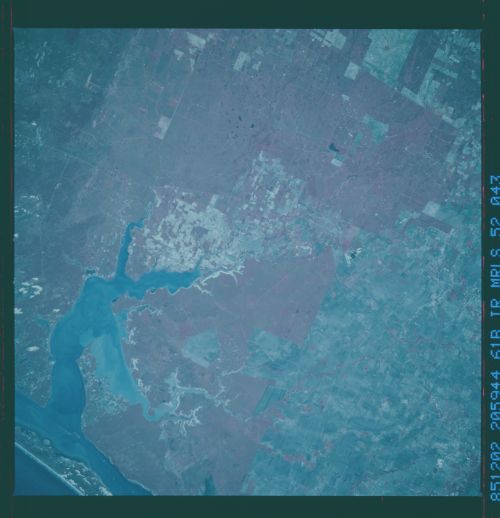
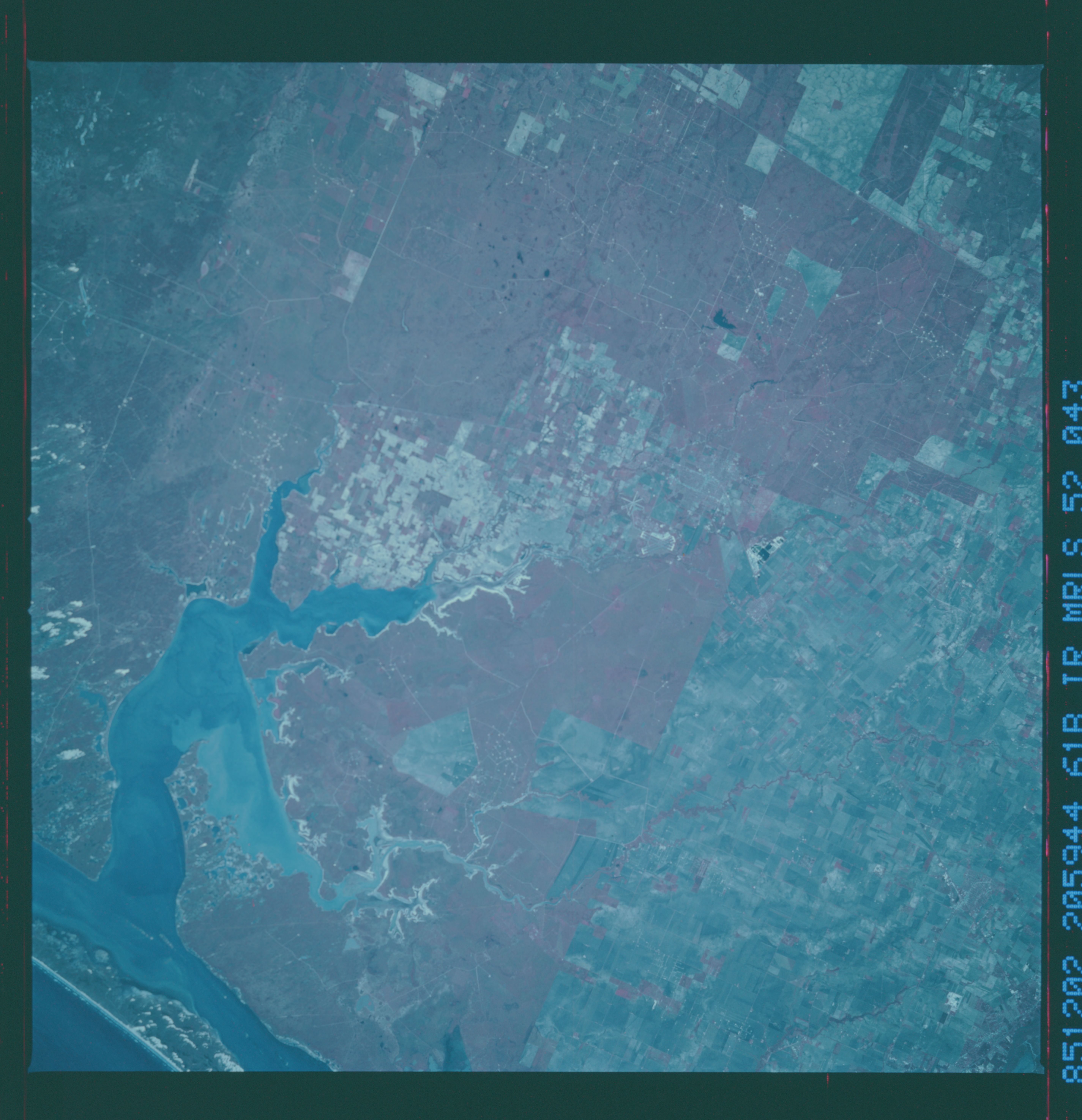
Image Caption: STS61B-052-0043 Kingsville, Alazan Bay, and Baffin Bay, Texas, U.S.A. November 1985
This north-northwest-looking, low-oblique color infrared photograph features the grasslands and scrubland that comprise portions of the 2000-square-mile (5180-square-kilometer) King Ranch in south Texas. Kingsville, 34 miles (55 kilometers) southwest of Corpus Christi (not in photograph) and headquarters of the King Ranch, is a processing center for natural gas, dairy cattle, cotton, and winter vegetables. Visible are Baffin Bay and sediment-laden Alazan Bay. A small portion of Padre Island is also discernible.
This north-northwest-looking, low-oblique color infrared photograph features the grasslands and scrubland that comprise portions of the 2000-square-mile (5180-square-kilometer) King Ranch in south Texas. Kingsville, 34 miles (55 kilometers) southwest of Corpus Christi (not in photograph) and headquarters of the King Ranch, is a processing center for natural gas, dairy cattle, cotton, and winter vegetables. Visible are Baffin Bay and sediment-laden Alazan Bay. A small portion of Padre Island is also discernible.
