STS61B-49-101
| NASA Photo ID | STS61B-49-101 |
| Focal Length | 100mm |
| Date taken | 1985.12.01 |
| Time taken | 06:46:14 GMT |
Resolutions offered for this image:
1536 x 1536 pixels 639 x 639 pixels 5700 x 5900 pixels 500 x 518 pixels 640 x 480 pixels
1536 x 1536 pixels 639 x 639 pixels 5700 x 5900 pixels 500 x 518 pixels 640 x 480 pixels

Cloud masks available for this image:
Spacecraft nadir point: 17.2° N, 94.7° E
Photo center point: 16.5° N, 95.0° E
Photo center point by machine learning:
Photo center point: 16.5° N, 95.0° E
Photo center point by machine learning:
Nadir to Photo Center: South
Spacecraft Altitude: 172 nautical miles (319km)
Country or Geographic Name: | MYANMAR (BURMA) |
Features: | MOUTHS OF THE IRRAWADDY |
| Features Found Using Machine Learning: | |
Cloud Cover Percentage: | 20 (11-25)% |
Sun Elevation Angle: | 46° |
Sun Azimuth: | 206° |
Camera: | Hasselblad |
Focal Length: | 100mm |
Camera Tilt: | 15 degrees |
Format: | 2443: Kodak Aerochrome 2443, color IR, thin base, EA-5 process thru June 1999, E-6 process afterward |
Film Exposure: | Normal |
| Additional Information | |
| Width | Height | Annotated | Cropped | Purpose | Links |
|---|---|---|---|---|---|
| 1536 pixels | 1536 pixels | No | No | Earth From Space collection | Download Image |
| 639 pixels | 639 pixels | No | No | Earth From Space collection | Download Image |
| 5700 pixels | 5900 pixels | No | No | Download Image | |
| 500 pixels | 518 pixels | No | No | Download Image | |
| 640 pixels | 480 pixels | No | No | Download Image |
Download Packaged File
Download a Google Earth KML for this Image
View photo footprint information
Download a GeoTIFF for this photo
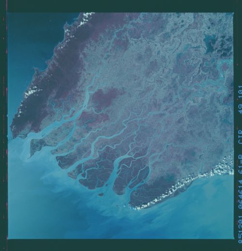
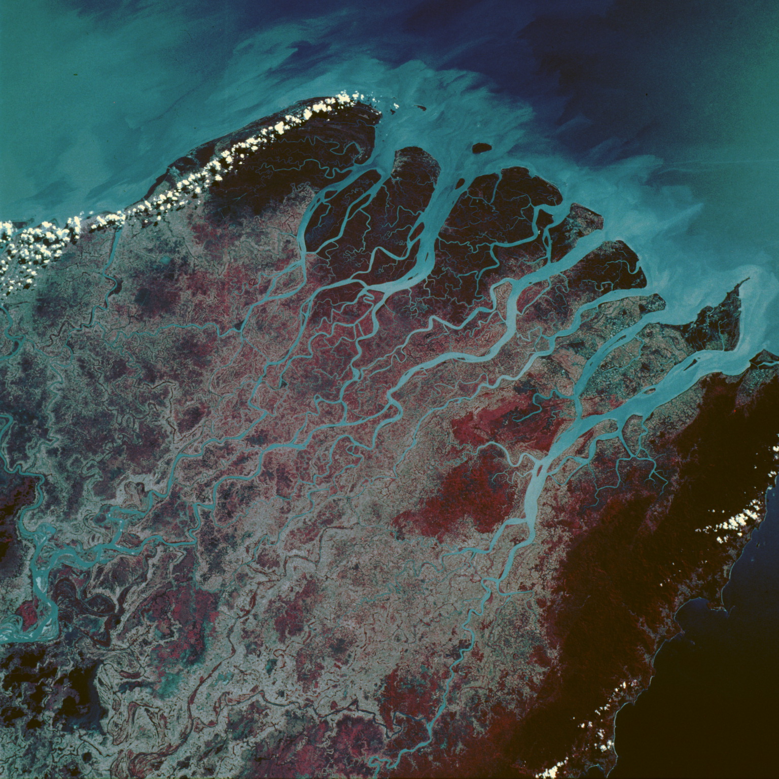
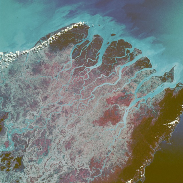
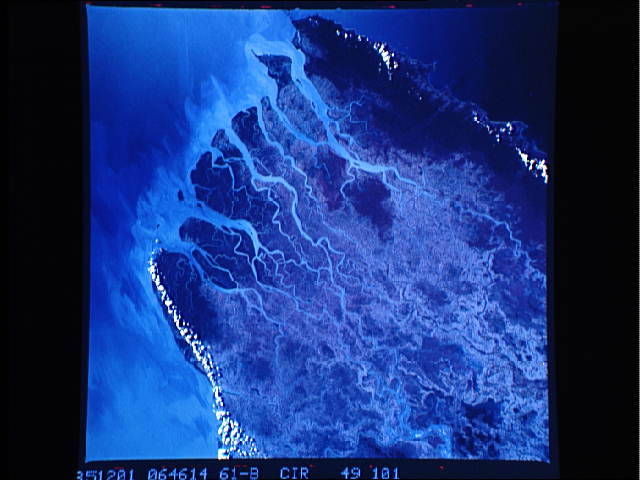
Image Caption: STS61B-49-0101 Mouths of the Irrawaddy River, Burma (Myanmar) November 1985
Infrared film helps accentuate plant growth and sediment accumulations in this near-vertical photograph of the numerous mouths of the Irrawaddy River in western Burma. The Irrawaddy Delta, one of the world's great rice-producing regions, consists of fertile river mud and sand deposited during the last 2 million years. The southernmost extent of the low, forested Arakan Yoma Mountain Range can be seen along the western edge of the photograph. This north-south trending mountain range is usually well watered by the summer monsoons that severely impact the environments of Bangladesh and northeastern India. The deep reds indicate a healthy forest region that is wholly dependent on the summer monsoons for its major precipitation, to the extent that the area is classified as a monsoon rain forest. The deep reds at the southern end of the multichanneled delta reflect large mangrove forests. The light blues show the sediment plumes within the stream channels extending southward into the Andaman Sea.
Infrared film helps accentuate plant growth and sediment accumulations in this near-vertical photograph of the numerous mouths of the Irrawaddy River in western Burma. The Irrawaddy Delta, one of the world's great rice-producing regions, consists of fertile river mud and sand deposited during the last 2 million years. The southernmost extent of the low, forested Arakan Yoma Mountain Range can be seen along the western edge of the photograph. This north-south trending mountain range is usually well watered by the summer monsoons that severely impact the environments of Bangladesh and northeastern India. The deep reds indicate a healthy forest region that is wholly dependent on the summer monsoons for its major precipitation, to the extent that the area is classified as a monsoon rain forest. The deep reds at the southern end of the multichanneled delta reflect large mangrove forests. The light blues show the sediment plumes within the stream channels extending southward into the Andaman Sea.
