STS61B-44-6
| NASA Photo ID | STS61B-44-6 |
| Focal Length | 250mm |
| Date taken | 1985.11.28 |
| Time taken | 00:20:12 GMT |
Resolutions offered for this image:
5255 x 5255 pixels 639 x 639 pixels 5700 x 6000 pixels 500 x 526 pixels 640 x 480 pixels 883 x 852 pixels
5255 x 5255 pixels 639 x 639 pixels 5700 x 6000 pixels 500 x 526 pixels 640 x 480 pixels 883 x 852 pixels


Cloud masks available for this image:
Spacecraft nadir point: 24.0° S, 128.3° E
Photo center point: 24.5° S, 132.5° E
Photo center point by machine learning:
Photo center point: 24.5° S, 132.5° E
Photo center point by machine learning:
Nadir to Photo Center: East
Spacecraft Altitude: 197 nautical miles (365km)
Country or Geographic Name: | AUSTRALIA-NT |
Features: | JAMES RANGES, FINKE RIV. |
| Features Found Using Machine Learning: | |
Cloud Cover Percentage: | 0 (no clouds present) |
Sun Elevation Angle: | 49° |
Sun Azimuth: | 95° |
Camera: | Hasselblad |
Focal Length: | 250mm |
Camera Tilt: | 52 degrees |
Format: | 5017: Kodak, natural color positive, Ektachrome, X Professional, ASA 64, standard base |
Film Exposure: | Normal |
| Additional Information | |
| Width | Height | Annotated | Cropped | Purpose | Links |
|---|---|---|---|---|---|
| 5255 pixels | 5255 pixels | No | No | Earth From Space collection | Download Image |
| 639 pixels | 639 pixels | No | No | Earth From Space collection | Download Image |
| 5700 pixels | 6000 pixels | No | No | Download Image | |
| 500 pixels | 526 pixels | No | No | Download Image | |
| 640 pixels | 480 pixels | No | No | Download Image | |
| 883 pixels | 852 pixels | No | No | Download Image |
Download Packaged File
Download a Google Earth KML for this Image
View photo footprint information
Download a GeoTIFF for this photo
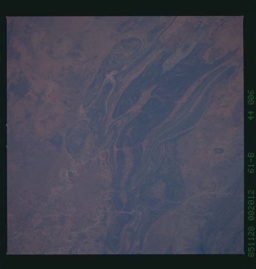
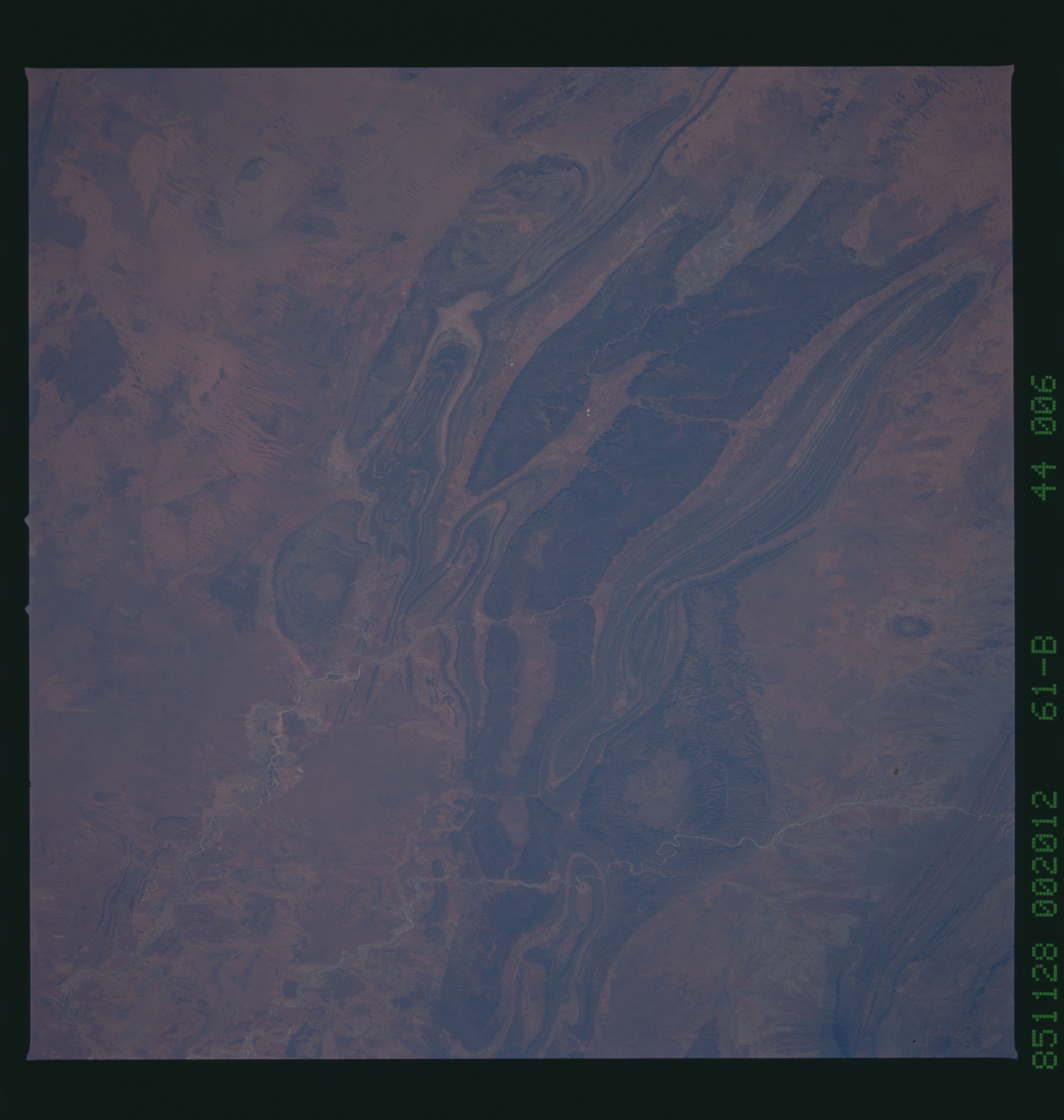
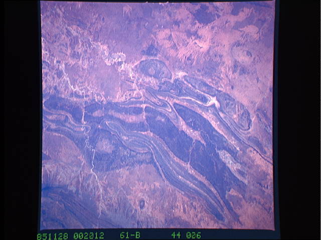
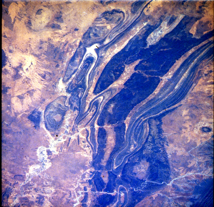
Image Caption: STS61B-44-6 Mountain Ranges, Northern Territory, Australia November 1985
This photograph shows a series of northwest-southeast-trending mountains, most of which rise less than 2500 feet (800 meters) above sea level, near the geographic center of Australia. These ranges--James, Gardiner's, Middle, Krichauff, and George Gills--lie south-southwest of the more well-known Macdonnell Ranges. Several features are discernible in the photograph--the southeast-flowing Finke River near the eastern edge of the photograph; circular Gosses Bluff, an impact crater (northern edge of the photograph), which lies in the arid, flat Missionary Plain between the Macdonnell Ranges to the north (partially visible in the northeast corner of the photograph) and the James Range to the south; and an area of sand ridges south of these low, folded ranges.
This photograph shows a series of northwest-southeast-trending mountains, most of which rise less than 2500 feet (800 meters) above sea level, near the geographic center of Australia. These ranges--James, Gardiner's, Middle, Krichauff, and George Gills--lie south-southwest of the more well-known Macdonnell Ranges. Several features are discernible in the photograph--the southeast-flowing Finke River near the eastern edge of the photograph; circular Gosses Bluff, an impact crater (northern edge of the photograph), which lies in the arid, flat Missionary Plain between the Macdonnell Ranges to the north (partially visible in the northeast corner of the photograph) and the James Range to the south; and an area of sand ridges south of these low, folded ranges.
