STS61A-48-88

| NASA Photo ID | STS61A-48-88 |
| Focal Length | 250mm |
| Date taken | 1985.11.03 |
| Time taken | 18:13:55 GMT |
Resolutions offered for this image:
3904 x 3936 pixels 634 x 639 pixels 5700 x 5900 pixels 500 x 518 pixels 640 x 480 pixels
3904 x 3936 pixels 634 x 639 pixels 5700 x 5900 pixels 500 x 518 pixels 640 x 480 pixels


Cloud masks available for this image:
Spacecraft nadir point: 36.5° N, 112.1° W
Photo center point: 36.0° N, 114.5° W
Photo center point by machine learning:
Photo center point: 36.0° N, 114.5° W
Photo center point by machine learning:
Nadir to Photo Center: West
Spacecraft Altitude: 178 nautical miles (330km)
Country or Geographic Name: | USA-ARIZONA |
Features: | LAKE MEAD |
| Features Found Using Machine Learning: | |
Cloud Cover Percentage: | 0 (no clouds present) |
Sun Elevation Angle: | 36° |
Sun Azimuth: | 162° |
Camera: | Hasselblad |
Focal Length: | 250mm |
Camera Tilt: | 40 degrees |
Format: | 5017: Kodak, natural color positive, Ektachrome, X Professional, ASA 64, standard base |
Film Exposure: | Normal |
| Additional Information | |
| Width | Height | Annotated | Cropped | Purpose | Links |
|---|---|---|---|---|---|
| 3904 pixels | 3936 pixels | No | No | Earth From Space collection | Download Image |
| 634 pixels | 639 pixels | No | No | Earth From Space collection | Download Image |
| 5700 pixels | 5900 pixels | No | No | Download Image | |
| 500 pixels | 518 pixels | No | No | Download Image | |
| 640 pixels | 480 pixels | No | No | Download Image |
Download Packaged File
Download a Google Earth KML for this Image
View photo footprint information
Download a GeoTIFF for this photo
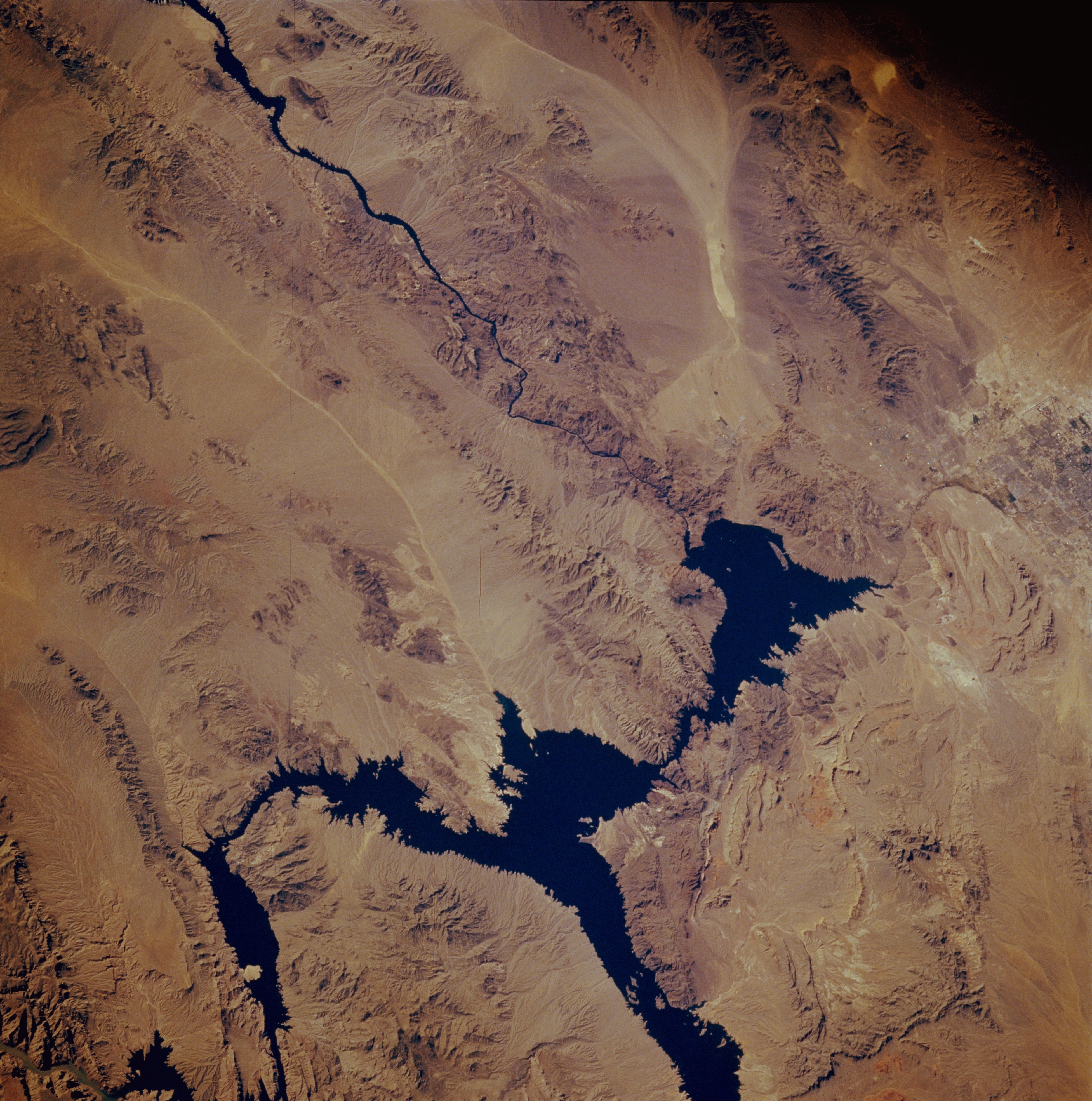
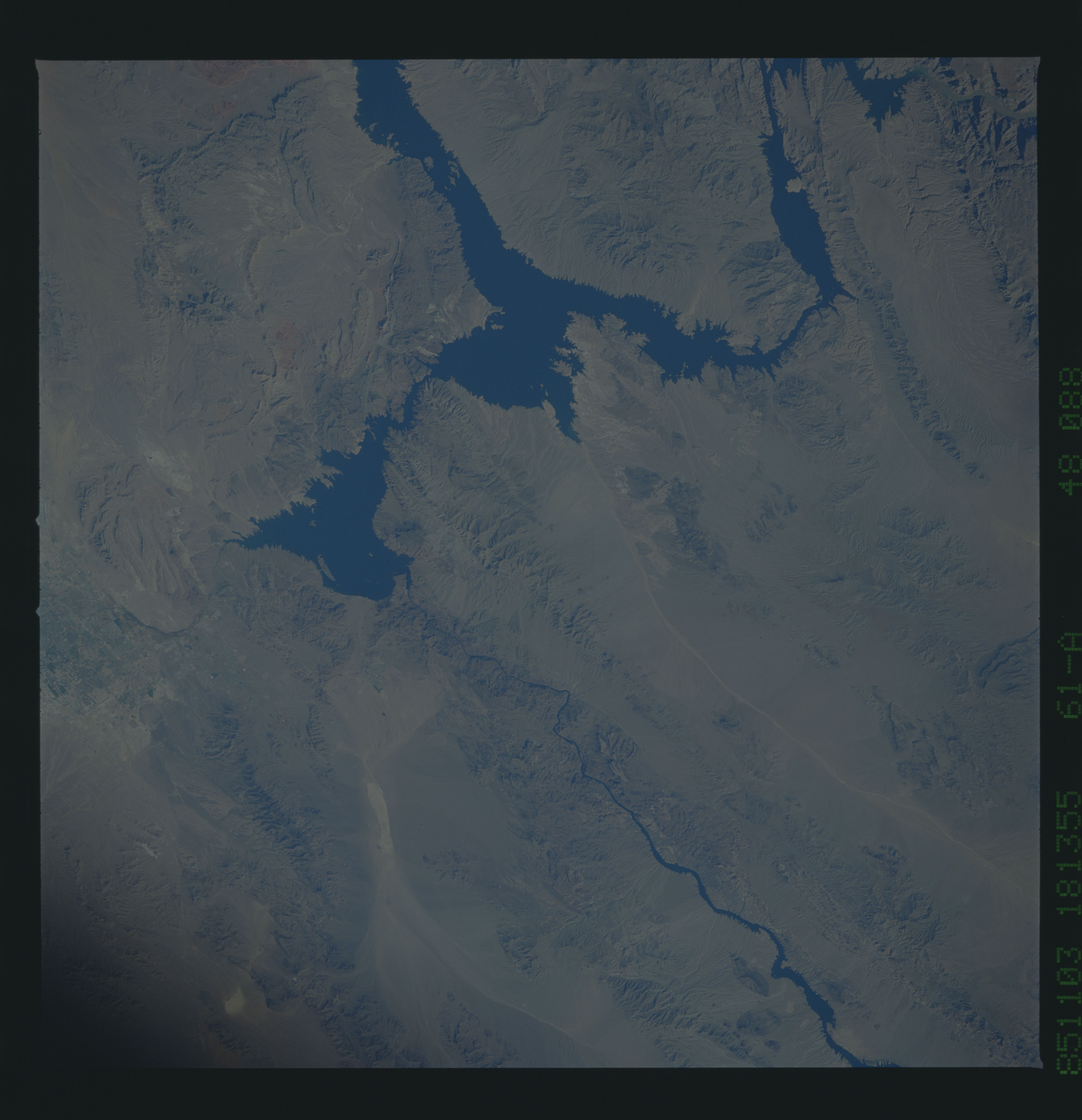
Image Caption: STS61A-048-0088 Lake Mead, Arizona, U.S.A. November 1985
This low-oblique, southwest-looking photograph of northwest Arizona and southeast Nevada shows a desert landscape dominated by spectacular features. Lake Mead, formed by Hoover Dam (formerly Boulder Dam), and the Colorado River constitute part of the boundary between the two states. Although Hoover Dam, which was completed in 1936, was originally constructed to provide flood control, irrigation, power, and river regulation, adjacent Lake Mead has become a major recreational site. Increasing tourism and the growing population of Las Vegas, Nevada, (part of which is visible along the right edge of the photograph) have placed heavier demands on Lake Mead. Part of a drainage system--light, linear Detrital Wash--extends southward from the middle of Lake Mead. Using Las Vegas as a starting point, several mountains are visible--to the northeast, the Virgin Mountains on a large peninsula that extends southward; to the east, the Muddy Mountains; to the southeast, the Black Mountains (in Arizona) and Eldorado Mountains (in Nevada), which are located on either side of the Colorado River south of Hoover Dam; and to the south, the McCullough Mountains. The lighter, elongated area southeast of the McCullough Mountains is a dry lakebed (playa).
This low-oblique, southwest-looking photograph of northwest Arizona and southeast Nevada shows a desert landscape dominated by spectacular features. Lake Mead, formed by Hoover Dam (formerly Boulder Dam), and the Colorado River constitute part of the boundary between the two states. Although Hoover Dam, which was completed in 1936, was originally constructed to provide flood control, irrigation, power, and river regulation, adjacent Lake Mead has become a major recreational site. Increasing tourism and the growing population of Las Vegas, Nevada, (part of which is visible along the right edge of the photograph) have placed heavier demands on Lake Mead. Part of a drainage system--light, linear Detrital Wash--extends southward from the middle of Lake Mead. Using Las Vegas as a starting point, several mountains are visible--to the northeast, the Virgin Mountains on a large peninsula that extends southward; to the east, the Muddy Mountains; to the southeast, the Black Mountains (in Arizona) and Eldorado Mountains (in Nevada), which are located on either side of the Colorado River south of Hoover Dam; and to the south, the McCullough Mountains. The lighter, elongated area southeast of the McCullough Mountains is a dry lakebed (playa).
