STS61A-48-85
| NASA Photo ID | STS61A-48-85 |
| Focal Length | 250mm |
| Date taken | 1985.11.03 |
| Time taken | 18:12:45 GMT |
Resolutions offered for this image:
5700 x 5900 pixels 7254 x 7346 pixels 500 x 518 pixels 640 x 480 pixels 1142 x 1295 pixels 426 x 426 pixels
5700 x 5900 pixels 7254 x 7346 pixels 500 x 518 pixels 640 x 480 pixels 1142 x 1295 pixels 426 x 426 pixels


Cloud masks available for this image:
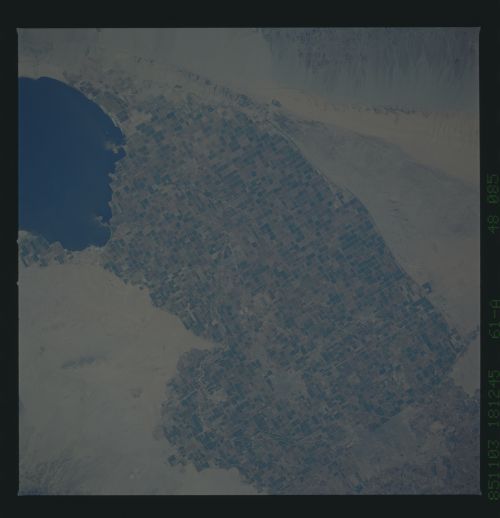
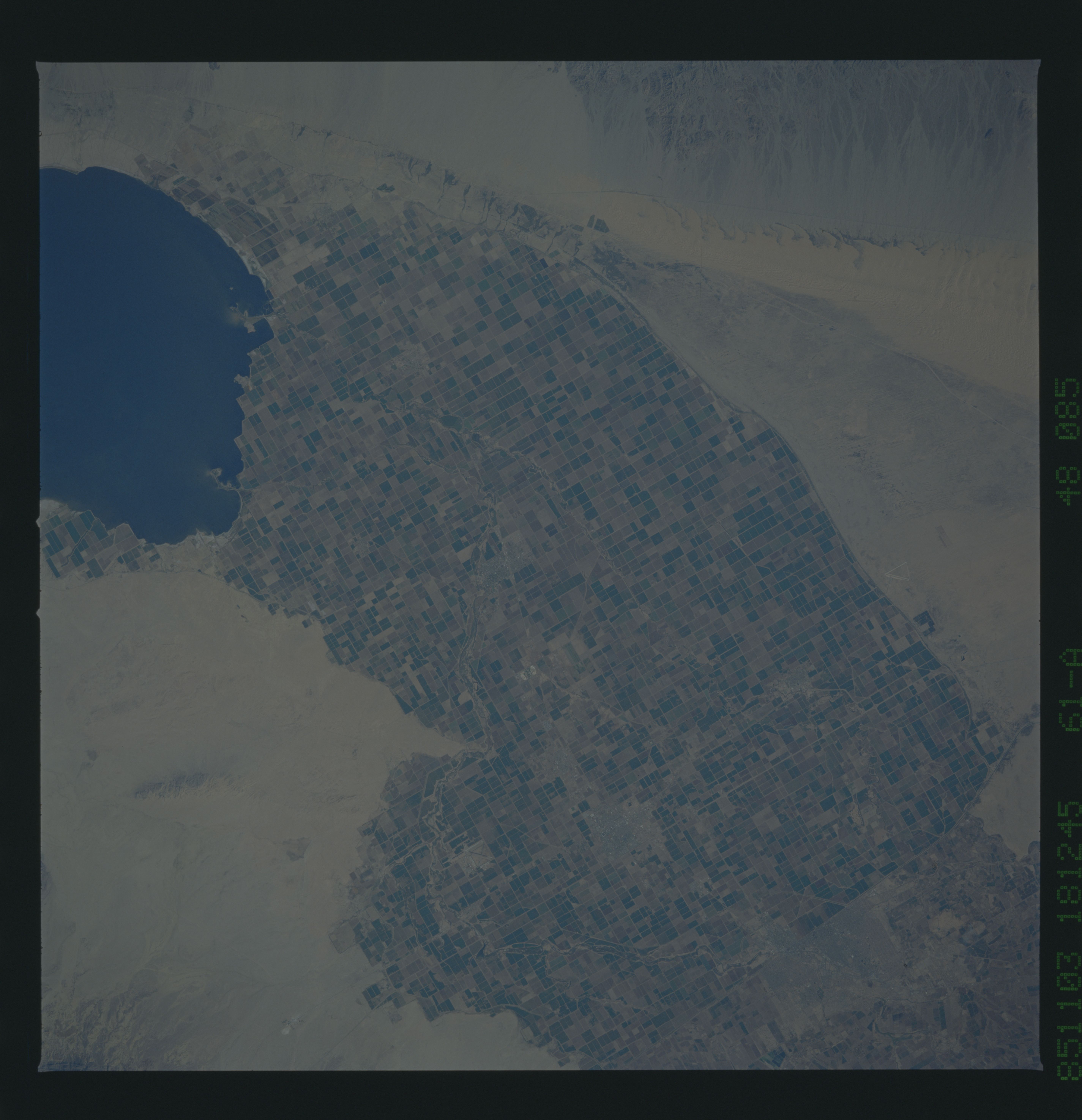
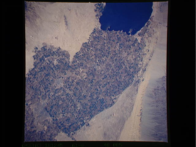
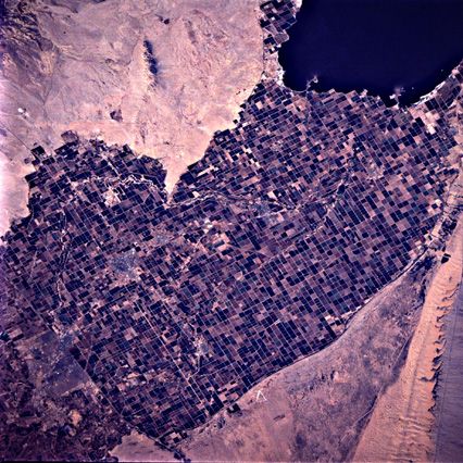
Spacecraft nadir point: 33.0° N, 115.6° W
Photo center point: 33.0° N, 115.5° W
Photo center point by machine learning:
Photo center point: 33.0° N, 115.5° W
Photo center point by machine learning:
Nadir to Photo Center: East
Spacecraft Altitude: 178 nautical miles (330km)
Country or Geographic Name: | USA-CALIFORNIA |
Features: | IMPERIAL VALLEY |
| Features Found Using Machine Learning: | |
Cloud Cover Percentage: | 0 (no clouds present) |
Sun Elevation Angle: | 38° |
Sun Azimuth: | 157° |
Camera: | Hasselblad |
Focal Length: | 250mm |
Camera Tilt: | 2 degrees |
Format: | 5017: Kodak, natural color positive, Ektachrome, X Professional, ASA 64, standard base |
Film Exposure: | Normal |
| Additional Information | |
| Width | Height | Annotated | Cropped | Purpose | Links |
|---|---|---|---|---|---|
| 5700 pixels | 5900 pixels | No | No | Download Image | |
| 7254 pixels | 7346 pixels | No | No | Scientist Request | Download Image |
| 500 pixels | 518 pixels | No | No | Download Image | |
| 640 pixels | 480 pixels | No | No | Download Image | |
| 1142 pixels | 1295 pixels | No | No | Download Image | |
| 426 pixels | 426 pixels | No | No | Download Image |
Download Packaged File
Download a Google Earth KML for this Image
View photo footprint information
Download a GeoTIFF for this photo
Image Caption: none
