STS61A-48-73
| NASA Photo ID | STS61A-48-73 |
| Focal Length | 250mm |
| Date taken | 1985.11.03 |
| Time taken | 16:40:38 GMT |
Resolutions offered for this image:
3904 x 3904 pixels 639 x 639 pixels 5700 x 5900 pixels 500 x 518 pixels 640 x 480 pixels
3904 x 3904 pixels 639 x 639 pixels 5700 x 5900 pixels 500 x 518 pixels 640 x 480 pixels
Cloud masks available for this image:
Spacecraft nadir point: 29.7° N, 95.4° W
Photo center point: 29.5° N, 95.0° W
Photo center point by machine learning:
Photo center point: 29.5° N, 95.0° W
Photo center point by machine learning:
Nadir to Photo Center: Southeast
Spacecraft Altitude: 177 nautical miles (328km)
Country or Geographic Name: | USA-TEXAS |
Features: | GALVESTON BAY |
| Features Found Using Machine Learning: | |
Cloud Cover Percentage: | 0 (no clouds present) |
Sun Elevation Angle: | 40° |
Sun Azimuth: | 152° |
Camera: | Hasselblad |
Focal Length: | 250mm |
Camera Tilt: | 9 degrees |
Format: | 5017: Kodak, natural color positive, Ektachrome, X Professional, ASA 64, standard base |
Film Exposure: | Normal |
| Additional Information | |
| Width | Height | Annotated | Cropped | Purpose | Links |
|---|---|---|---|---|---|
| 3904 pixels | 3904 pixels | No | No | Earth From Space collection | Download Image |
| 639 pixels | 639 pixels | No | No | Earth From Space collection | Download Image |
| 5700 pixels | 5900 pixels | No | No | Download Image | |
| 500 pixels | 518 pixels | No | No | Download Image | |
| 640 pixels | 480 pixels | No | No | Download Image |
Download Packaged File
Download a Google Earth KML for this Image
View photo footprint information
Download a GeoTIFF for this photo
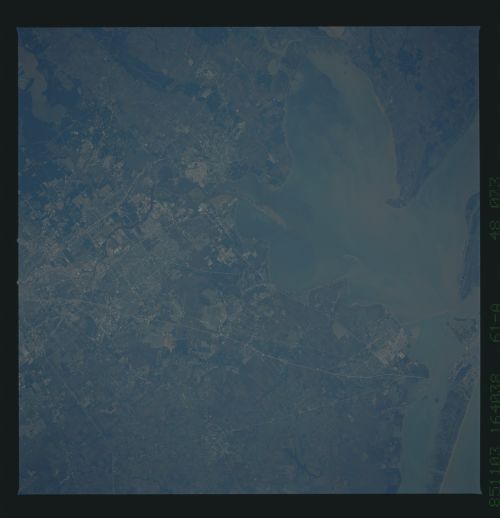
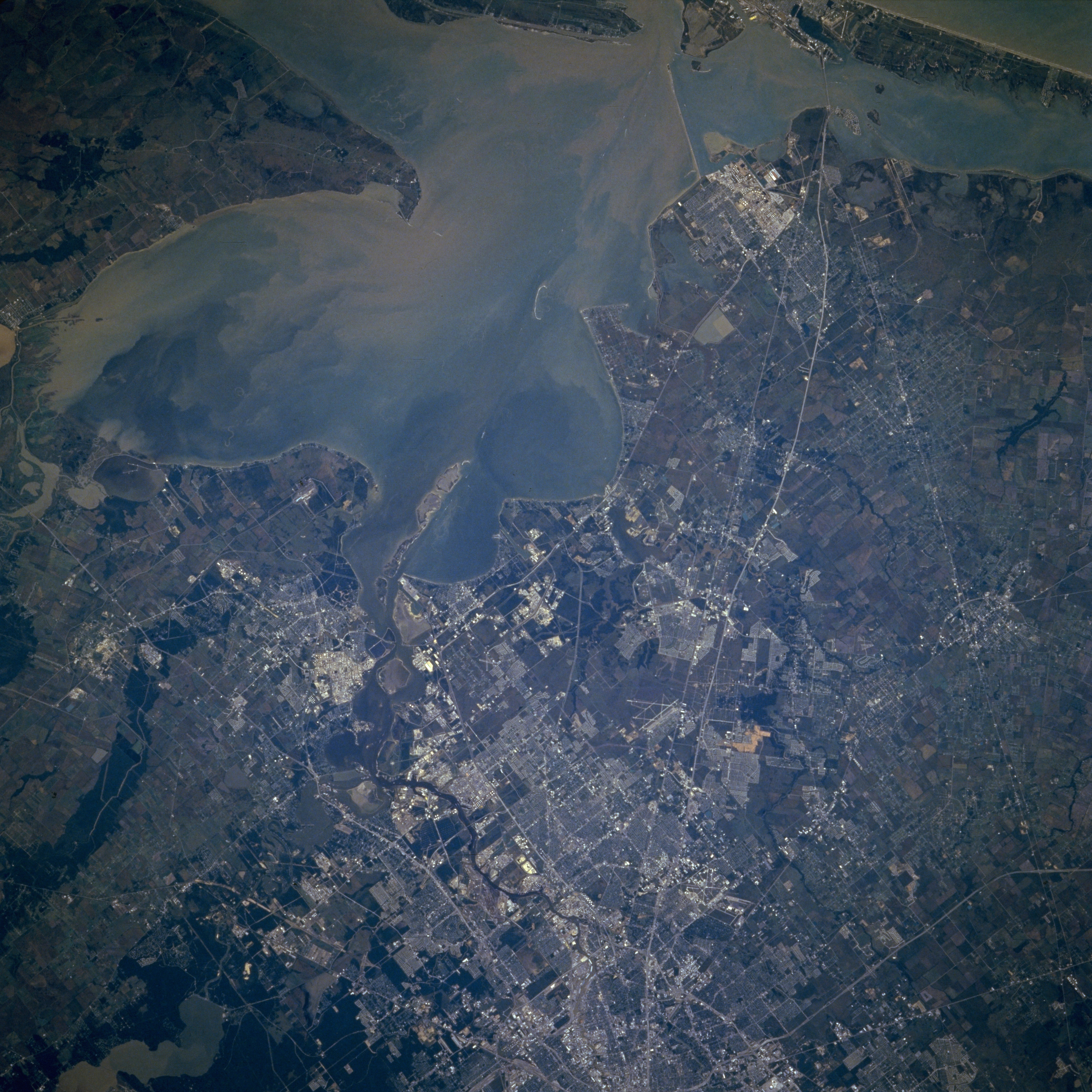
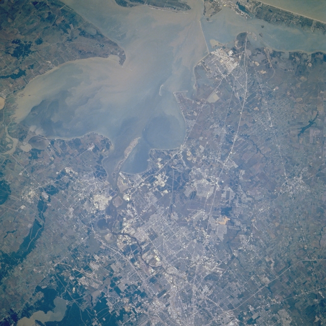
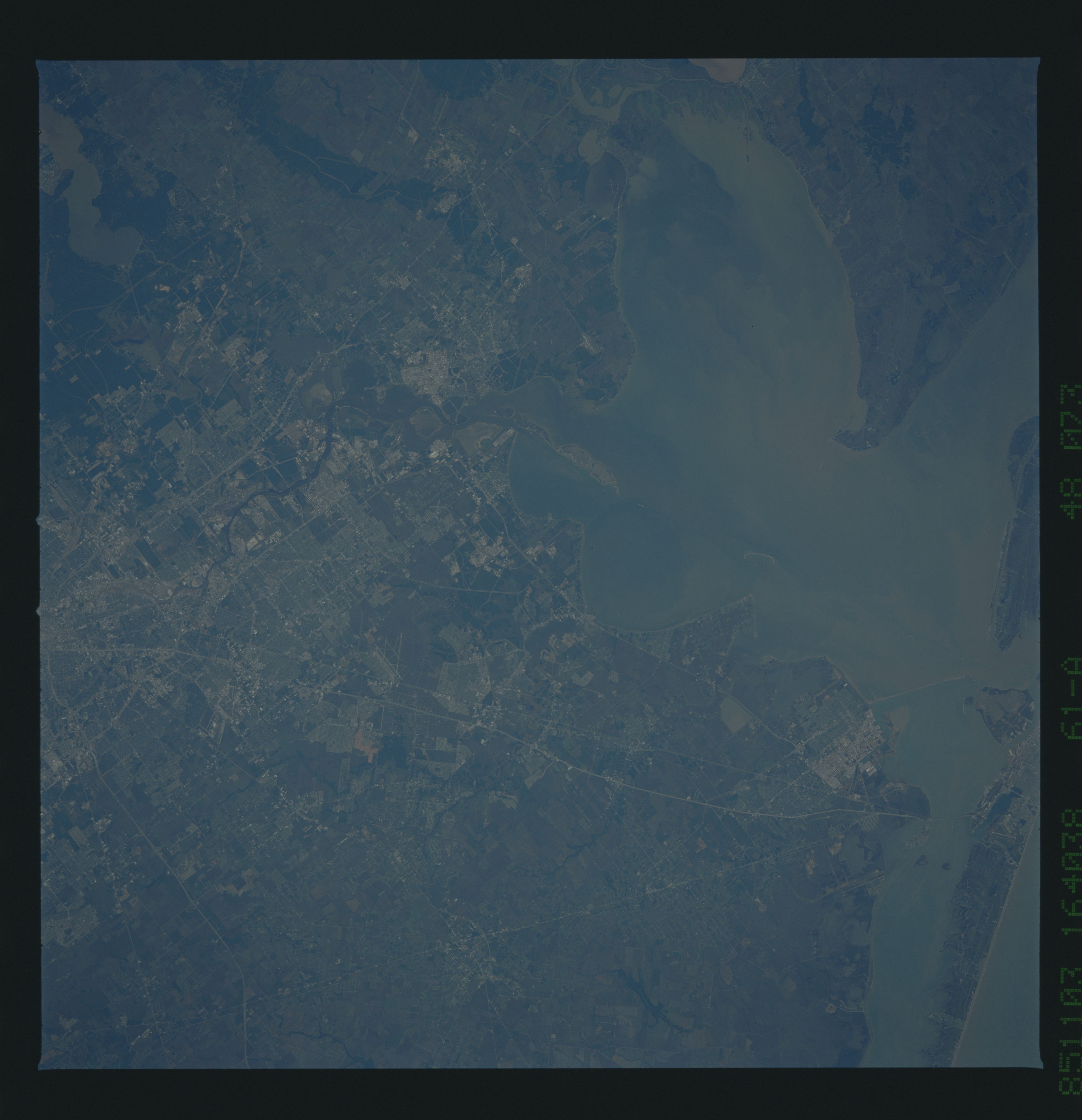
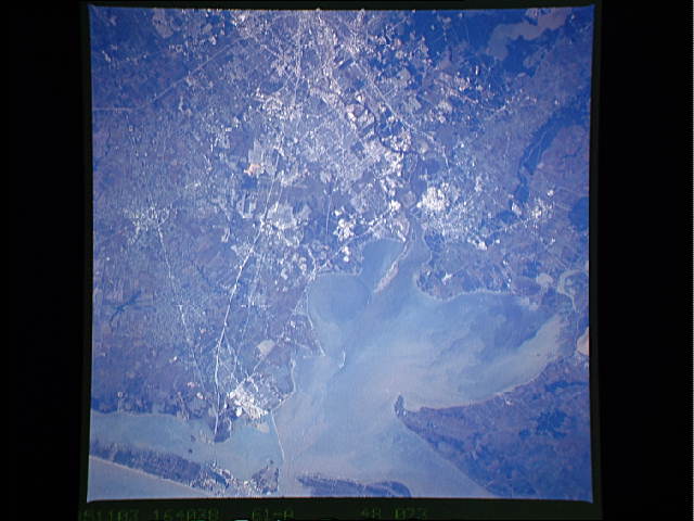
Image Caption: STS61A-048-0073 Southeast Houston and Galveston Bay, Texas, U.S.A. November 1985
Sediment-laden Galveston Bay and surrounding communities are featured in the east-southeast-looking, low-oblique photograph. Much of the sediment enters Galveston Bay from the mouth of the Trinity River (slightly above left center). Covering the former mouths and estuaries of both the Trinity River and San Jacinto River, Galveston Bay is a shallow bay with an average depth of 12 feet (4 meters). Dredging allows the entrance of large merchant ships into the bay from the Gulf of Mexico and access to the Port of Houston, the third-busiest port in the United States. Apparent is the snakelike Houston Ship Channel, 57 miles (92 kilometers) long, 200 feet (61 meters) wide, and 34 feet (10 meters) deep, bounded by petrochemical facilities, oil refineries, and numerous other industries along its banks. Visible are Interstate Highway 45 traversing from the center of Houston southeastward to Galveston Island; Lake Houston (lower left); and Clear Lake City, home of the NASA Lyndon B. Johnson Space Center (right of center).
Sediment-laden Galveston Bay and surrounding communities are featured in the east-southeast-looking, low-oblique photograph. Much of the sediment enters Galveston Bay from the mouth of the Trinity River (slightly above left center). Covering the former mouths and estuaries of both the Trinity River and San Jacinto River, Galveston Bay is a shallow bay with an average depth of 12 feet (4 meters). Dredging allows the entrance of large merchant ships into the bay from the Gulf of Mexico and access to the Port of Houston, the third-busiest port in the United States. Apparent is the snakelike Houston Ship Channel, 57 miles (92 kilometers) long, 200 feet (61 meters) wide, and 34 feet (10 meters) deep, bounded by petrochemical facilities, oil refineries, and numerous other industries along its banks. Visible are Interstate Highway 45 traversing from the center of Houston southeastward to Galveston Island; Lake Houston (lower left); and Clear Lake City, home of the NASA Lyndon B. Johnson Space Center (right of center).
