STS61A-48-72
| NASA Photo ID | STS61A-48-72 |
| Focal Length | 250mm |
| Date taken | 1985.11.03 |
| Time taken | 16:40:34 GMT |
Resolutions offered for this image:
3904 x 3904 pixels 639 x 639 pixels 5700 x 5900 pixels 500 x 518 pixels 640 x 480 pixels
3904 x 3904 pixels 639 x 639 pixels 5700 x 5900 pixels 500 x 518 pixels 640 x 480 pixels


Cloud masks available for this image:
Spacecraft nadir point: 29.5° N, 95.5° W
Photo center point: 29.5° N, 95.0° W
Photo center point by machine learning:
Photo center point: 29.5° N, 95.0° W
Photo center point by machine learning:
Nadir to Photo Center: East
Spacecraft Altitude: 177 nautical miles (328km)
Country or Geographic Name: | USA-TEXAS |
Features: | GALVESTON BAY |
| Features Found Using Machine Learning: | |
Cloud Cover Percentage: | 0 (no clouds present) |
Sun Elevation Angle: | 40° |
Sun Azimuth: | 152° |
Camera: | Hasselblad |
Focal Length: | 250mm |
Camera Tilt: | 10 degrees |
Format: | 5017: Kodak, natural color positive, Ektachrome, X Professional, ASA 64, standard base |
Film Exposure: | Normal |
| Additional Information | |
| Width | Height | Annotated | Cropped | Purpose | Links |
|---|---|---|---|---|---|
| 3904 pixels | 3904 pixels | No | No | Earth From Space collection | Download Image |
| 639 pixels | 639 pixels | No | No | Earth From Space collection | Download Image |
| 5700 pixels | 5900 pixels | No | No | Download Image | |
| 500 pixels | 518 pixels | No | No | Download Image | |
| 640 pixels | 480 pixels | No | No | Download Image |
Download Packaged File
Download a Google Earth KML for this Image
View photo footprint information
Download a GeoTIFF for this photo
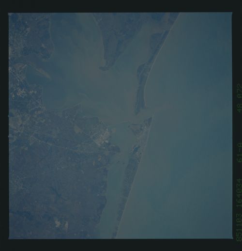
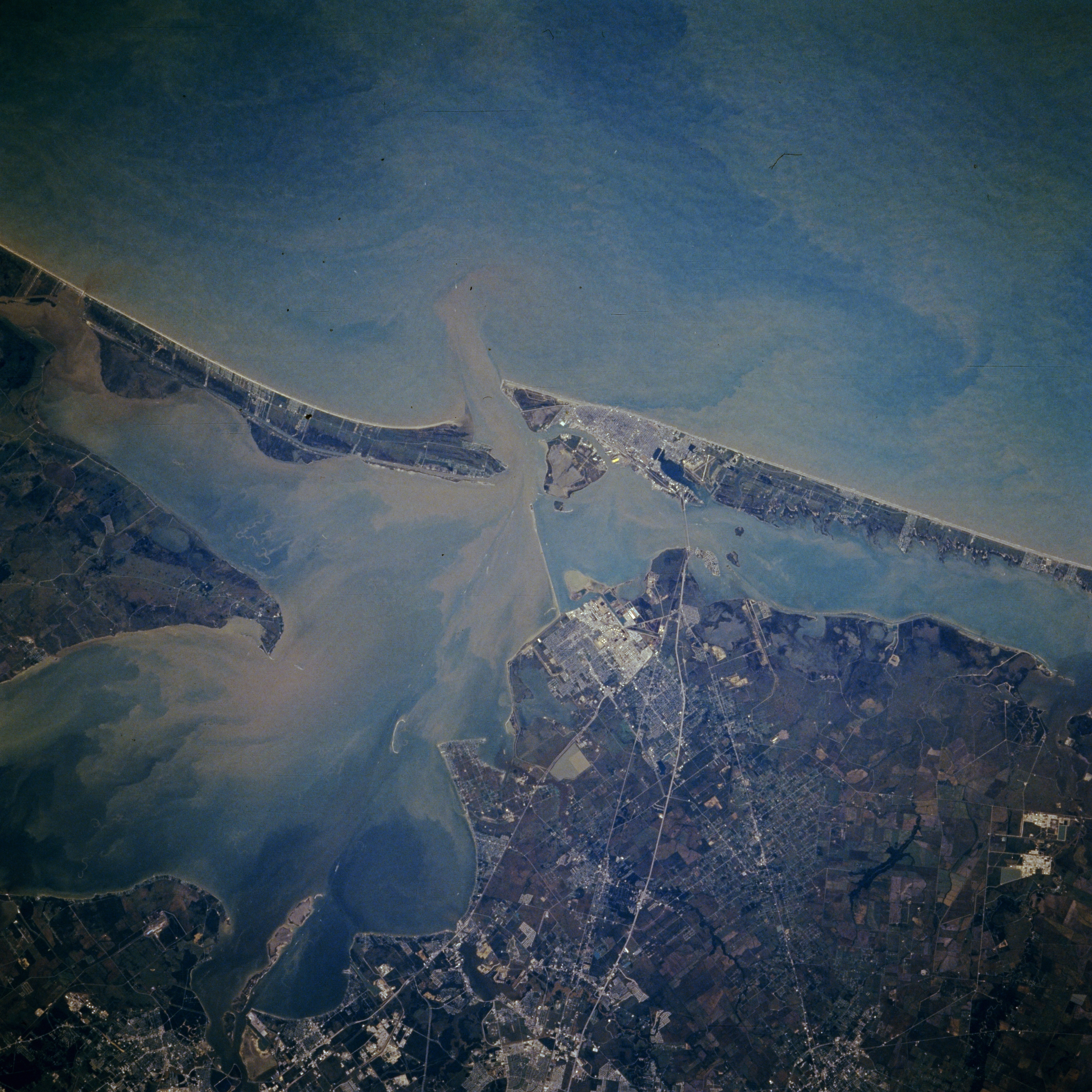
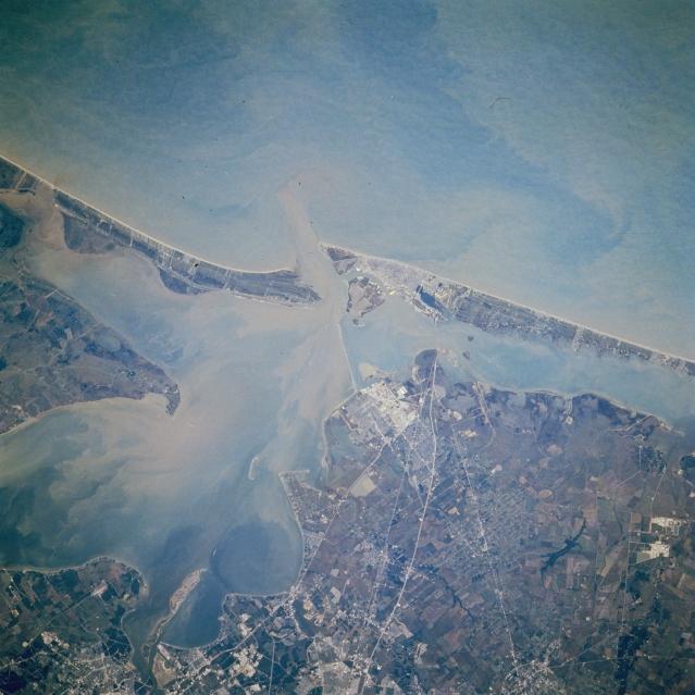
Image Caption: STS61A-048-0072 Galveston and Galveston Bay, Texas, U.S.A. November 1985
Apparent in this southeast-looking, low-oblique photograph is Galveston on the eastern tip of Galveston Island at the entrance to sediment-laden Galveston Bay, a shallow inlet of the Gulf of Mexico. Galveston is a major port of entry with shipbuilding and repair, oil refining, fishing and shrimping, and tourism as major industries. East Bay and West Bay, between Bolivar Peninsula and the barrier island of Galveston, are part of the Intracoastal Waterway. The reflective area northwest of Galveston denotes numerous oil refineries and petrochemical plants in Texas City. Clear Lake City, home of the NASA Lyndon B. Johnson Space Center, is discernible (bottom center).
Apparent in this southeast-looking, low-oblique photograph is Galveston on the eastern tip of Galveston Island at the entrance to sediment-laden Galveston Bay, a shallow inlet of the Gulf of Mexico. Galveston is a major port of entry with shipbuilding and repair, oil refining, fishing and shrimping, and tourism as major industries. East Bay and West Bay, between Bolivar Peninsula and the barrier island of Galveston, are part of the Intracoastal Waterway. The reflective area northwest of Galveston denotes numerous oil refineries and petrochemical plants in Texas City. Clear Lake City, home of the NASA Lyndon B. Johnson Space Center, is discernible (bottom center).
