STS61A-44-97
| NASA Photo ID | STS61A-44-97 |
| Focal Length | 250mm |
| Date taken | 1985.11.03 |
| Time taken | 01:31:38 GMT |
Resolutions offered for this image:
4072 x 4072 pixels 639 x 639 pixels 5700 x 5900 pixels 500 x 518 pixels 640 x 480 pixels
4072 x 4072 pixels 639 x 639 pixels 5700 x 5900 pixels 500 x 518 pixels 640 x 480 pixels


Cloud masks available for this image:
Spacecraft nadir point: 34.1° N, 139.6° E
Photo center point: 35.0° N, 136.5° E
Photo center point by machine learning:
Photo center point: 35.0° N, 136.5° E
Photo center point by machine learning:
Nadir to Photo Center: West
Spacecraft Altitude: 178 nautical miles (330km)
Country or Geographic Name: | JAPAN |
Features: | NAGOYA |
| Features Found Using Machine Learning: | |
Cloud Cover Percentage: | 5 (1-10)% |
Sun Elevation Angle: | 39° |
Sun Azimuth: | 163° |
Camera: | Hasselblad |
Focal Length: | 250mm |
Camera Tilt: | 47 degrees |
Format: | 5017: Kodak, natural color positive, Ektachrome, X Professional, ASA 64, standard base |
Film Exposure: | Normal |
| Additional Information | |
| Width | Height | Annotated | Cropped | Purpose | Links |
|---|---|---|---|---|---|
| 4072 pixels | 4072 pixels | No | No | Earth From Space collection | Download Image |
| 639 pixels | 639 pixels | No | No | Earth From Space collection | Download Image |
| 5700 pixels | 5900 pixels | No | No | Download Image | |
| 500 pixels | 518 pixels | No | No | Download Image | |
| 640 pixels | 480 pixels | No | No | Download Image |
Download Packaged File
Download a Google Earth KML for this Image
View photo footprint information
Download a GeoTIFF for this photo
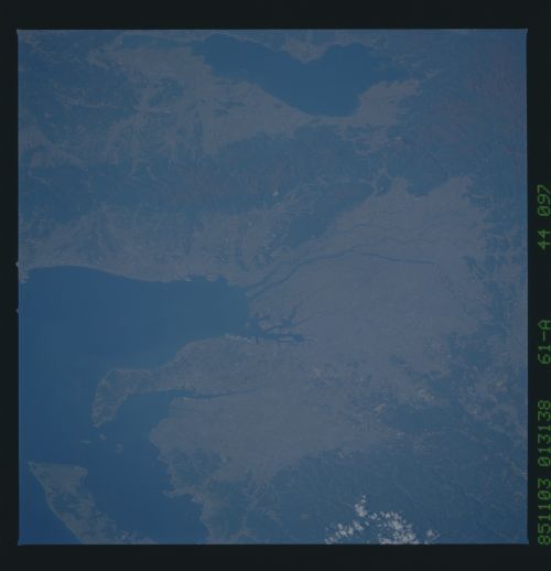
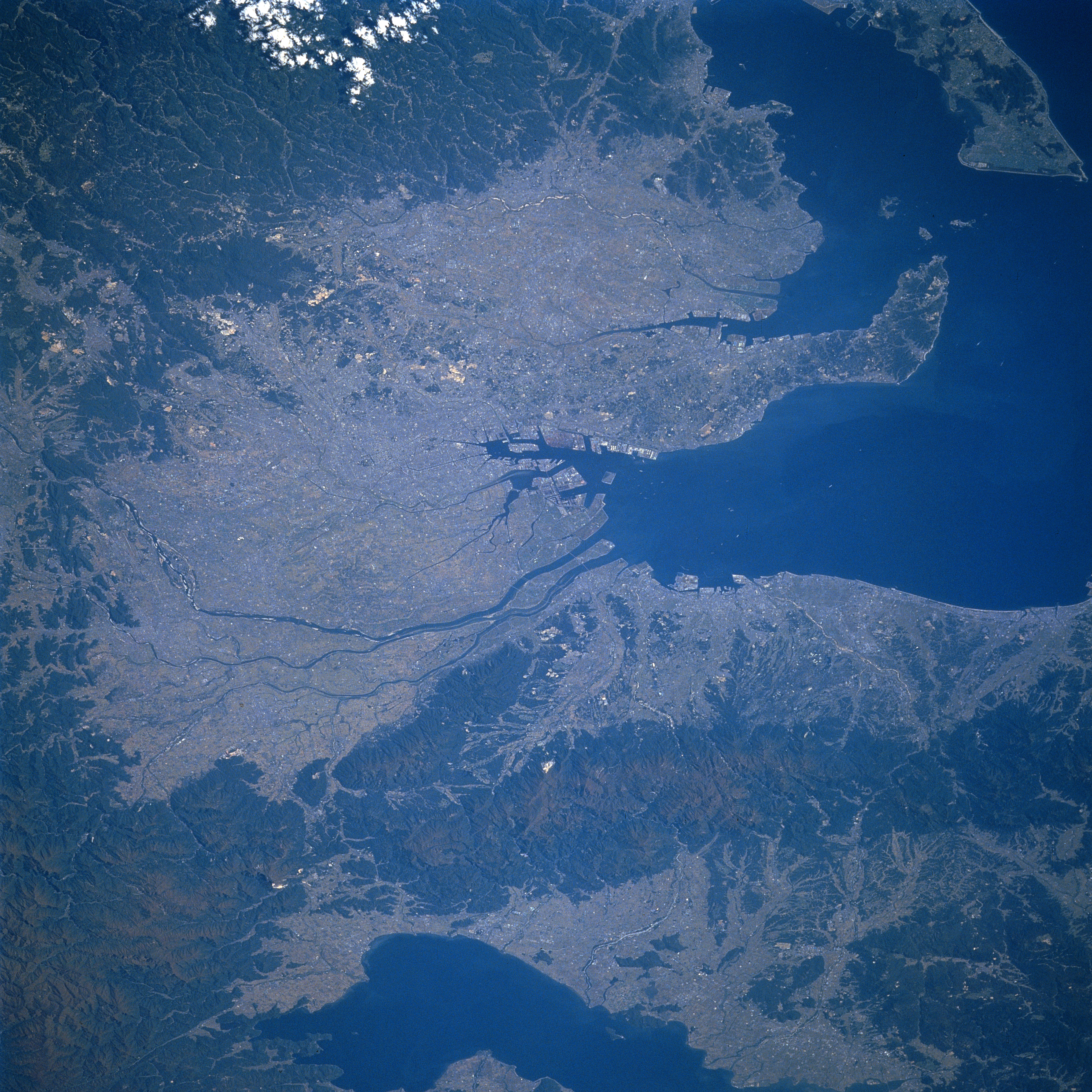
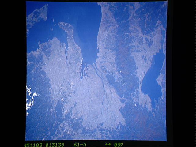
Image Caption: STS61A-44-0097 Nagoya, Honshu, Japan November 1985
Located along the south central coast of Honshu, Nagoya, one of Japan's major industrial centers, can be located in the center of this west-looking view. This important port city is strategically located at the northeast end of Ise Bay (note the extensive harbor facilities slightly below the center of the picture), as well as being located between the larger Kobe/Osaka and Tokyo/Yokahmana metroplexes, west and east respectively (not in this image). Nagoya is sited on a densely populated (over 2 million people), low-lying, alluvial plain that is surrounded by volcanic mountains (darker landscape). Several other industrial cities that are situated around the periphery of Ise Bay blend together to give the appearance of one urban area (lighter colored landscape). There is some farming activity where topography allows which also adds to the overall lighter colored terrain. Several short-flowing rivers, including the Nagara River, drain southward and enter the northern end of Ise Bay west of Nagoya. Lake Biwa is the large lake west of the mountains (top center).
Located along the south central coast of Honshu, Nagoya, one of Japan's major industrial centers, can be located in the center of this west-looking view. This important port city is strategically located at the northeast end of Ise Bay (note the extensive harbor facilities slightly below the center of the picture), as well as being located between the larger Kobe/Osaka and Tokyo/Yokahmana metroplexes, west and east respectively (not in this image). Nagoya is sited on a densely populated (over 2 million people), low-lying, alluvial plain that is surrounded by volcanic mountains (darker landscape). Several other industrial cities that are situated around the periphery of Ise Bay blend together to give the appearance of one urban area (lighter colored landscape). There is some farming activity where topography allows which also adds to the overall lighter colored terrain. Several short-flowing rivers, including the Nagara River, drain southward and enter the northern end of Ise Bay west of Nagoya. Lake Biwa is the large lake west of the mountains (top center).
