STS61A-44-55
| NASA Photo ID | STS61A-44-55 |
| Focal Length | 250mm |
| Date taken | 1985.11.02 |
| Time taken | 22:08:19 GMT |
Resolutions offered for this image:
5255 x 5255 pixels 639 x 639 pixels 5700 x 5900 pixels 500 x 518 pixels 640 x 480 pixels
5255 x 5255 pixels 639 x 639 pixels 5700 x 5900 pixels 500 x 518 pixels 640 x 480 pixels


Cloud masks available for this image:
Spacecraft nadir point: 34.4° S, 138.9° E
Photo center point: 35.5° S, 139.5° E
Photo center point by machine learning:
Photo center point: 35.5° S, 139.5° E
Photo center point by machine learning:
Nadir to Photo Center: Southeast
Spacecraft Altitude: 180 nautical miles (333km)
Country or Geographic Name: | AUSTRALIA-SA |
Features: | LAKE ALEXANDRINA |
| Features Found Using Machine Learning: | |
Cloud Cover Percentage: | 0 (no clouds present) |
Sun Elevation Angle: | 29° |
Sun Azimuth: | 88° |
Camera: | Hasselblad |
Focal Length: | 250mm |
Camera Tilt: | 23 degrees |
Format: | 5017: Kodak, natural color positive, Ektachrome, X Professional, ASA 64, standard base |
Film Exposure: | Normal |
| Additional Information | |
| Width | Height | Annotated | Cropped | Purpose | Links |
|---|---|---|---|---|---|
| 5255 pixels | 5255 pixels | No | No | Earth From Space collection | Download Image |
| 639 pixels | 639 pixels | No | No | Earth From Space collection | Download Image |
| 5700 pixels | 5900 pixels | No | No | Download Image | |
| 500 pixels | 518 pixels | No | No | Download Image | |
| 640 pixels | 480 pixels | No | No | Download Image |
Download Packaged File
Download a Google Earth KML for this Image
View photo footprint information
Download a GeoTIFF for this photo
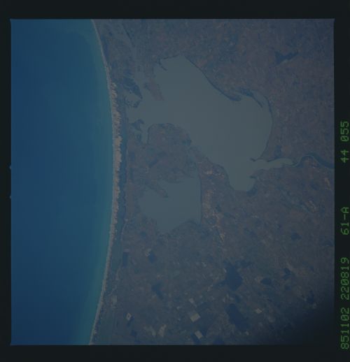
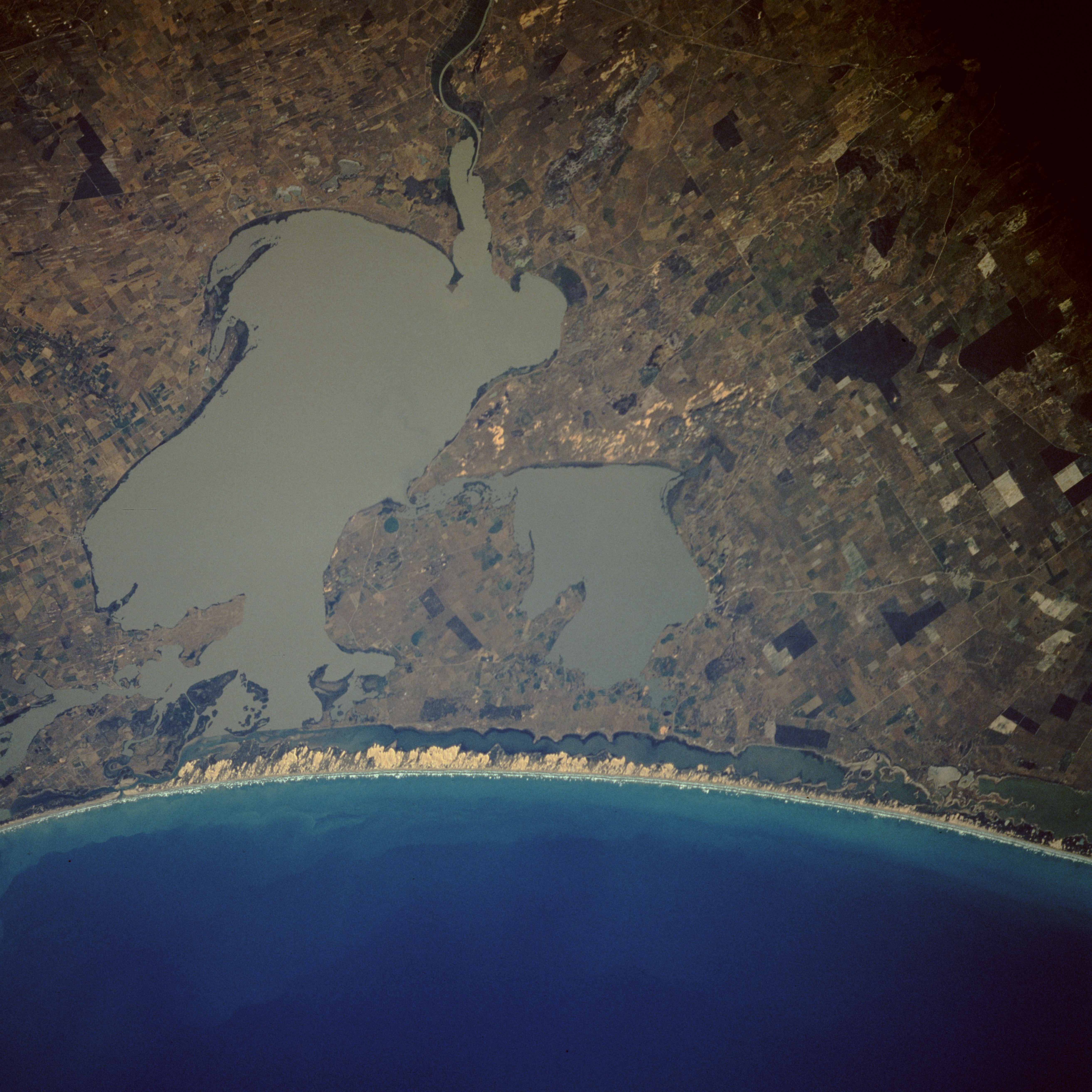
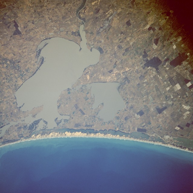
Image Caption: STS61A-44-0055 Lake Alexandrina and Lake Albert, South Australia, Australia November 1985
Lake Alexandrina and smaller Lake Albert are located approximately 50 miles (80 kilometers) southeast of Adelaide, the capital of South Australia. Despite the fact that the Murray River and its major tributary, the Darling River, make up the most significant river network in Australia, this photograph shows an unimpressive delta as the Murray River enters the northeast side of Lake Alexandrina, which in turn empties into Encounter Bay to the west. The long, narrow sandy beach is part of Younghusband Peninsula, and the lagoon behind the beach is known as The Coorong. The Coorong and the two lakes have been identified as Ramsar Sites, critical wetland ecosystems where international attention will be focused. The major industry in this region is raising sheep--Merino sheep for wool production and fat lambs for human consumption. This area was the last part of the Australian coast to be surveyed by early explorers in the early 1800s.
Lake Alexandrina and smaller Lake Albert are located approximately 50 miles (80 kilometers) southeast of Adelaide, the capital of South Australia. Despite the fact that the Murray River and its major tributary, the Darling River, make up the most significant river network in Australia, this photograph shows an unimpressive delta as the Murray River enters the northeast side of Lake Alexandrina, which in turn empties into Encounter Bay to the west. The long, narrow sandy beach is part of Younghusband Peninsula, and the lagoon behind the beach is known as The Coorong. The Coorong and the two lakes have been identified as Ramsar Sites, critical wetland ecosystems where international attention will be focused. The major industry in this region is raising sheep--Merino sheep for wool production and fat lambs for human consumption. This area was the last part of the Australian coast to be surveyed by early explorers in the early 1800s.
