STS61A-43-42
| NASA Photo ID | STS61A-43-42 |
| Focal Length | 100mm |
| Date taken | 1985.11.02 |
| Time taken | 07:11:10 GMT |
Resolutions offered for this image:
5257 x 5257 pixels 640 x 640 pixels 5700 x 5900 pixels 500 x 518 pixels 640 x 480 pixels 632 x 647 pixels
5257 x 5257 pixels 640 x 640 pixels 5700 x 5900 pixels 500 x 518 pixels 640 x 480 pixels 632 x 647 pixels
Cloud masks available for this image:
Spacecraft nadir point: 8.7° N, 38.7° E
Photo center point: 14.0° N, 41.0° E
Photo center point by machine learning:
Photo center point: 14.0° N, 41.0° E
Photo center point by machine learning:
Nadir to Photo Center: North
Spacecraft Altitude: 175 nautical miles (324km)
Country or Geographic Name: | ETHIOPIA |
Features: | DANAKIL DEPR., AFRERA L. |
| Features Found Using Machine Learning: | |
Cloud Cover Percentage: | 0 (no clouds present) |
Sun Elevation Angle: | 52° |
Sun Azimuth: | 128° |
Camera: | Hasselblad |
Focal Length: | 100mm |
Camera Tilt: | High Oblique |
Format: | 5017: Kodak, natural color positive, Ektachrome, X Professional, ASA 64, standard base |
Film Exposure: | Normal |
| Additional Information | |
| Width | Height | Annotated | Cropped | Purpose | Links |
|---|---|---|---|---|---|
| 5257 pixels | 5257 pixels | No | No | Earth From Space collection | Download Image |
| 640 pixels | 640 pixels | No | No | Earth From Space collection | Download Image |
| 5700 pixels | 5900 pixels | No | No | Download Image | |
| 500 pixels | 518 pixels | No | No | Download Image | |
| 640 pixels | 480 pixels | No | No | Download Image | |
| 632 pixels | 647 pixels | No | No | Download Image |
Download Packaged File
Download a Google Earth KML for this Image
View photo footprint information
Download a GeoTIFF for this photo
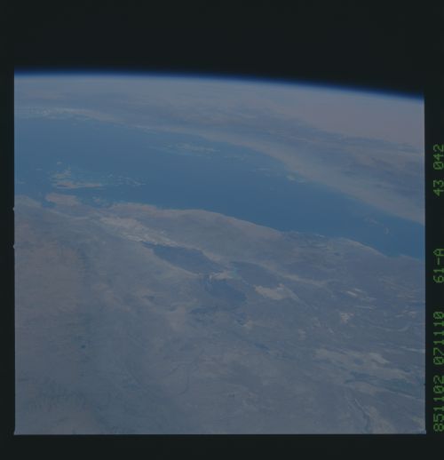
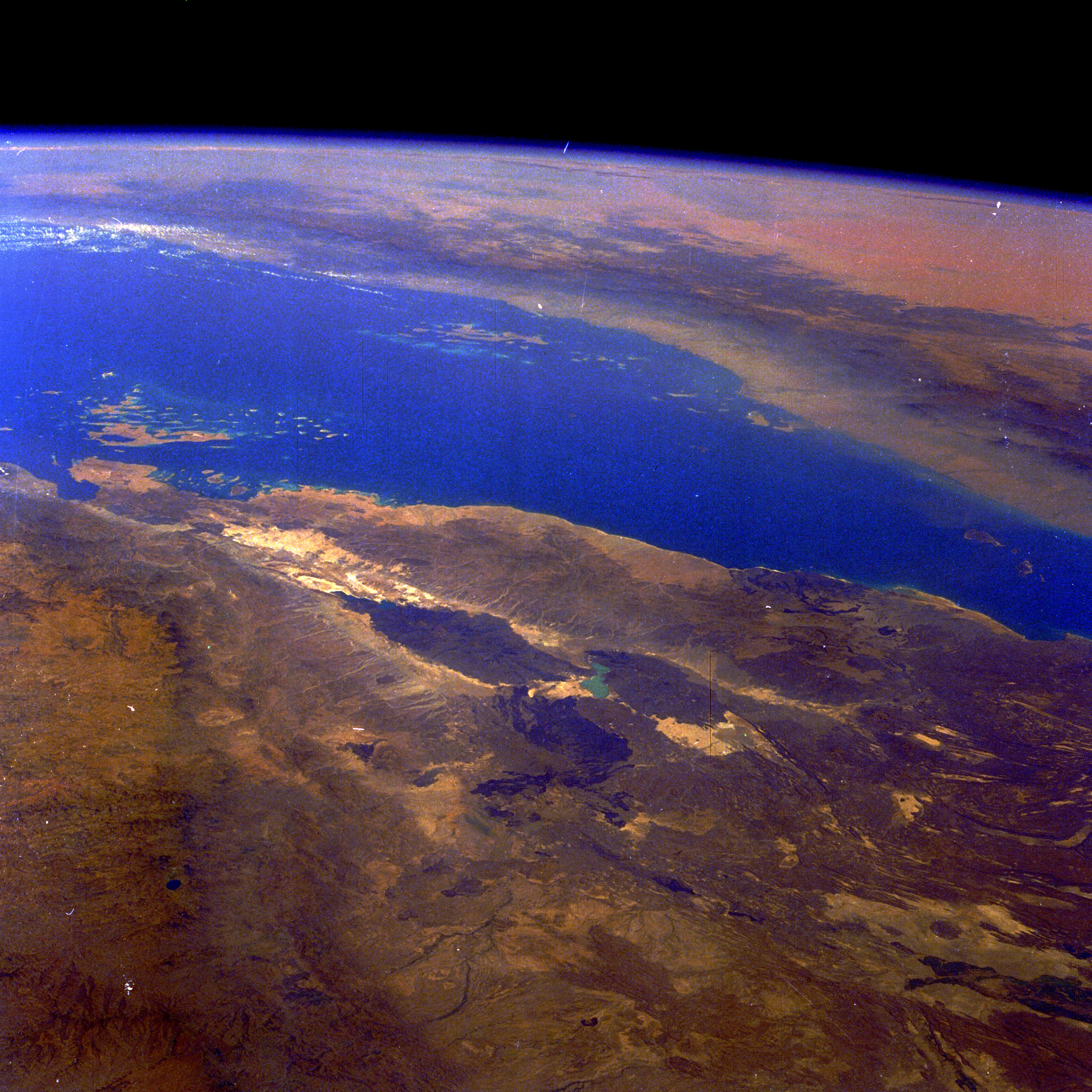
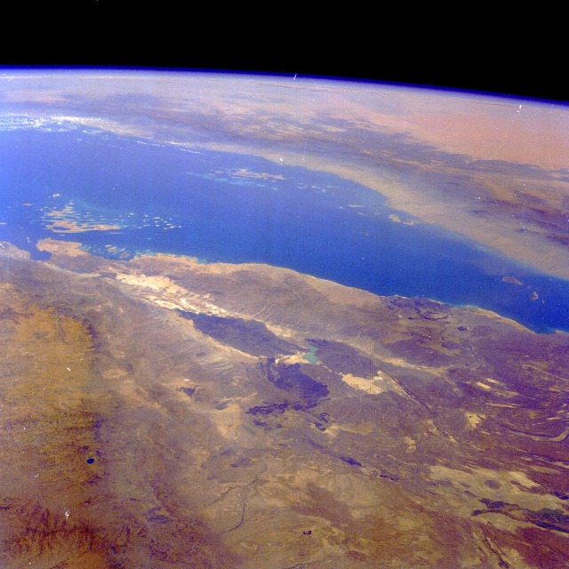
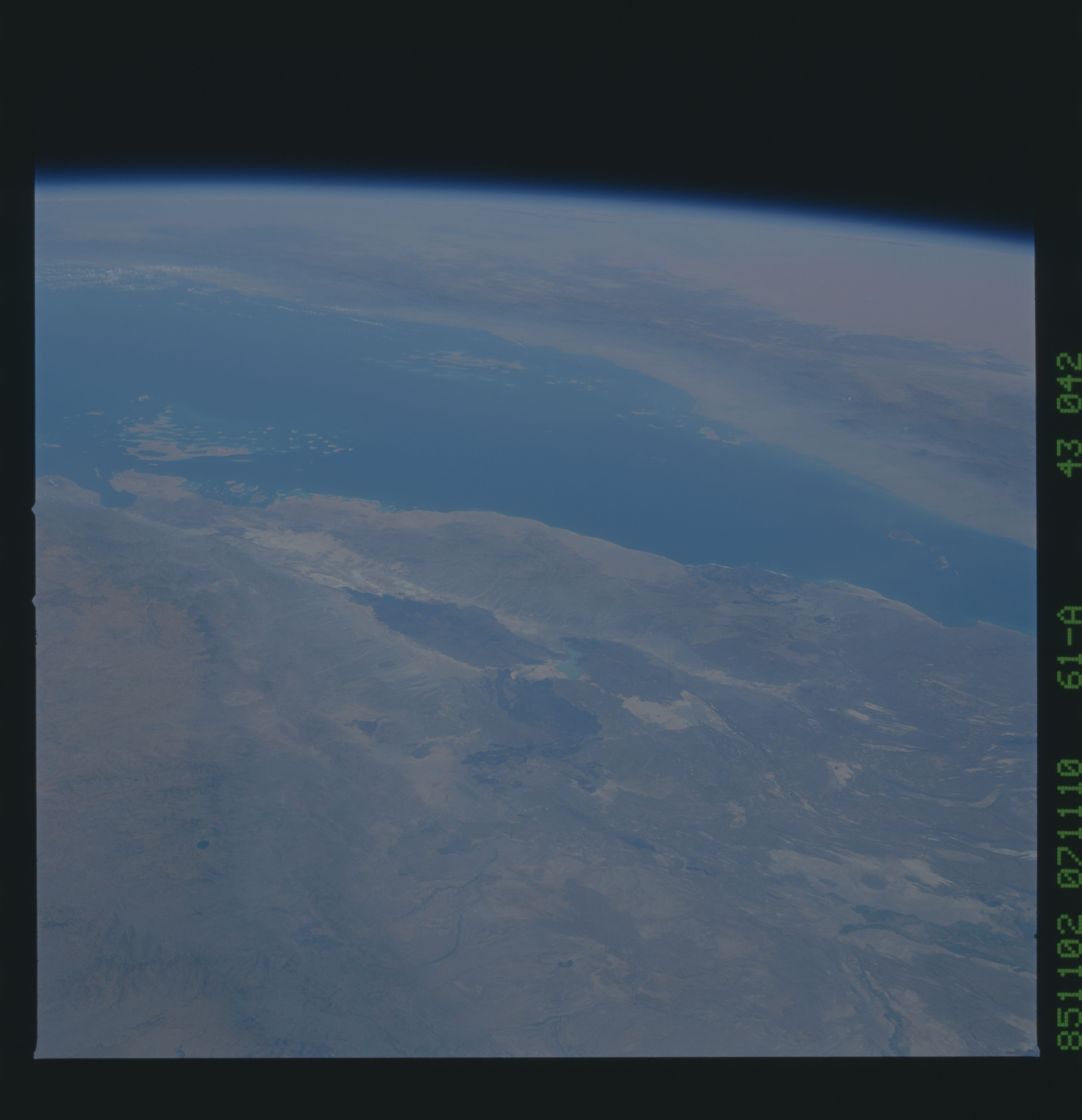
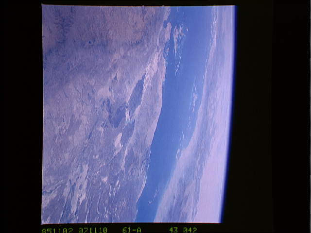
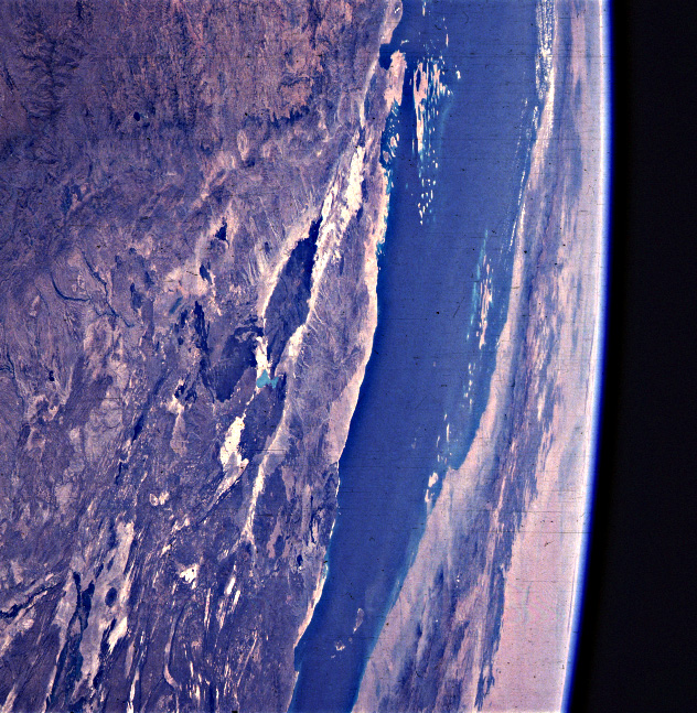
Image Caption: STS61A-43-0042 Denakil Desert, Eritrea and Ethiopia November 1985
The Denakil Desert, one of the most hostile environments in the world, can be seen in this high-oblique, northeast-looking photograph. This part of the great Rift Valley, known as the Afar Triangle, stretches north-south 350 miles (570 kilometers), varying in width from 50 to 250 miles (80 to 400 kilometers). Bounded on the north and east by the Red Sea and on the west by the highlands of Ethiopia (both visible in the photograph), much of this extremely hot and dry desert is below sea level. Erta Alle (dark gray area near the center of the photograph), a large shield volcano referred to as the "smoking volcano" by local tribesmen, has been in a constant state of eruption since the late 1960s. Just north of Erta Alle Volcano are the Dalol Salt Flats. Formerly a shallow lake, the area now sits 400 feet (120 meters) below sea level and is covered with salt deposits, some of which are estimated to be 3 miles (5 kilometers) thick. Across the Red Sea, the Hijaz Mountains are visible. Beyond these mountains are the northwestern portions of the Empty Quarter Desert of Saudi Arabia. The Denakil is a great example of the forces of nature at work, altering and changing the landscape.
The Denakil Desert, one of the most hostile environments in the world, can be seen in this high-oblique, northeast-looking photograph. This part of the great Rift Valley, known as the Afar Triangle, stretches north-south 350 miles (570 kilometers), varying in width from 50 to 250 miles (80 to 400 kilometers). Bounded on the north and east by the Red Sea and on the west by the highlands of Ethiopia (both visible in the photograph), much of this extremely hot and dry desert is below sea level. Erta Alle (dark gray area near the center of the photograph), a large shield volcano referred to as the "smoking volcano" by local tribesmen, has been in a constant state of eruption since the late 1960s. Just north of Erta Alle Volcano are the Dalol Salt Flats. Formerly a shallow lake, the area now sits 400 feet (120 meters) below sea level and is covered with salt deposits, some of which are estimated to be 3 miles (5 kilometers) thick. Across the Red Sea, the Hijaz Mountains are visible. Beyond these mountains are the northwestern portions of the Empty Quarter Desert of Saudi Arabia. The Denakil is a great example of the forces of nature at work, altering and changing the landscape.
