STS61A-42-43
| NASA Photo ID | STS61A-42-43 |
| Focal Length | 250mm |
| Date taken | 1985.11.05 |
| Time taken | 15:42:18 GMT |
Resolutions offered for this image:
3872 x 3904 pixels 634 x 639 pixels 5700 x 5900 pixels 500 x 518 pixels 640 x 480 pixels
3872 x 3904 pixels 634 x 639 pixels 5700 x 5900 pixels 500 x 518 pixels 640 x 480 pixels

Cloud masks available for this image:
Spacecraft nadir point: 27.8° N, 93.4° W
Photo center point: 30.0° N, 95.0° W
Photo center point by machine learning:
Photo center point: 30.0° N, 95.0° W
Photo center point by machine learning:
Nadir to Photo Center: Northwest
Spacecraft Altitude: 176 nautical miles (326km)
Country or Geographic Name: | USA-TEXAS |
Features: | GALVESTON BAY |
| Features Found Using Machine Learning: | |
Cloud Cover Percentage: | 0 (no clouds present) |
Sun Elevation Angle: | 35° |
Sun Azimuth: | 138° |
Camera: | Hasselblad |
Focal Length: | 250mm |
Camera Tilt: | 43 degrees |
Format: | 5017: Kodak, natural color positive, Ektachrome, X Professional, ASA 64, standard base |
Film Exposure: | Normal |
| Additional Information | |
| Width | Height | Annotated | Cropped | Purpose | Links |
|---|---|---|---|---|---|
| 3872 pixels | 3904 pixels | No | No | Earth From Space collection | Download Image |
| 634 pixels | 639 pixels | No | No | Earth From Space collection | Download Image |
| 5700 pixels | 5900 pixels | No | No | Download Image | |
| 500 pixels | 518 pixels | No | No | Download Image | |
| 640 pixels | 480 pixels | No | No | Download Image |
Download Packaged File
Download a Google Earth KML for this Image
View photo footprint information
Download a GeoTIFF for this photo
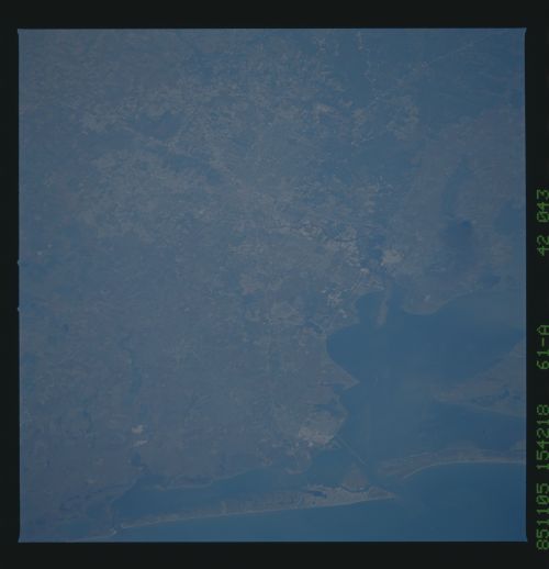
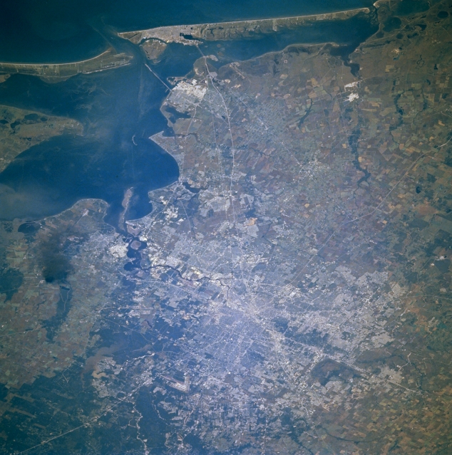
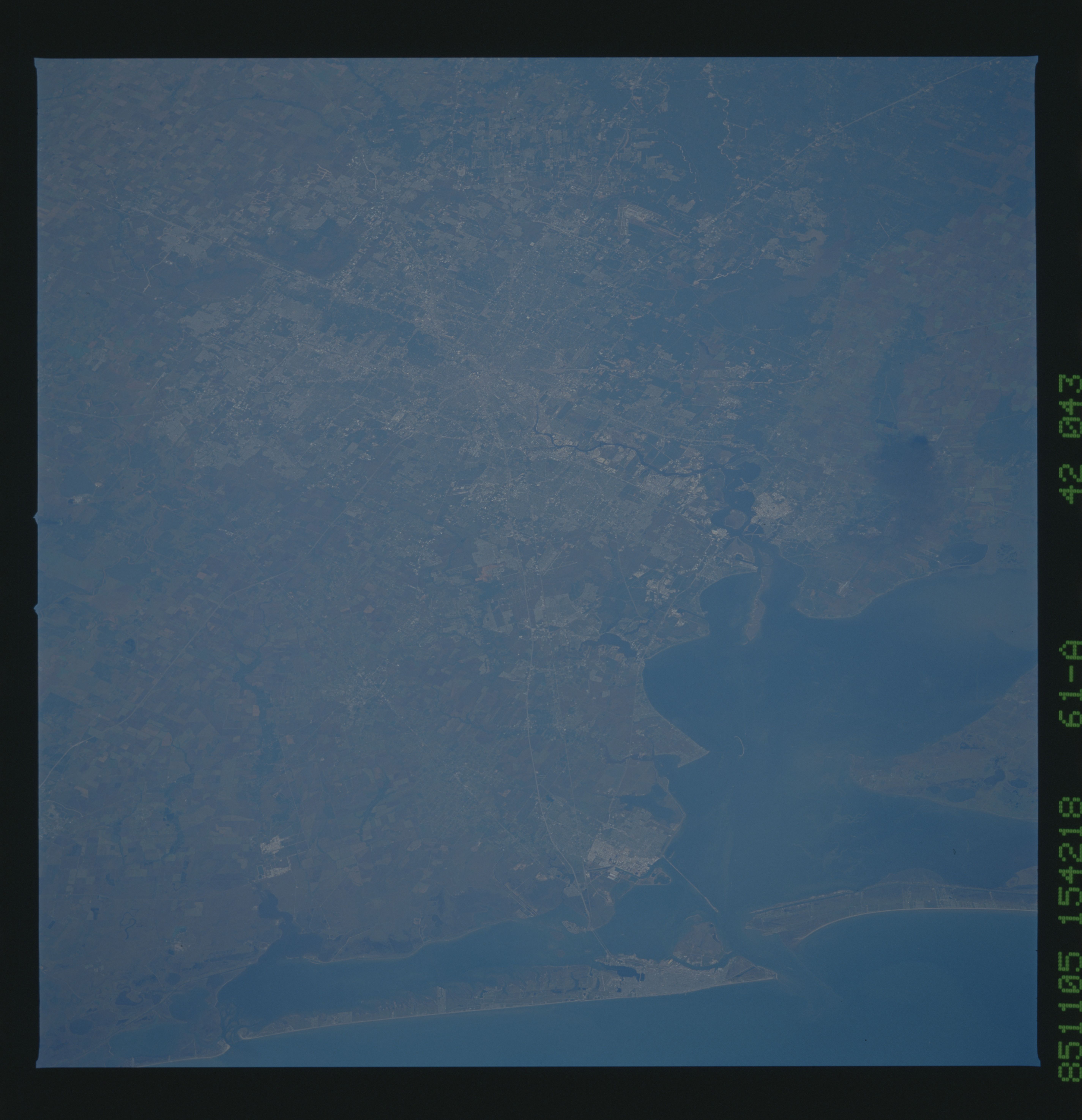
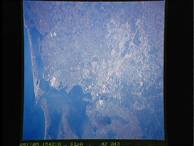
Image Caption: STS61A-042-0043 Houston and Galveston, Texas, U.S.A. November 1985
The Houston and Galveston metropolitan areas are apparent in this southeast-looking, low-oblique photograph. Houston, the fourth most populous city in the United States, is one of the world's major oil centers; a great commercial, financial, medical, and industrial hub; and home of the NASA Lyndon B. Johnson Space Center. Access to the Port of Houston, the third-busiest port in the United States, is possible via a dredged channel from the Gulf of Mexico through shallow Galveston Bay. Galveston has major shipbuilding and repair yards and is a major tourist area. Rich agricultural lands of the coastal plain surround Houston from the south to the northwest. The large smoke plume (left center) was caused by an explosion and fire at a major oil refinery in the small community of Mont Belvieu.
The Houston and Galveston metropolitan areas are apparent in this southeast-looking, low-oblique photograph. Houston, the fourth most populous city in the United States, is one of the world's major oil centers; a great commercial, financial, medical, and industrial hub; and home of the NASA Lyndon B. Johnson Space Center. Access to the Port of Houston, the third-busiest port in the United States, is possible via a dredged channel from the Gulf of Mexico through shallow Galveston Bay. Galveston has major shipbuilding and repair yards and is a major tourist area. Rich agricultural lands of the coastal plain surround Houston from the south to the northwest. The large smoke plume (left center) was caused by an explosion and fire at a major oil refinery in the small community of Mont Belvieu.
