STS61A-39-84
| NASA Photo ID | STS61A-39-84 |
| Focal Length | 250mm |
| Date taken | 1985.11.01 |
| Time taken | 06:43:24 GMT |

Cloud masks available for this image:
Spacecraft nadir point: 27.7° S, 25.7° E
Photo center point: 27.0° S, 27.0° E
Photo center point by machine learning:
Photo center point: 27.0° S, 27.0° E
Photo center point by machine learning:
Nadir to Photo Center: Northeast
Spacecraft Altitude: 178 nautical miles (330km)
Country or Geographic Name: | REPUBLIC SOUTH AFRICA |
Features: | VREDEFORT DOME |
| Features Found Using Machine Learning: | |
Cloud Cover Percentage: | 20 (11-25)% |
Sun Elevation Angle: | 42° |
Sun Azimuth: | 84° |
Camera: | Hasselblad |
Focal Length: | 250mm |
Camera Tilt: | 26 degrees |
Format: | 5017: Kodak, natural color positive, Ektachrome, X Professional, ASA 64, standard base |
Film Exposure: | Normal |
| Additional Information | |
| Width | Height | Annotated | Cropped | Purpose | Links |
|---|---|---|---|---|---|
| 5700 pixels | 5900 pixels | No | No | Download Image | |
| 500 pixels | 518 pixels | No | No | Download Image | |
| 640 pixels | 480 pixels | No | No | Download Image |
Download Packaged File
Download a Google Earth KML for this Image
View photo footprint information
Download a GeoTIFF for this photo
Image Caption:
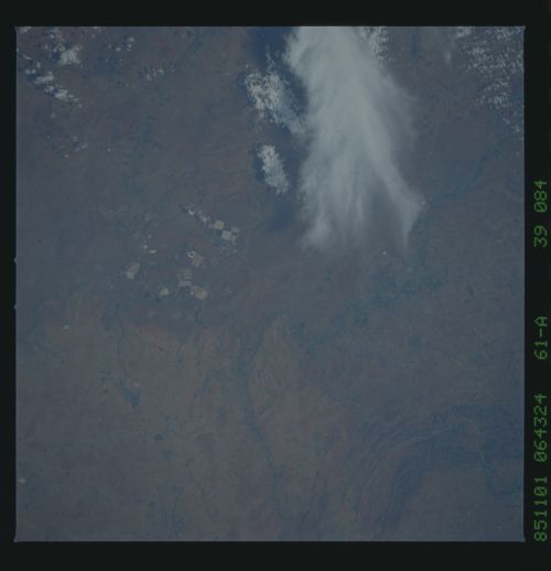
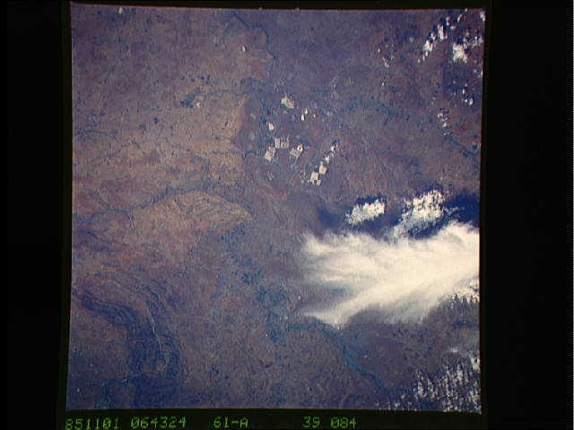
Western Extension of the Reef T45
The Reef is the name given to the 300 km-long series of gold min-
ing towns on the central plateau of South Africa. Rectangular
mine dumps of waste material from the westernmost gold mines of
Klerksdorp and Orkney, are prominent (left center). The
Afrikaans- language university town of Potchefstroom (1) is si-
tuated on the Mooi ("beautiful") River and the vacation town of
Parys on the Vaal ("grey") River (2). The Vaal marks the boun-
dary between the provinces of Transvaal (top) and Orange Free
State (bottom): it is not clear why the latter shows signifi-
cantly more soil erosion (light brown field patterns). (61A-39-
84)
