STS61A-35-82

| NASA Photo ID | STS61A-35-82 |
| Focal Length | 250mm |
| Date taken | 1985.11.01 |
| Time taken | 19:16:20 GMT |
Resolutions offered for this image:
5239 x 5239 pixels 640 x 640 pixels 5700 x 5900 pixels 500 x 518 pixels 640 x 480 pixels
5239 x 5239 pixels 640 x 640 pixels 5700 x 5900 pixels 500 x 518 pixels 640 x 480 pixels
Cloud masks available for this image:
Spacecraft nadir point: 48.9° N, 97.5° W
Photo center point: 49.0° N, 100.0° W
Photo center point by machine learning:
Photo center point: 49.0° N, 100.0° W
Photo center point by machine learning:
Nadir to Photo Center: West
Spacecraft Altitude: 181 nautical miles (335km)
Country or Geographic Name: | USA-NORTH DAKOTA |
Features: | PEACE GARDEN |
| Features Found Using Machine Learning: | |
Cloud Cover Percentage: | 0 (no clouds present) |
Sun Elevation Angle: | 25° |
Sun Azimuth: | 196° |
Camera: | Hasselblad |
Focal Length: | 250mm |
Camera Tilt: | 40 degrees |
Format: | 5017: Kodak, natural color positive, Ektachrome, X Professional, ASA 64, standard base |
Film Exposure: | Normal |
| Additional Information | |
| Width | Height | Annotated | Cropped | Purpose | Links |
|---|---|---|---|---|---|
| 5239 pixels | 5239 pixels | No | No | Earth From Space collection | Download Image |
| 640 pixels | 640 pixels | No | No | Earth From Space collection | Download Image |
| 5700 pixels | 5900 pixels | No | No | Download Image | |
| 500 pixels | 518 pixels | No | No | Download Image | |
| 640 pixels | 480 pixels | No | No | Download Image |
Download Packaged File
Download a Google Earth KML for this Image
View photo footprint information
Download a GeoTIFF for this photo
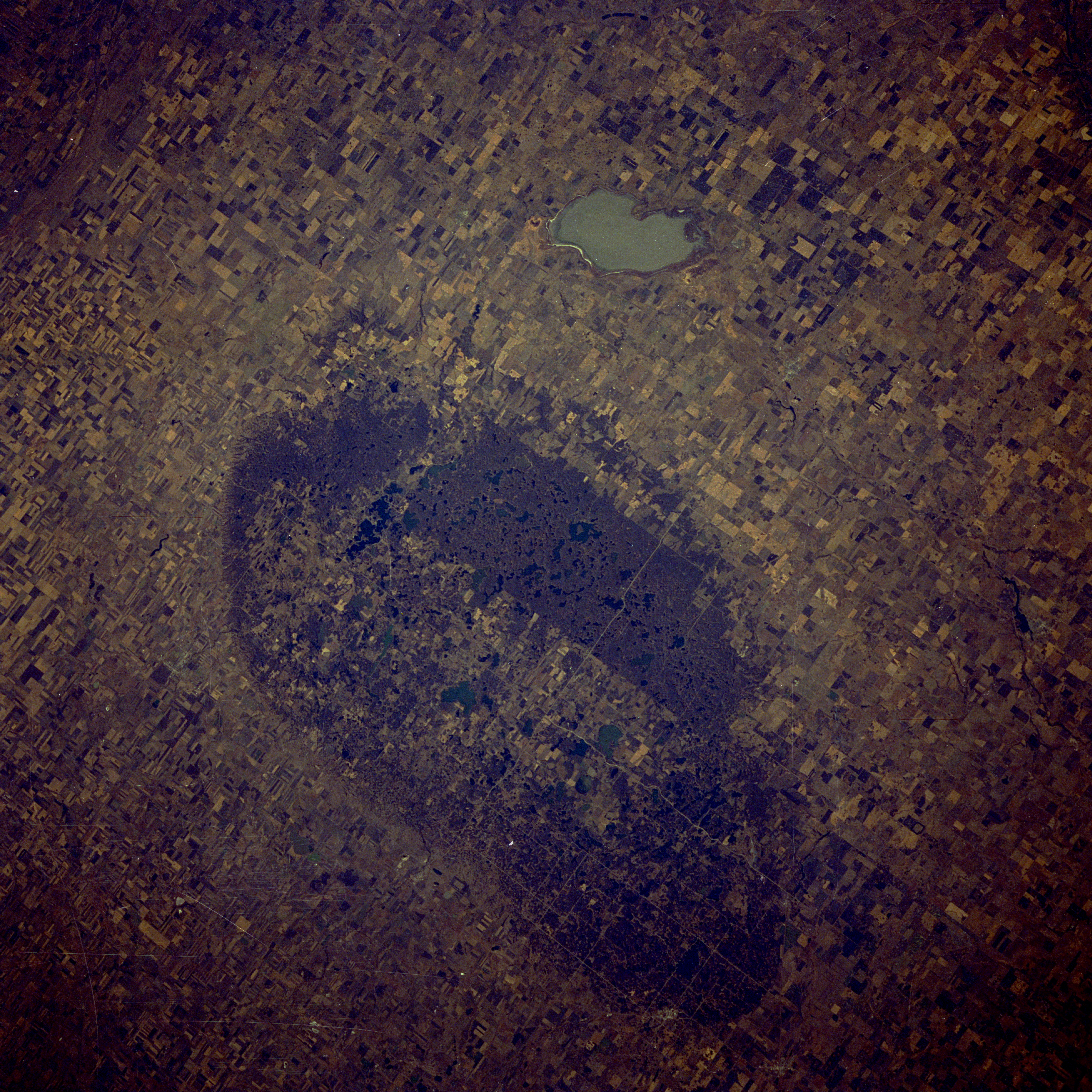
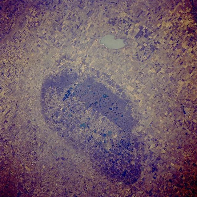
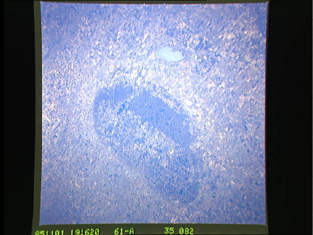
Image Caption: STS61A-35-0082 International Peace Garden, North-Central North Dakota, U.S.A., and Southwest Manitoba, Canada November 1985
The International Peace Garden is an international park that straddles the United States-Canada border. This physiographic phenomenon is slightly elevated [by several hundred feet (tens of meters)] from the surrounding flatland farming of the Great Plains. The region is in the heart of the spring wheat belt of north-central North Dakota and southwest Manitoba. A discernible line measuring 2000 feet (610 meters) outlines the perimeter of the rather oval International Peace Garden. The 49th parallel, the east-west alignment of the international border through the Peace Garden, can be distinguished by the dense vegetation and numerous small lakes (darker areas) on the Canadian side of the border and the farmland on the U.S. side. Whitewater Lake in southwestern Manitoba lies approximately 7 miles (11 kilometers) north of the International Peace Garden.
The International Peace Garden is an international park that straddles the United States-Canada border. This physiographic phenomenon is slightly elevated [by several hundred feet (tens of meters)] from the surrounding flatland farming of the Great Plains. The region is in the heart of the spring wheat belt of north-central North Dakota and southwest Manitoba. A discernible line measuring 2000 feet (610 meters) outlines the perimeter of the rather oval International Peace Garden. The 49th parallel, the east-west alignment of the international border through the Peace Garden, can be distinguished by the dense vegetation and numerous small lakes (darker areas) on the Canadian side of the border and the farmland on the U.S. side. Whitewater Lake in southwestern Manitoba lies approximately 7 miles (11 kilometers) north of the International Peace Garden.
