STS61A-33-44
| NASA Photo ID | STS61A-33-44 |
| Focal Length | 100mm |
| Date taken | 1985.10.31 |
| Time taken | 17:25:55 GMT |
Resolutions offered for this image:
3872 x 3904 pixels 634 x 639 pixels 5700 x 5900 pixels 500 x 518 pixels 640 x 480 pixels
3872 x 3904 pixels 634 x 639 pixels 5700 x 5900 pixels 500 x 518 pixels 640 x 480 pixels
Cloud masks available for this image:
Spacecraft nadir point: 42.3° N, 75.8° W
Photo center point: 43.0° N, 74.5° W
Photo center point by machine learning:
Photo center point: 43.0° N, 74.5° W
Photo center point by machine learning:
Nadir to Photo Center: Northeast
Spacecraft Altitude: 180 nautical miles (333km)
Country or Geographic Name: | USA-NEW YORK |
Features: | ALBANY |
| Features Found Using Machine Learning: | |
Cloud Cover Percentage: | 0 (no clouds present) |
Sun Elevation Angle: | 32° |
Sun Azimuth: | 191° |
Camera: | Hasselblad |
Focal Length: | 100mm |
Camera Tilt: | 26 degrees |
Format: | 5017: Kodak, natural color positive, Ektachrome, X Professional, ASA 64, standard base |
Film Exposure: | Normal |
| Additional Information | |
| Width | Height | Annotated | Cropped | Purpose | Links |
|---|---|---|---|---|---|
| 3872 pixels | 3904 pixels | No | No | Earth From Space collection | Download Image |
| 634 pixels | 639 pixels | No | No | Earth From Space collection | Download Image |
| 5700 pixels | 5900 pixels | No | No | Download Image | |
| 500 pixels | 518 pixels | No | No | Download Image | |
| 640 pixels | 480 pixels | No | No | Download Image |
Download Packaged File
Download a Google Earth KML for this Image
View photo footprint information
Download a GeoTIFF for this photo
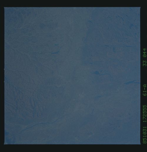
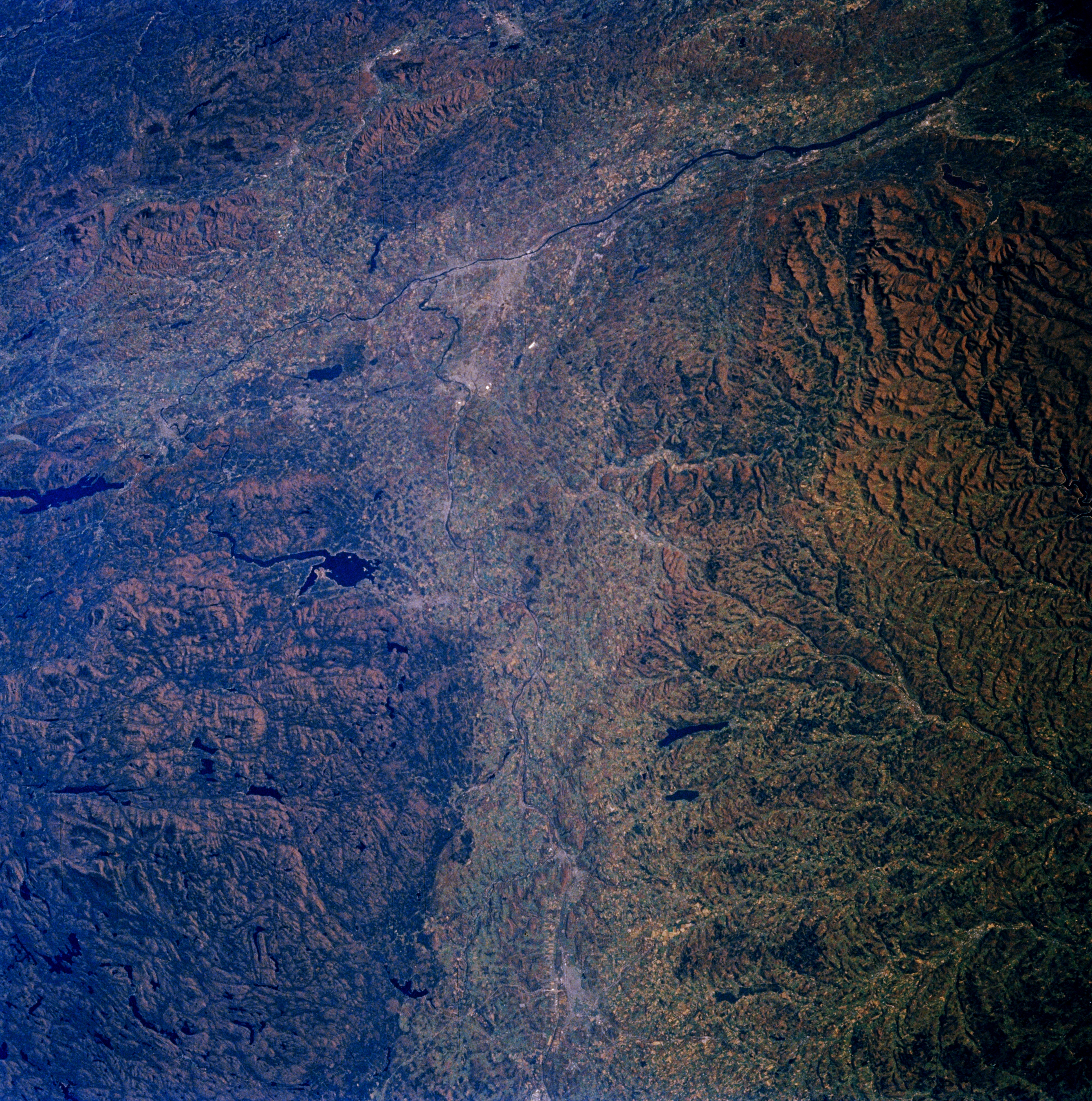
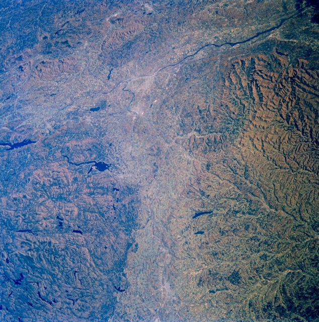
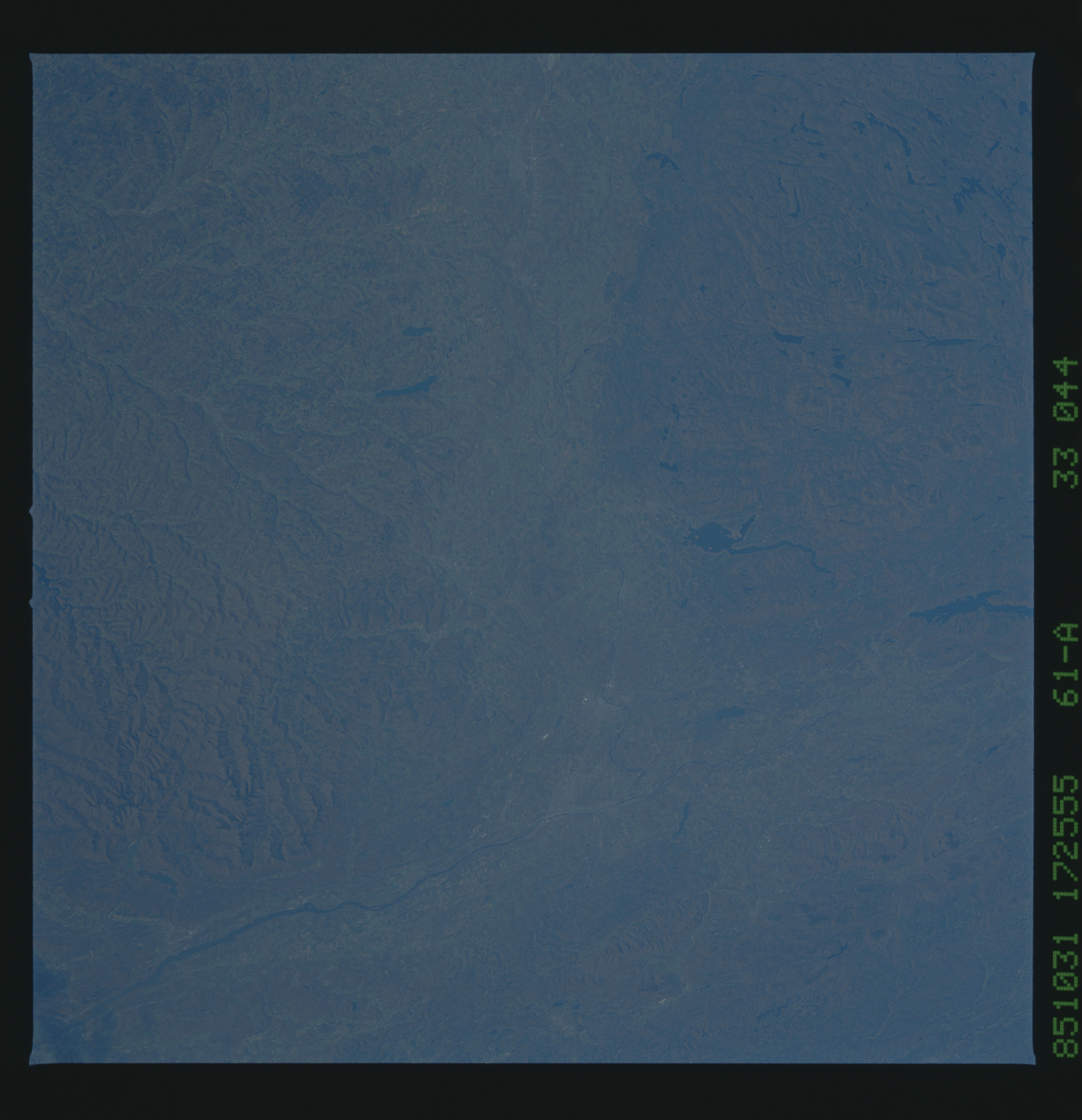
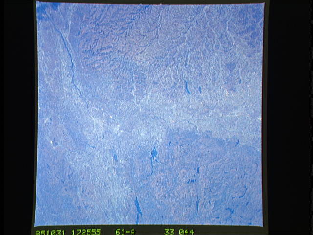
Image Caption: STS61A-33-0044 Mohawk/Hudson River Valleys, New York November 1985
The valleys of the Mohawk and Hudson Rivers can be seen in this east-looking view. The Mohawk River, 148 miles (238 km) long enters the scene near Utica (bottom center) and flows east emptying into the Hudson River north of Albany (midway between the center and upper center of the image). The Mohawk River is the Hudson River's largest tributary. The New York State Barge Canal starts at the mouth of the Mohawk River and goes westward to near Rome, New York. This canal links the Hudson River with the Great Lakes. The beautiful and fertile Mohawk River Valley has long been an important transportation route from the cities of the northeast to the west. North (left) of the Mohawk River are the rugged Adirondack Mountains. The Great Sacandaga Lake is visible to the left of the center of the image. To the south (right) of the Mohawk River and covering the center and lower portions of the image are the beautiful, forested Catskill Mountains. Setting in the Albany Plain (former Lake Albany) is the valley of the north-south flowing Hudson River. The Taconic Hills lie to the east of the Hudson River in the upper left quadrant of the image.
The valleys of the Mohawk and Hudson Rivers can be seen in this east-looking view. The Mohawk River, 148 miles (238 km) long enters the scene near Utica (bottom center) and flows east emptying into the Hudson River north of Albany (midway between the center and upper center of the image). The Mohawk River is the Hudson River's largest tributary. The New York State Barge Canal starts at the mouth of the Mohawk River and goes westward to near Rome, New York. This canal links the Hudson River with the Great Lakes. The beautiful and fertile Mohawk River Valley has long been an important transportation route from the cities of the northeast to the west. North (left) of the Mohawk River are the rugged Adirondack Mountains. The Great Sacandaga Lake is visible to the left of the center of the image. To the south (right) of the Mohawk River and covering the center and lower portions of the image are the beautiful, forested Catskill Mountains. Setting in the Albany Plain (former Lake Albany) is the valley of the north-south flowing Hudson River. The Taconic Hills lie to the east of the Hudson River in the upper left quadrant of the image.
