STS61A-31-37

| NASA Photo ID | STS61A-31-37 |
| Focal Length | 100mm |
| Date taken | 1985.10.31 |
| Time taken | 00:20:26 GMT |
Resolutions offered for this image:
3904 x 3904 pixels 639 x 639 pixels 5700 x 5900 pixels 500 x 518 pixels 640 x 480 pixels
3904 x 3904 pixels 639 x 639 pixels 5700 x 5900 pixels 500 x 518 pixels 640 x 480 pixels

Cloud masks available for this image:
Spacecraft nadir point: 34.1° S, 122.3° E
Photo center point: 33.5° S, 122.5° E
Photo center point by machine learning:
Photo center point: 33.5° S, 122.5° E
Photo center point by machine learning:
Nadir to Photo Center: North
Spacecraft Altitude: 179 nautical miles (332km)
Country or Geographic Name: | AUSTRALIA-WA |
Features: | RECHERCHE ARCH, COAST, AGR |
| Features Found Using Machine Learning: | |
Cloud Cover Percentage: | 0 (no clouds present) |
Sun Elevation Angle: | 41° |
Sun Azimuth: | 77° |
Camera: | Hasselblad |
Focal Length: | 100mm |
Camera Tilt: | 12 degrees |
Format: | 5017: Kodak, natural color positive, Ektachrome, X Professional, ASA 64, standard base |
Film Exposure: | Normal |
| Additional Information | |
| Width | Height | Annotated | Cropped | Purpose | Links |
|---|---|---|---|---|---|
| 3904 pixels | 3904 pixels | No | No | Earth From Space collection | Download Image |
| 639 pixels | 639 pixels | No | No | Earth From Space collection | Download Image |
| 5700 pixels | 5900 pixels | No | No | Download Image | |
| 500 pixels | 518 pixels | No | No | Download Image | |
| 640 pixels | 480 pixels | No | No | Download Image |
Download Packaged File
Download a Google Earth KML for this Image
View photo footprint information
Download a GeoTIFF for this photo
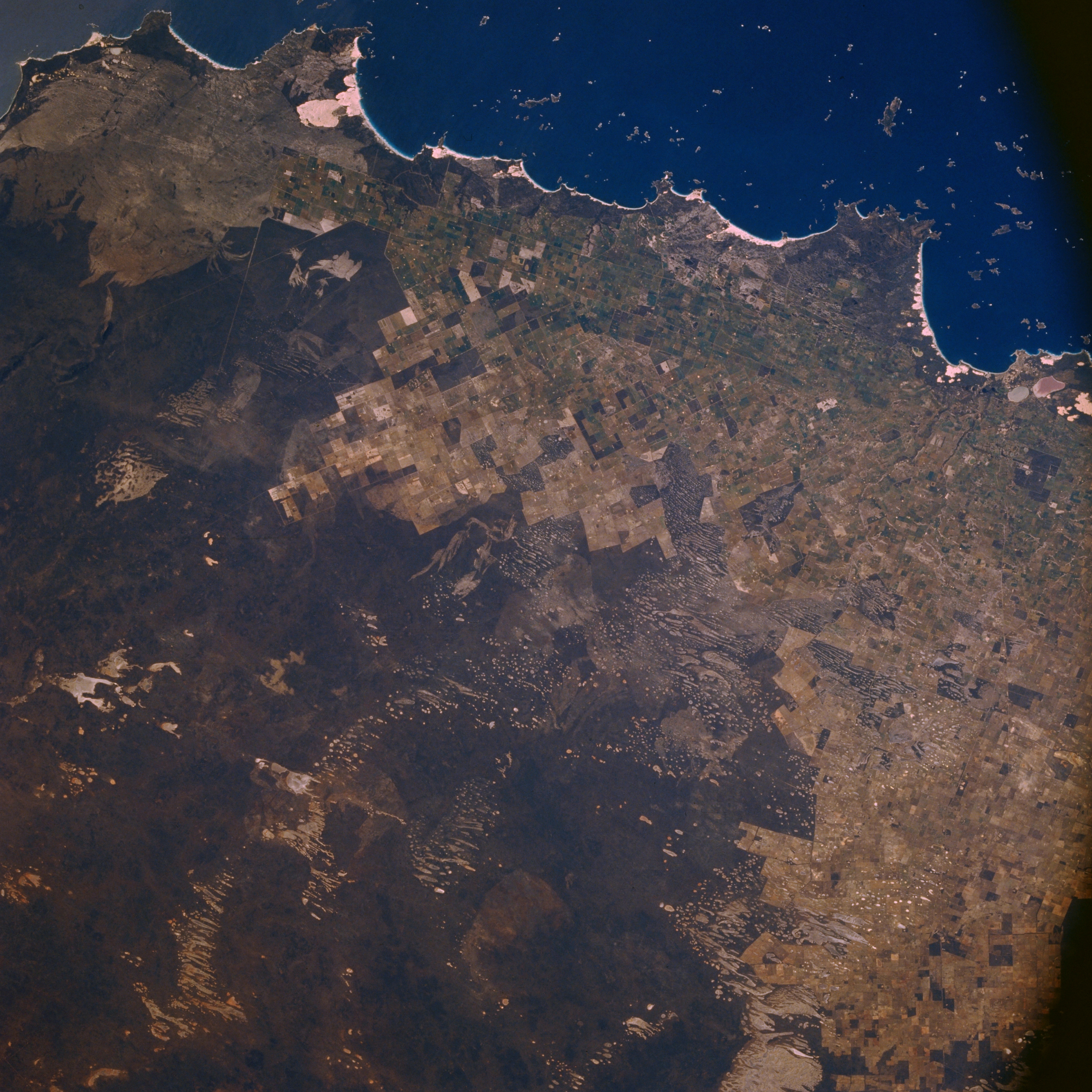
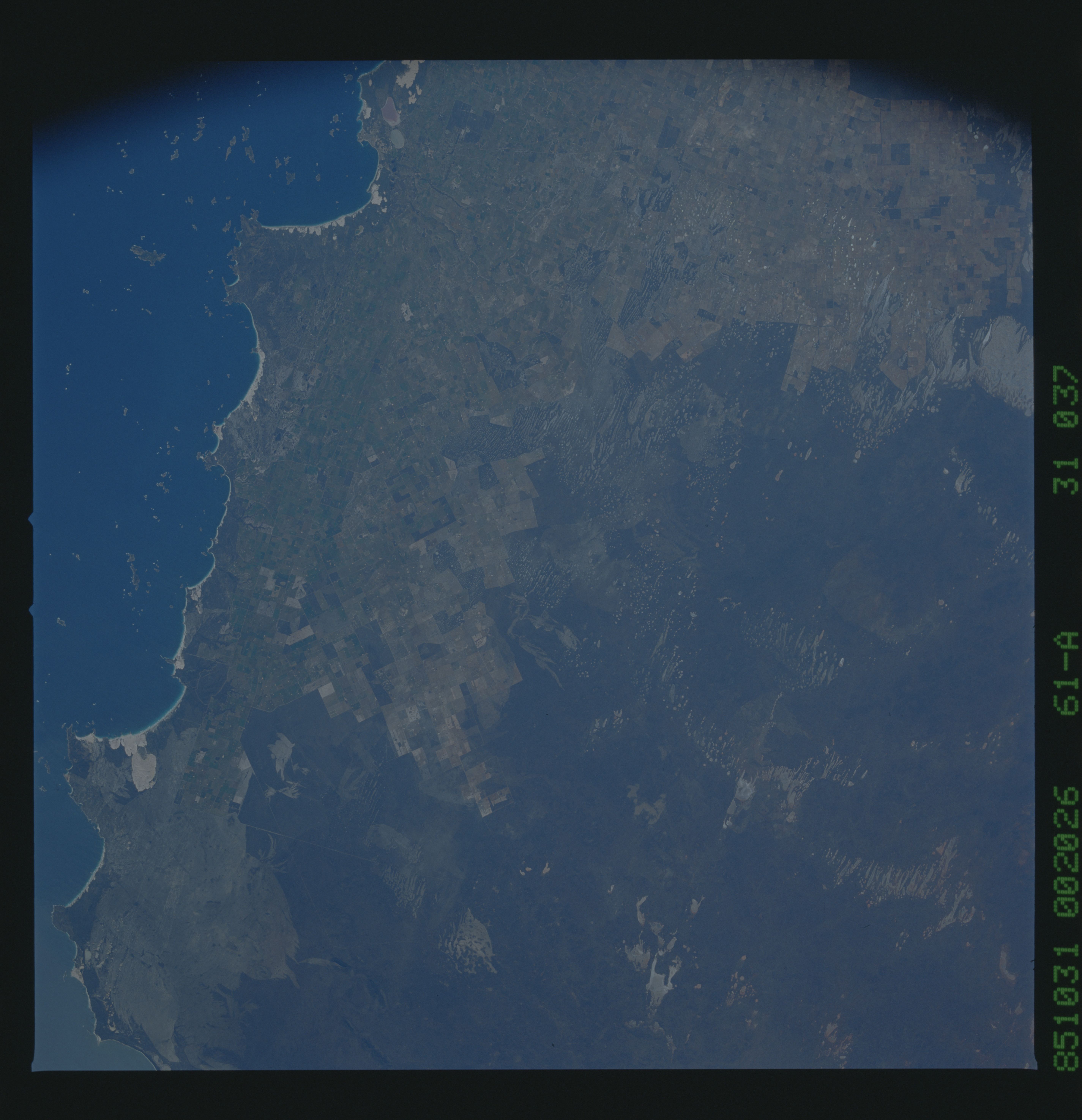
Image Caption: STS61A-31-0037 Recherche Archipeligo, Western Australia, Australia November 1985
The southern coast of Western Australia between the port city of Esperance (west side) and Point Malcolm (east) is captured in this regional view. An extensive array of small islands, the Recherche Archipeligo, as well as a scattered reef system are intermingled along this coastline. The highly reflective strips along the shoreline are very large sandy beaches. The lighter-colored landscape tends to be cultivated fields or extensive rangeland while the darker terrain shows large areas of undeveloped land consisting of natural vegetation. Straight lines indicate property boundaries.
The southern coast of Western Australia between the port city of Esperance (west side) and Point Malcolm (east) is captured in this regional view. An extensive array of small islands, the Recherche Archipeligo, as well as a scattered reef system are intermingled along this coastline. The highly reflective strips along the shoreline are very large sandy beaches. The lighter-colored landscape tends to be cultivated fields or extensive rangeland while the darker terrain shows large areas of undeveloped land consisting of natural vegetation. Straight lines indicate property boundaries.
