STS51J-47-79
| NASA Photo ID | STS51J-47-79 |
| Focal Length | 250mm |
| Date taken | 1985.10.06 |
| Time taken | 23:27:52 GMT |
Cloud masks available for this image:
Spacecraft nadir point: 28.7° N, 132.3° E
Photo center point: 31.5° N, 130.5° E
Photo center point by machine learning:
Photo center point: 31.5° N, 130.5° E
Photo center point by machine learning:
Nadir to Photo Center: Northwest
Spacecraft Altitude: 256 nautical miles (474km)
Country or Geographic Name: | JAPAN |
Features: | SAKURAJIMA VOLCANO PLUME |
| Features Found Using Machine Learning: | |
Cloud Cover Percentage: | 40 (26-50)% |
Sun Elevation Angle: | 29° |
Sun Azimuth: | 115° |
Camera: | Hasselblad |
Focal Length: | 250mm |
Camera Tilt: | Near Vertical |
Format: | 5017: Kodak, natural color positive, Ektachrome, X Professional, ASA 64, standard base |
Film Exposure: | Normal |
| Additional Information | |
| Width | Height | Annotated | Cropped | Purpose | Links |
|---|---|---|---|---|---|
| 5700 pixels | 5900 pixels | No | No | Download Image | |
| 500 pixels | 518 pixels | No | No | Download Image | |
| 640 pixels | 480 pixels | No | No | Download Image |
Download Packaged File
Download a Google Earth KML for this Image
View photo footprint information
Download a GeoTIFF for this photo
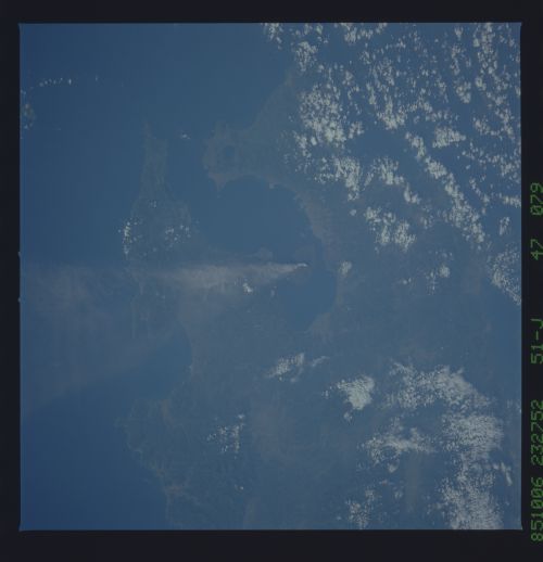
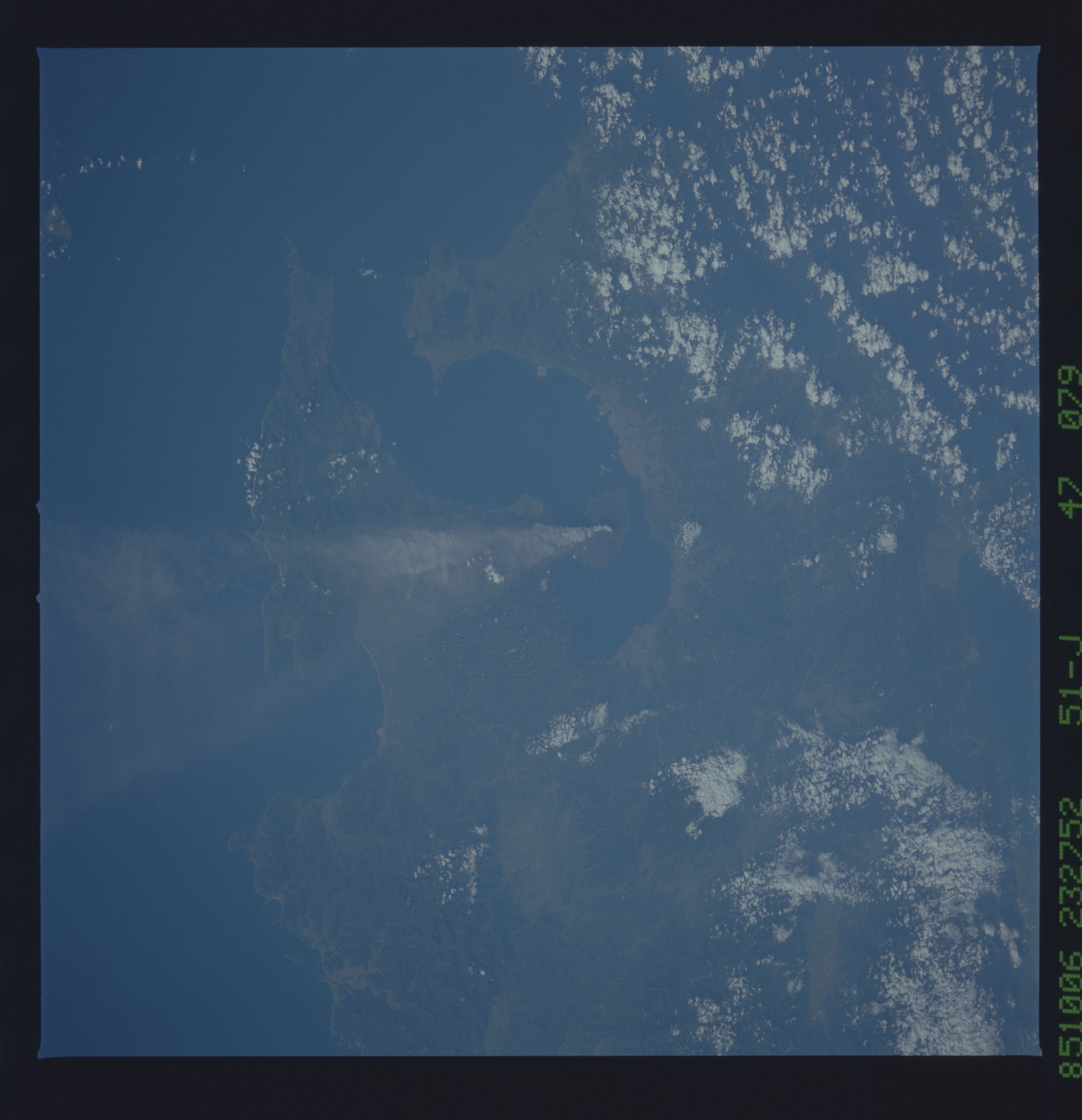
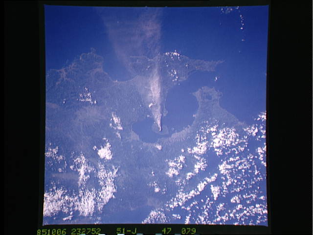
Image Caption: Sakurajima Erupting in South Japan
Mount Fuji is extinct, but subduction of the Pacific Plate
continues under Japan accounting for the numerous
earthquakes of the region. Volcanism should also be
expected to continue as the Pacific Plate undergoes partial
melting in the upper mantle. This active volcano is
Sakurajima located at the southern end of the island of
Kyushu. The plume of ash is easily visible extending off
the southeast.
Photographs of volcanic plumes (this is Sakurajima, Japan), give
useful information about the extent and composition of the plume.
This photograph was taken on 6 October 1985 from an altitude of
246 n.mi. (474 km) using a Hasselblad camera equipped with a 240
mm lens and color visible film. (Photo ID: 51J-47-079).
