STS51J-43-21
| NASA Photo ID | STS51J-43-21 |
| Focal Length | 250mm |
| Date taken | 1985.10.05 |
| Time taken | 13:19:50 GMT |


Cloud masks available for this image:
Spacecraft nadir point: 8.9° S, 40.4° E
Photo center point: 8.5° S, 39.0° E
Photo center point by machine learning:
Photo center point: 8.5° S, 39.0° E
Photo center point by machine learning:
Nadir to Photo Center: West
Spacecraft Altitude: 276 nautical miles (511km)
Country or Geographic Name: | TANZANIA |
Features: | KISIMANI CHANNEL |
| Features Found Using Machine Learning: | |
Cloud Cover Percentage: | 10 (1-10)% |
Sun Elevation Angle: | 27° |
Sun Azimuth: | 269° |
Camera: | Hasselblad |
Focal Length: | 250mm |
Camera Tilt: | 18 degrees |
Format: | 5017: Kodak, natural color positive, Ektachrome, X Professional, ASA 64, standard base |
Film Exposure: | Normal |
| Additional Information | |
| Width | Height | Annotated | Cropped | Purpose | Links |
|---|---|---|---|---|---|
| 5700 pixels | 5900 pixels | No | No | Download Image | |
| 500 pixels | 518 pixels | No | No | Download Image | |
| 640 pixels | 480 pixels | No | No | Download Image |
Download Packaged File
Download a Google Earth KML for this Image
View photo footprint information
Download a GeoTIFF for this photo
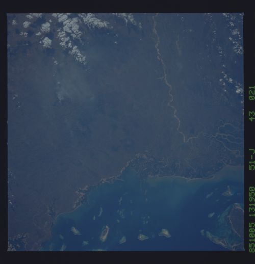
Image Caption: The top of the photograph is Mafia Island, just to the south of
Zanzibar. The large delta on the mainland (1) is from the Great
Rufiji River; the river emptied into the sea to the south some
time ago, evidenced by the abandoned delta (2). Note the burning
areas blowing to the west on mainland Tanzania in the limestone
hills (3). (51-J-43-021)
Zanzibar. The large delta on the mainland (1) is from the Great
Rufiji River; the river emptied into the sea to the south some
time ago, evidenced by the abandoned delta (2). Note the burning
areas blowing to the west on mainland Tanzania in the limestone
hills (3). (51-J-43-021)
