STS51J-39-56
| NASA Photo ID | STS51J-39-56 |
| Focal Length | 250mm |
| Date taken | 1985.10.04 |
| Time taken | 16:28:09 GMT |
Resolutions offered for this image:
3904 x 3904 pixels 639 x 639 pixels 6830 x 4937 pixels 500 x 361 pixels 640 x 480 pixels
3904 x 3904 pixels 639 x 639 pixels 6830 x 4937 pixels 500 x 361 pixels 640 x 480 pixels
Cloud masks available for this image:
Spacecraft nadir point: 28.2° N, 94.8° W
Photo center point: 29.5° N, 95.0° W
Photo center point by machine learning:
Photo center point: 29.5° N, 95.0° W
Photo center point by machine learning:
Nadir to Photo Center: North
Spacecraft Altitude: 259 nautical miles (480km)
Country or Geographic Name: | USA-TEXAS |
Features: | GALVESTON BAY, HOUSTON |
| Features Found Using Machine Learning: | |
Cloud Cover Percentage: | 0 (no clouds present) |
Sun Elevation Angle: | 49° |
Sun Azimuth: | 139° |
Camera: | Hasselblad |
Focal Length: | 250mm |
Camera Tilt: | 17 degrees |
Format: | 5017: Kodak, natural color positive, Ektachrome, X Professional, ASA 64, standard base |
Film Exposure: | Normal |
| Additional Information | |
| Width | Height | Annotated | Cropped | Purpose | Links |
|---|---|---|---|---|---|
| 3904 pixels | 3904 pixels | No | No | Earth From Space collection | Download Image |
| 639 pixels | 639 pixels | No | No | Earth From Space collection | Download Image |
| 6830 pixels | 4937 pixels | No | No | Download Image | |
| 500 pixels | 361 pixels | No | No | Download Image | |
| 640 pixels | 480 pixels | No | No | Download Image |
Download Packaged File
Download a Google Earth KML for this Image
View photo footprint information
Download a GeoTIFF for this photo
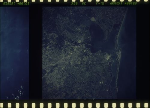
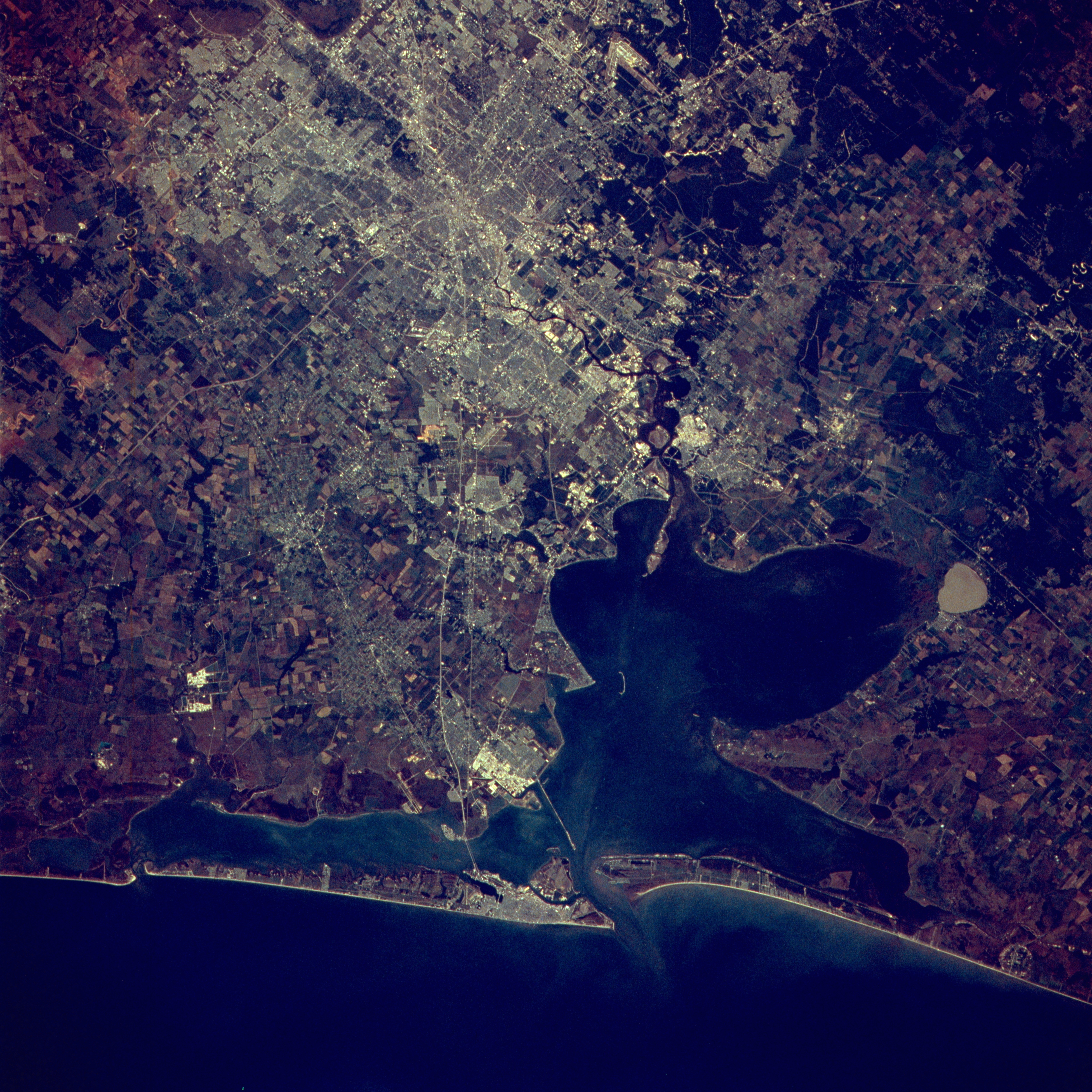
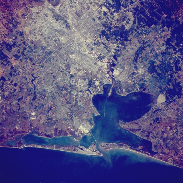
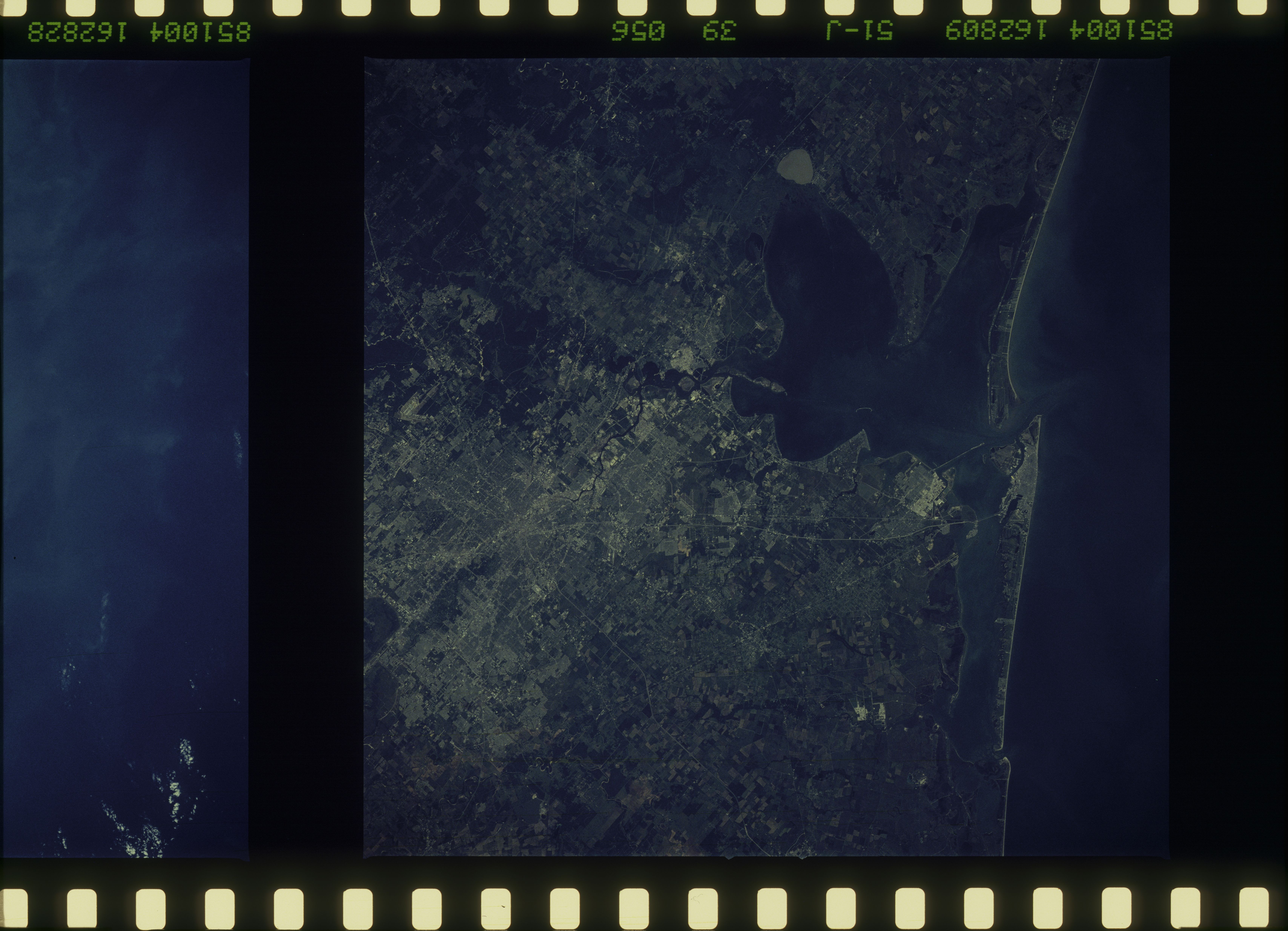
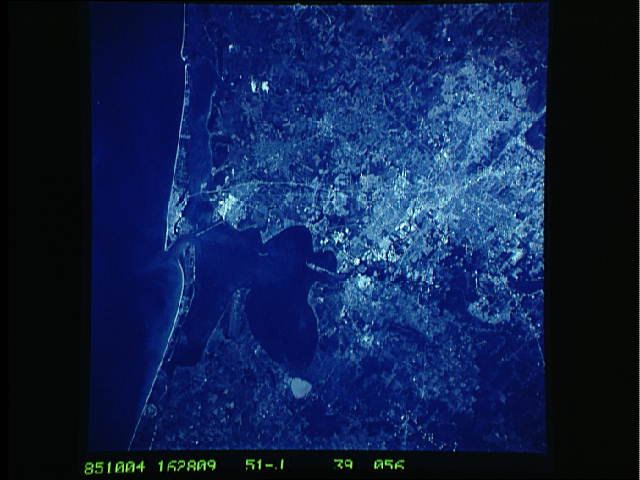
Image Caption: STS51J-039-0056 Houston and Galveston, Texas, U.S.A. October 1985
The Houston and Galveston metropolitan areas appear in this northwest-looking, low-oblique photograph. Houston, the fourth most populous city in the United States and home of the NASA Lyndon B. Johnson Space Center, is a major oil center and a major commercial, medical, financial, and transportation hub along the Gulf of Mexico. The city has grown rapidly with the completion of the Houston Ship Channel in 1914 and is now the third-busiest port in the United States. From the center of the city Interstate Highway 45 extends southeastward to Galveston, which has major shipbuilding and ship repair facilities and is a major tourist area. Visible is Galveston Bay, a shallow inlet of the Gulf of Mexico.
The Houston and Galveston metropolitan areas appear in this northwest-looking, low-oblique photograph. Houston, the fourth most populous city in the United States and home of the NASA Lyndon B. Johnson Space Center, is a major oil center and a major commercial, medical, financial, and transportation hub along the Gulf of Mexico. The city has grown rapidly with the completion of the Houston Ship Channel in 1914 and is now the third-busiest port in the United States. From the center of the city Interstate Highway 45 extends southeastward to Galveston, which has major shipbuilding and ship repair facilities and is a major tourist area. Visible is Galveston Bay, a shallow inlet of the Gulf of Mexico.
