STS51I-42-40
| NASA Photo ID | STS51I-42-40 |
| Focal Length | 250mm |
| Date taken | 1985.08.30 |
| Time taken | 11:27:10 GMT |
Resolutions offered for this image:
5255 x 5255 pixels 639 x 639 pixels 5700 x 5900 pixels 500 x 518 pixels 640 x 480 pixels
5255 x 5255 pixels 639 x 639 pixels 5700 x 5900 pixels 500 x 518 pixels 640 x 480 pixels
Cloud masks available for this image:
Spacecraft nadir point: 22.5° S, 38.6° E
Photo center point:
Photo center point by machine learning:
Photo center point:
Photo center point by machine learning:
Nadir to Photo Center:
Spacecraft Altitude: 172 nautical miles (319km)
Country or Geographic Name: | MOZAMBIQUE CHANNEL |
Features: | CURRENT BOUNDARY |
| Features Found Using Machine Learning: | |
Cloud Cover Percentage: | 40 (26-50)% |
Sun Elevation Angle: | 46° |
Sun Azimuth: | 313° |
Camera: | Hasselblad |
Focal Length: | 250mm |
Camera Tilt: | |
Format: | 5017: Kodak, natural color positive, Ektachrome, X Professional, ASA 64, standard base |
Film Exposure: | Normal |
| Additional Information | |
| Width | Height | Annotated | Cropped | Purpose | Links |
|---|---|---|---|---|---|
| 5255 pixels | 5255 pixels | No | No | Earth From Space collection | Download Image |
| 639 pixels | 639 pixels | No | No | Earth From Space collection | Download Image |
| 5700 pixels | 5900 pixels | No | No | Download Image | |
| 500 pixels | 518 pixels | No | No | Download Image | |
| 640 pixels | 480 pixels | No | No | Download Image |
Download Packaged File
Download a Google Earth KML for this Image
View photo footprint information
Download a GeoTIFF for this photo
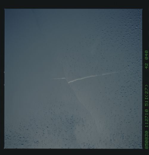
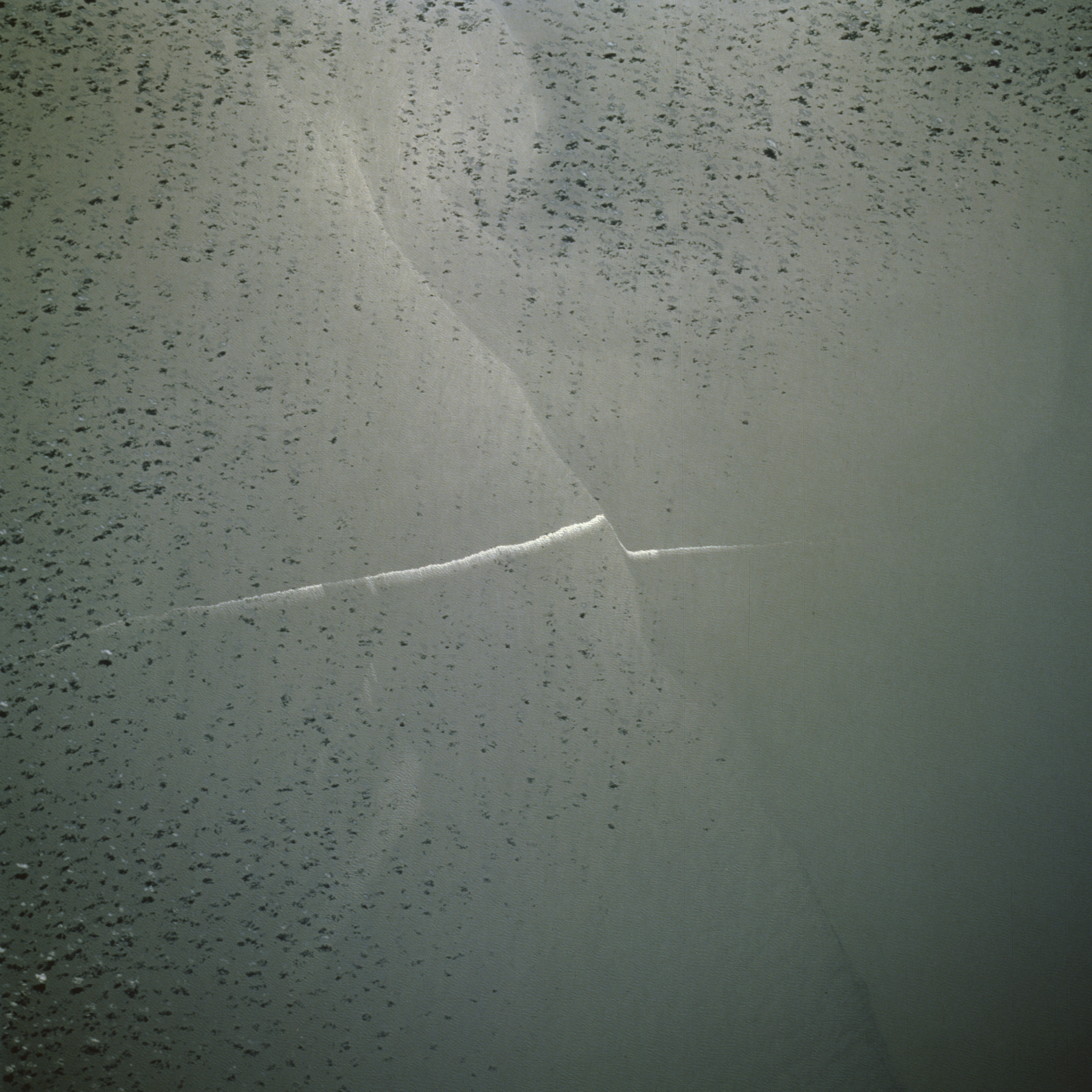
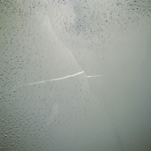
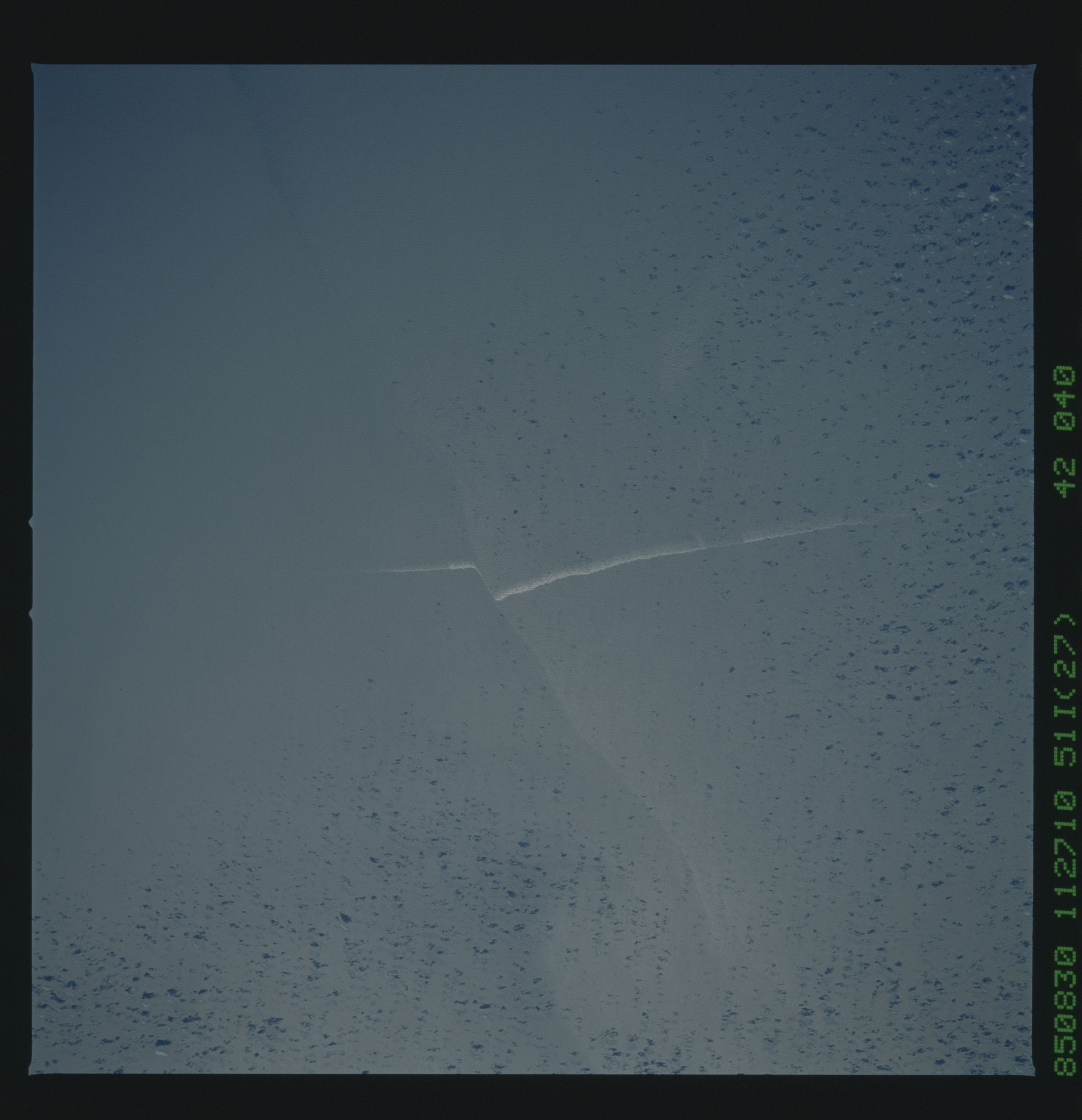
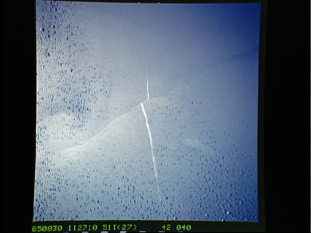
Image Caption: STS51I-42-40 Suloy, Mozambique Channel August 1985
The faint, irregular-shaped line running east-west is a convergence of two currents in the Mozambique Channel between Madagascar and Africa. The blurred white line, offset where it crosses the current boundary, is a bilge-pumped ship wake that has been affected by the water movement along the boundary between water fronts. The resultant linear feature caused by the convergence of two water currents is called a suloy (a new oceanographic term). A suloy is an unusual condition of the sea in which the surface is covered by precipitous and irregular waves that form in lines at a convergence and in the curved boundaries of eddies. The term was coined by the Russians to describe such features in the White Sea. Few, if any, quantitative measurements have been made of a suloy, and there are no useful estimates of frequency and wave spectra or hypotheses of generation. There are fewer than a dozen published articles devoted to suloys, each of which is a description of a unique phenomenon.
The faint, irregular-shaped line running east-west is a convergence of two currents in the Mozambique Channel between Madagascar and Africa. The blurred white line, offset where it crosses the current boundary, is a bilge-pumped ship wake that has been affected by the water movement along the boundary between water fronts. The resultant linear feature caused by the convergence of two water currents is called a suloy (a new oceanographic term). A suloy is an unusual condition of the sea in which the surface is covered by precipitous and irregular waves that form in lines at a convergence and in the curved boundaries of eddies. The term was coined by the Russians to describe such features in the White Sea. Few, if any, quantitative measurements have been made of a suloy, and there are no useful estimates of frequency and wave spectra or hypotheses of generation. There are fewer than a dozen published articles devoted to suloys, each of which is a description of a unique phenomenon.
