STS51I-40-27

| NASA Photo ID | STS51I-40-27 |
| Focal Length | 100mm |
| Date taken | 1985.08.30 |
| Time taken | 06:54:23 GMT |
Resolutions offered for this image:
3936 x 3939 pixels 639 x 640 pixels 5700 x 5900 pixels 500 x 518 pixels 640 x 480 pixels
3936 x 3939 pixels 639 x 640 pixels 5700 x 5900 pixels 500 x 518 pixels 640 x 480 pixels
Cloud masks available for this image:
Spacecraft nadir point: 24.5° S, 115.3° E
Photo center point: 23.5° S, 116.0° E
Photo center point by machine learning:
Photo center point: 23.5° S, 116.0° E
Photo center point by machine learning:
Nadir to Photo Center: Northeast
Spacecraft Altitude: 172 nautical miles (319km)
Country or Geographic Name: | AUSTRALIA-WA |
Features: | LYONS RIVER |
| Features Found Using Machine Learning: | |
Cloud Cover Percentage: | 0 (no clouds present) |
Sun Elevation Angle: | 39° |
Sun Azimuth: | 306° |
Camera: | Hasselblad |
Focal Length: | 100mm |
Camera Tilt: | 23 degrees |
Format: | 5017: Kodak, natural color positive, Ektachrome, X Professional, ASA 64, standard base |
Film Exposure: | Normal |
| Additional Information | |
| Width | Height | Annotated | Cropped | Purpose | Links |
|---|---|---|---|---|---|
| 3936 pixels | 3939 pixels | No | No | Earth From Space collection | Download Image |
| 639 pixels | 640 pixels | No | No | Earth From Space collection | Download Image |
| 5700 pixels | 5900 pixels | No | No | Download Image | |
| 500 pixels | 518 pixels | No | No | Download Image | |
| 640 pixels | 480 pixels | No | No | Download Image |
Download Packaged File
Download a Google Earth KML for this Image
View photo footprint information
Download a GeoTIFF for this photo
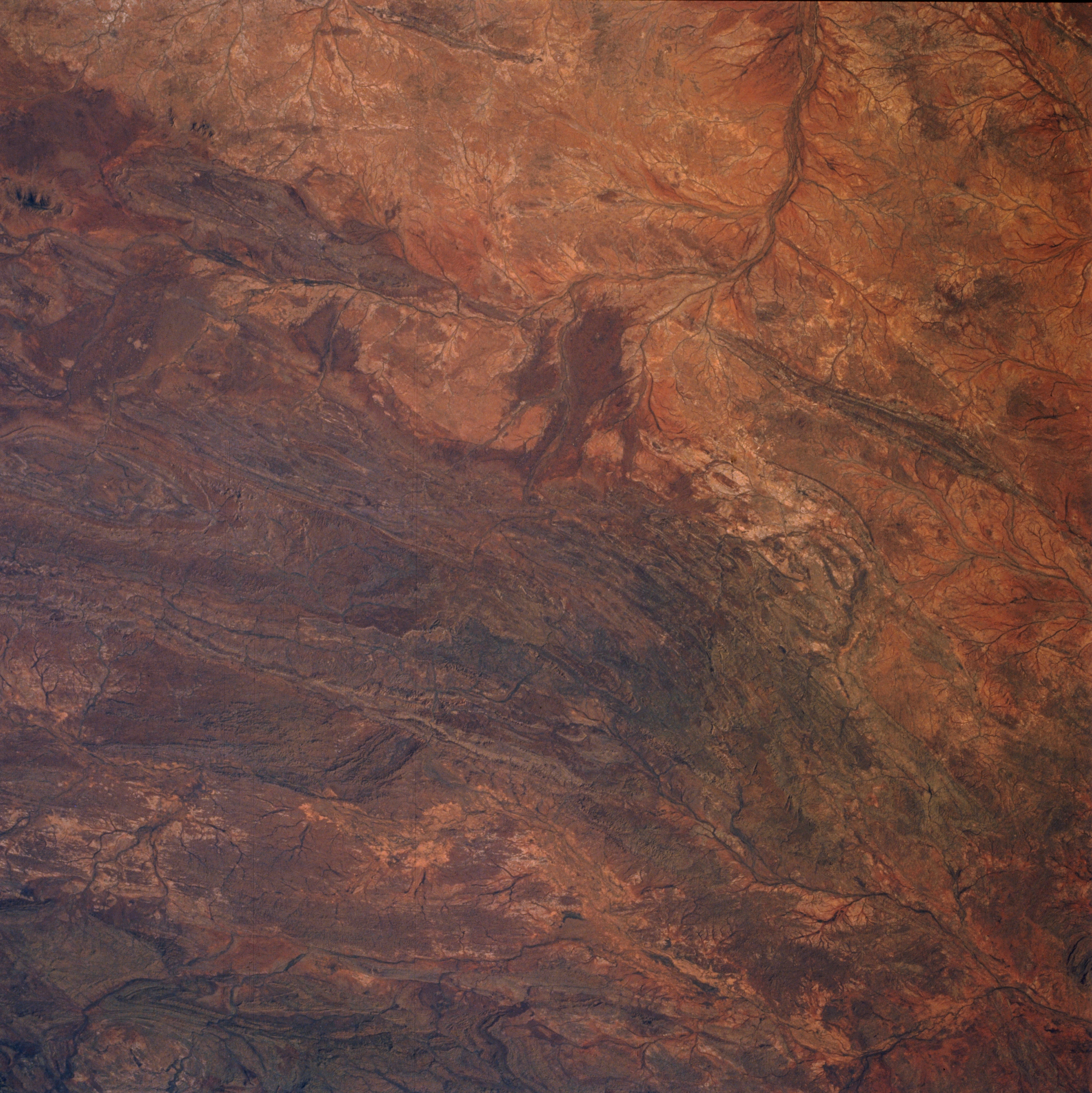
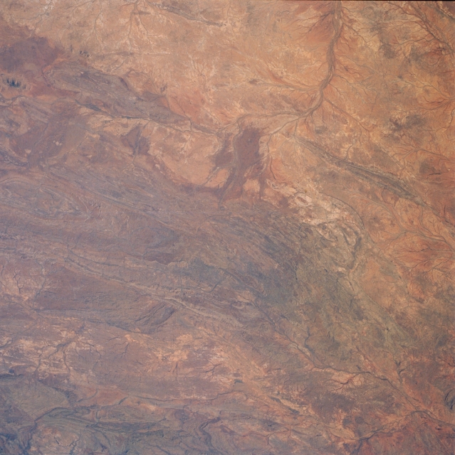
Image Caption: STS51I-40-0027 Barlee and High Ranges, Western Australia, Australia August 1985
The darker landscape of this image shows the rugged and folded mountains of west central Western Australia (south of the Hamersly Ranges). Numerous low mountains are seen in this picture but lack of detailed topographic maps precludes a specific identification of individual mountain ranges. The High Range and the Barlee Range can be located because of their positions north and northeast of the Lyons River (top). The floodplain and several of the Lyons Rivers braided stream channels help to identify this river as it makes roughly a 90 degree course change (drains to northwest then southwest) in the upper middle part of the image. Other unidentified streams are visible as they cut through narrow valleys in the lower left and lower right corners of the image. All of the drainage features are ephemeral streams and rivers.
The darker landscape of this image shows the rugged and folded mountains of west central Western Australia (south of the Hamersly Ranges). Numerous low mountains are seen in this picture but lack of detailed topographic maps precludes a specific identification of individual mountain ranges. The High Range and the Barlee Range can be located because of their positions north and northeast of the Lyons River (top). The floodplain and several of the Lyons Rivers braided stream channels help to identify this river as it makes roughly a 90 degree course change (drains to northwest then southwest) in the upper middle part of the image. Other unidentified streams are visible as they cut through narrow valleys in the lower left and lower right corners of the image. All of the drainage features are ephemeral streams and rivers.
