STS51G-37-28

| NASA Photo ID | STS51G-37-28 |
| Focal Length | 100mm |
| Date taken | 1985.06.22 |
| Time taken | 16:00:11 GMT |
Resolutions offered for this image:
5266 x 5266 pixels 639 x 639 pixels 5700 x 5900 pixels 500 x 518 pixels 640 x 480 pixels
5266 x 5266 pixels 639 x 639 pixels 5700 x 5900 pixels 500 x 518 pixels 640 x 480 pixels

Cloud masks available for this image:
Spacecraft nadir point: 15.2° S, 67.0° W
Photo center point: 15.9° S, 69.1° W
Photo center point by machine learning:
Photo center point: 15.9° S, 69.1° W
Photo center point by machine learning:
Nadir to Photo Center: West
Spacecraft Altitude: 180 nautical miles (333km)
Country or Geographic Name: | BOLIVIA |
Features: | LAKE TITICACA |
| Features Found Using Machine Learning: | |
Cloud Cover Percentage: | 20 (11-25)% |
Sun Elevation Angle: | 50° |
Sun Azimuth: | 10° |
Camera: | Hasselblad |
Focal Length: | 100mm |
Camera Tilt: | 36 degrees |
Format: | 5017: Kodak, natural color positive, Ektachrome, X Professional, ASA 64, standard base |
Film Exposure: | Normal |
| Additional Information | |
| Width | Height | Annotated | Cropped | Purpose | Links |
|---|---|---|---|---|---|
| 5266 pixels | 5266 pixels | No | No | Earth From Space collection | Download Image |
| 639 pixels | 639 pixels | No | No | Earth From Space collection | Download Image |
| 5700 pixels | 5900 pixels | No | No | Download Image | |
| 500 pixels | 518 pixels | No | No | Download Image | |
| 640 pixels | 480 pixels | No | No | Download Image |
Download Packaged File
Download a Google Earth KML for this Image
View photo footprint information
Download a GeoTIFF for this photo
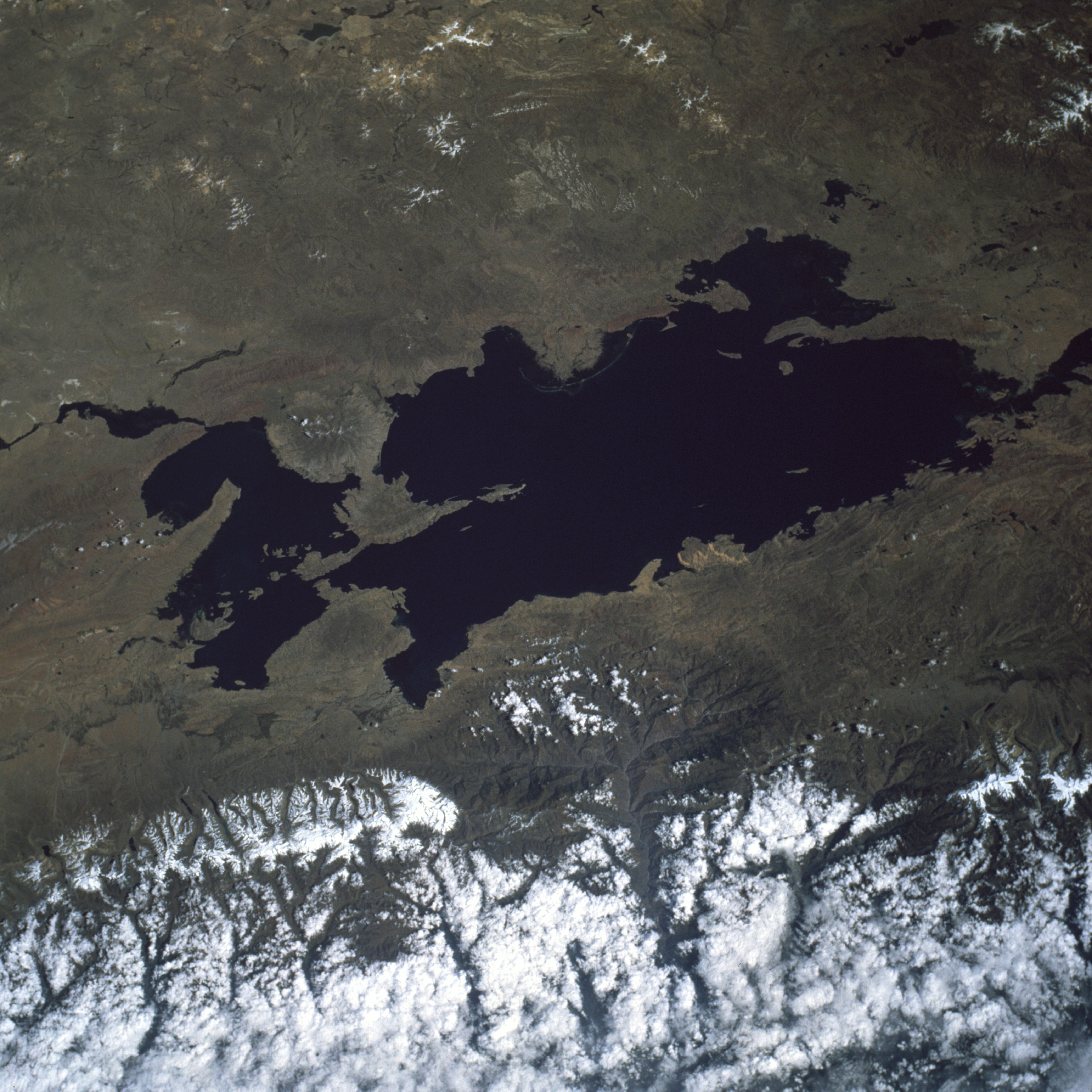
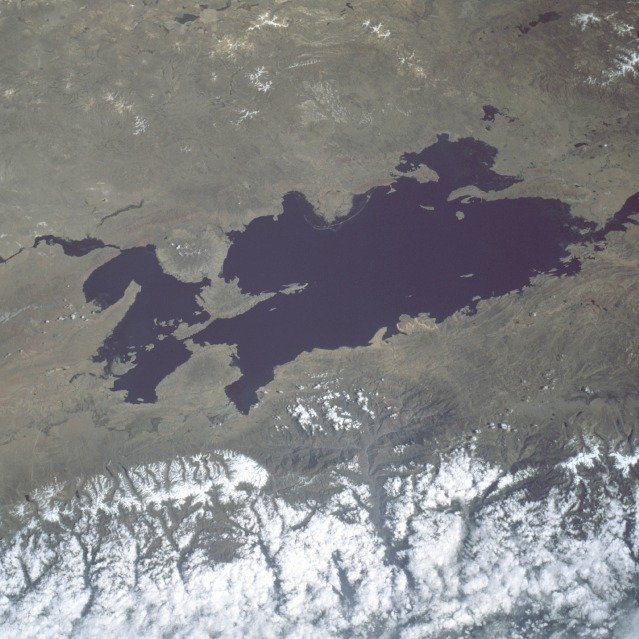
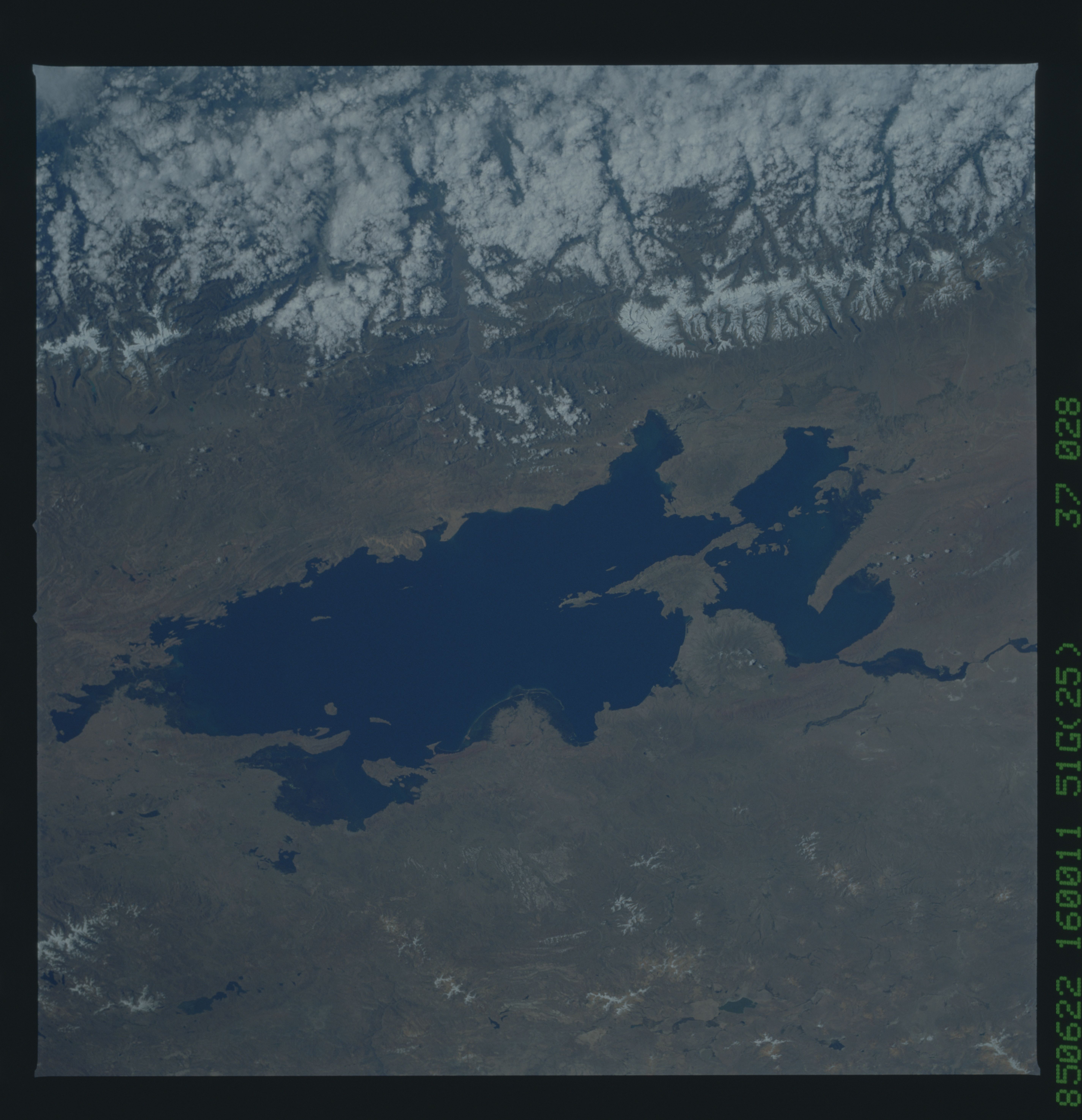
Image Caption: STS51G-037-0028 Lake Titicaca, Bolivia and Peru May 1985
Lake Titicaca, cupped in a depression in the Altiplano (high plains) between the eastern (cloud-covered) and western (not visible) ranges of the Andes Mountains, can be seen in this low-oblique, southwest-looking view. Covering an area of 3200 square miles (8290 square kilometers), Lake Titicaca is the largest freshwater lake in South America and, at 12 500 feet (3815 meters) above sea level, the world's highest navigable lake. The lake is nearly 120 miles (190 kilometers) long, averages 45 miles (72 kilometers) in width, and has an average depth of nearly 900 feet (275 meters). The two basins of the lake are connected by the Strait of Tiquina. Fed by rainfall and meltwater from glaciers on the high peaks that border the Altiplano, Lake Titicaca is drained by the Desaguadero River, which flows south from the lake into Lake Poopo (not visible on the photograph). Traces of former shorelines ringing its basin reveal that Lake Titicaca was even larger in the past. At the end of the Ice Age, approximately 12 000 years ago, torrents of meltwater from the huge ice cap that once blanketed the Andes Mountains poured into a virtual inland sea known as Lake Ballivian. Its shoreline was about 150 feet (45 meters) above the present level of Lake Titicaca. Even today, the water level varies as much as 16 feet (5 meters) from season to season and year to year. Much of the present lake water is lost through evaporation caused by intense sunshine and strong winds. Numerous Indian villages, once the center of Inca Indian life, now crowd the lake shoreline. The constant temperature of the lake at 51 degrees Fahrenheit (11 degrees Celsius) modifies the climate and makes growing maize and wheat possible at such a high altitude. (Refer to STS-057-075-046 for a later photograph and description of Lake Titicaca.)
Lake Titicaca, cupped in a depression in the Altiplano (high plains) between the eastern (cloud-covered) and western (not visible) ranges of the Andes Mountains, can be seen in this low-oblique, southwest-looking view. Covering an area of 3200 square miles (8290 square kilometers), Lake Titicaca is the largest freshwater lake in South America and, at 12 500 feet (3815 meters) above sea level, the world's highest navigable lake. The lake is nearly 120 miles (190 kilometers) long, averages 45 miles (72 kilometers) in width, and has an average depth of nearly 900 feet (275 meters). The two basins of the lake are connected by the Strait of Tiquina. Fed by rainfall and meltwater from glaciers on the high peaks that border the Altiplano, Lake Titicaca is drained by the Desaguadero River, which flows south from the lake into Lake Poopo (not visible on the photograph). Traces of former shorelines ringing its basin reveal that Lake Titicaca was even larger in the past. At the end of the Ice Age, approximately 12 000 years ago, torrents of meltwater from the huge ice cap that once blanketed the Andes Mountains poured into a virtual inland sea known as Lake Ballivian. Its shoreline was about 150 feet (45 meters) above the present level of Lake Titicaca. Even today, the water level varies as much as 16 feet (5 meters) from season to season and year to year. Much of the present lake water is lost through evaporation caused by intense sunshine and strong winds. Numerous Indian villages, once the center of Inca Indian life, now crowd the lake shoreline. The constant temperature of the lake at 51 degrees Fahrenheit (11 degrees Celsius) modifies the climate and makes growing maize and wheat possible at such a high altitude. (Refer to STS-057-075-046 for a later photograph and description of Lake Titicaca.)
