STS51G-36-63
| NASA Photo ID | STS51G-36-63 |
| Focal Length | 250mm |
| Date taken | 1985.06.20 |
| Time taken | 13:12:08 GMT |
Resolutions offered for this image:
3919 x 3965 pixels 632 x 640 pixels 5700 x 5900 pixels 500 x 518 pixels 640 x 480 pixels
3919 x 3965 pixels 632 x 640 pixels 5700 x 5900 pixels 500 x 518 pixels 640 x 480 pixels
Cloud masks available for this image:
Spacecraft nadir point: 17.2° N, 72.5° W
Photo center point: 18.5° N, 72.3° W
Photo center point by machine learning:
Photo center point: 18.5° N, 72.3° W
Photo center point by machine learning:
Nadir to Photo Center: North
Spacecraft Altitude: 205 nautical miles (380km)
Country or Geographic Name: | HAITI |
Features: | PORT-AU-PRINCE, BAY |
| Features Found Using Machine Learning: | |
Cloud Cover Percentage: | 10 (1-10)% |
Sun Elevation Angle: | 38° |
Sun Azimuth: | 73° |
Camera: | Hasselblad |
Focal Length: | 250mm |
Camera Tilt: | 21 degrees |
Format: | 5017: Kodak, natural color positive, Ektachrome, X Professional, ASA 64, standard base |
Film Exposure: | Under Exposed |
| Additional Information | |
| Width | Height | Annotated | Cropped | Purpose | Links |
|---|---|---|---|---|---|
| 3919 pixels | 3965 pixels | No | No | Earth From Space collection | Download Image |
| 632 pixels | 640 pixels | No | No | Earth From Space collection | Download Image |
| 5700 pixels | 5900 pixels | No | No | Download Image | |
| 500 pixels | 518 pixels | No | No | Download Image | |
| 640 pixels | 480 pixels | No | No | Download Image |
Download Packaged File
Download a Google Earth KML for this Image
View photo footprint information
Download a GeoTIFF for this photo
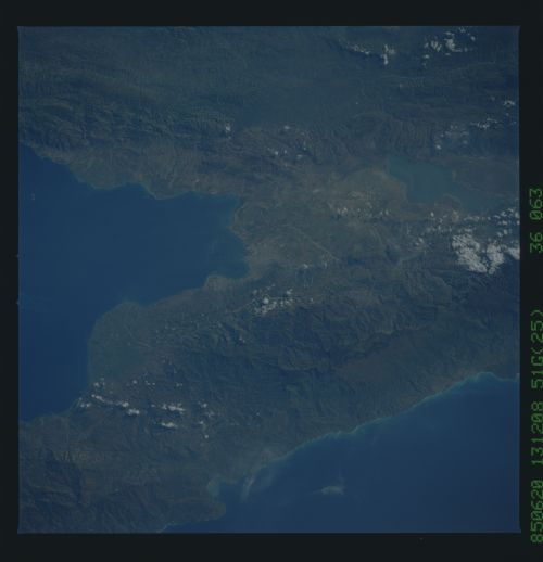
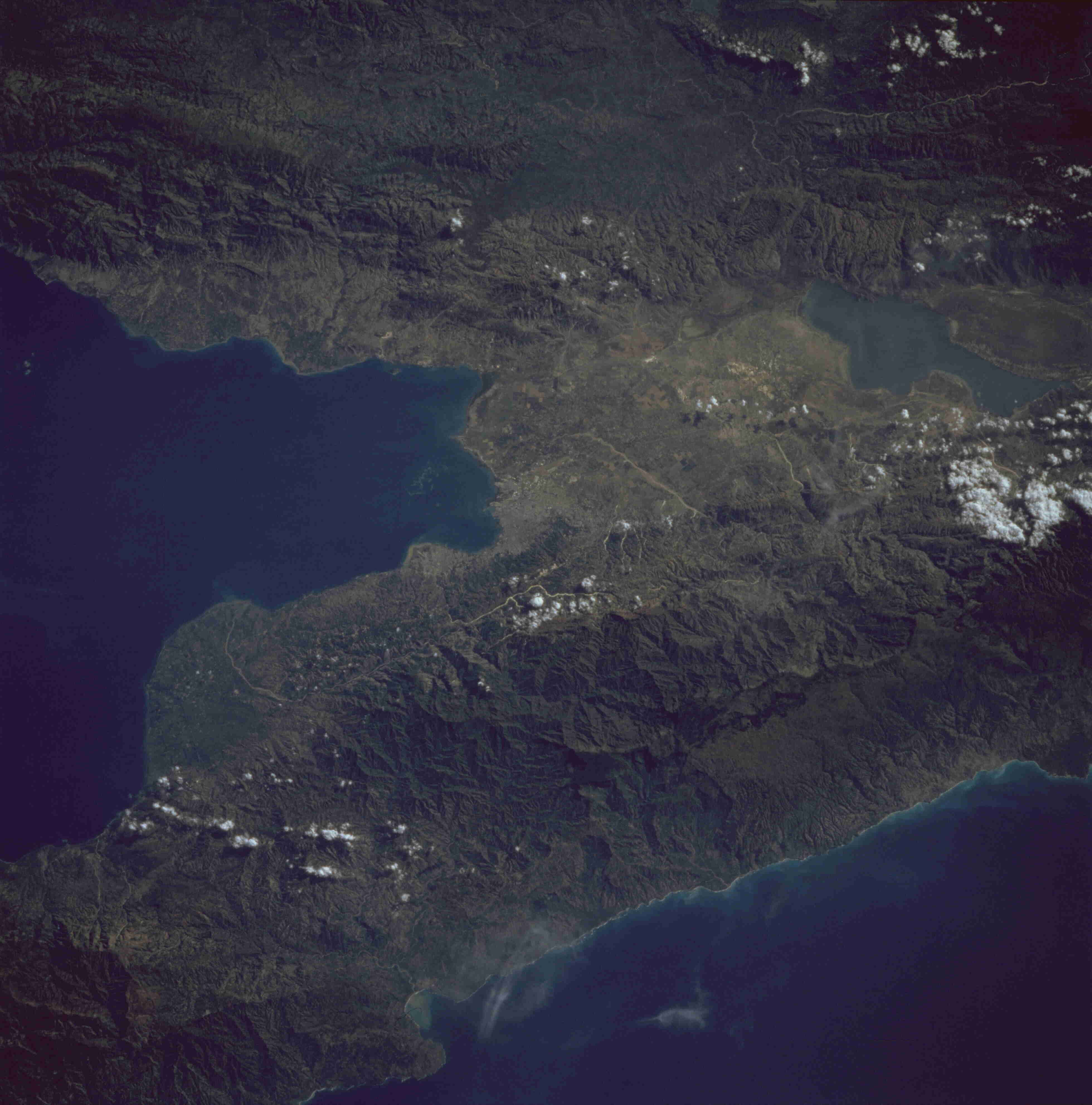
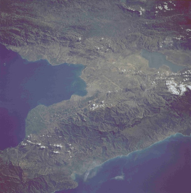
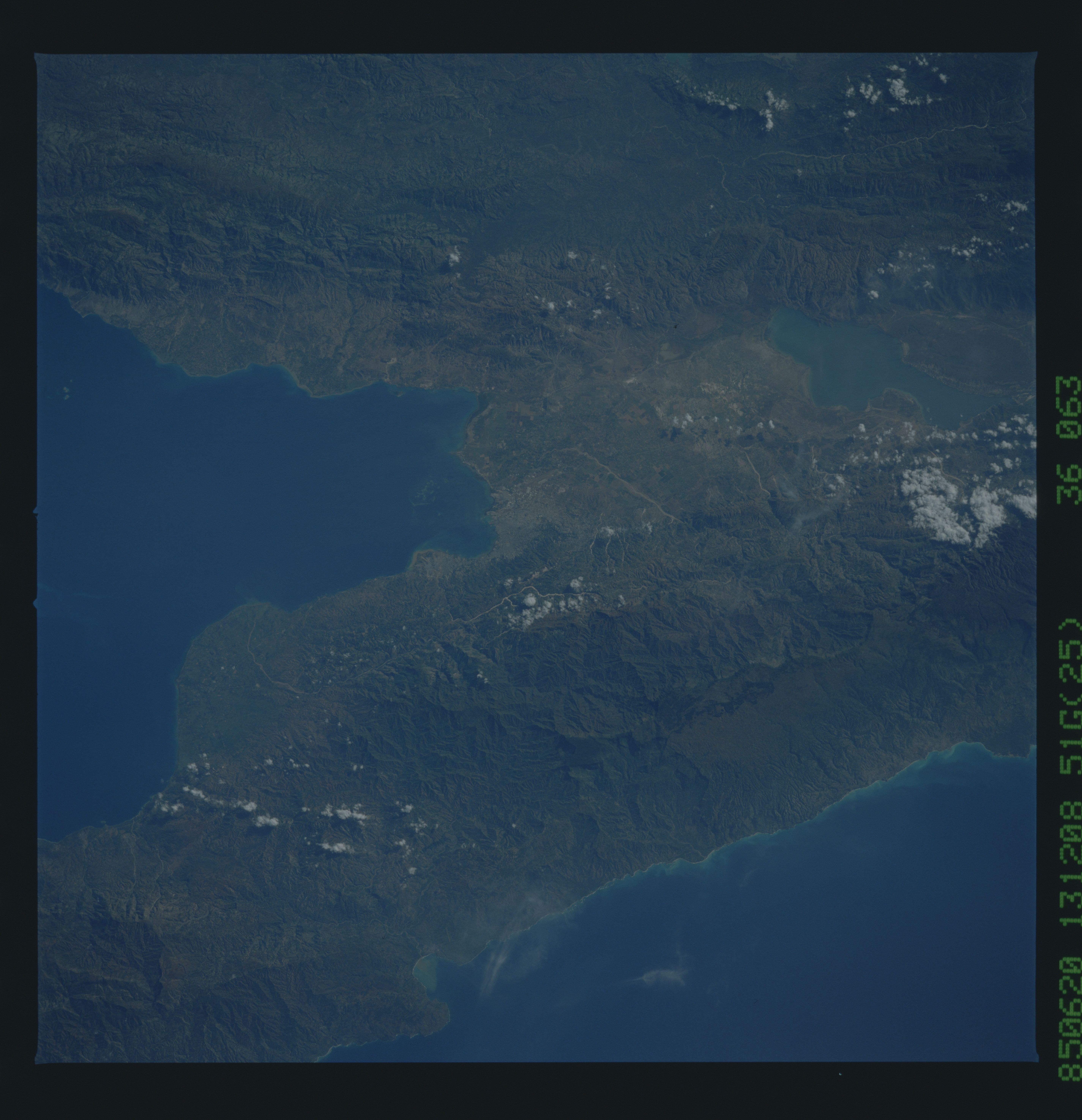
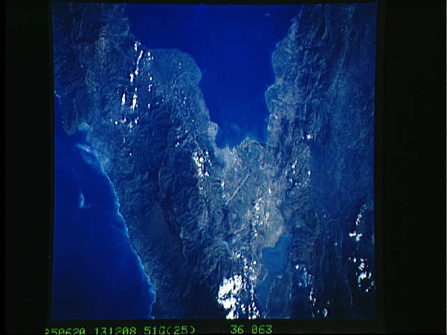
Image Caption: STS51G-036-0063 Port-au-Prince Area, Haiti June 1985
The leading seaport and capital city of Haiti, Port-au-Prince, can be seen in the center of this photograph. The two rugged and complex major mountain ranges (one range extending in an east-west direction south of the city and the second range generally aligned in a northwest-southeast direction north of the city) are separated by a structural depression known as the Enriquillo Cul de Sac. Elevations above sea level in these two ranges exceed 5000 feet (1500 meters) in the northern range and 7000 feet (2100 meters) in the southern range. The large lake east of Port-au-Prince, known as Etang Saumatre, is brackish and was formed as a result of a downfaulted block between the two mountain ranges.
The leading seaport and capital city of Haiti, Port-au-Prince, can be seen in the center of this photograph. The two rugged and complex major mountain ranges (one range extending in an east-west direction south of the city and the second range generally aligned in a northwest-southeast direction north of the city) are separated by a structural depression known as the Enriquillo Cul de Sac. Elevations above sea level in these two ranges exceed 5000 feet (1500 meters) in the northern range and 7000 feet (2100 meters) in the southern range. The large lake east of Port-au-Prince, known as Etang Saumatre, is brackish and was formed as a result of a downfaulted block between the two mountain ranges.
