STS51F-40-64
| NASA Photo ID | STS51F-40-64 |
| Focal Length | 250mm |
| Date taken | 1985.07.31 |
| Time taken | 12:22:24 GMT |
Resolutions offered for this image:
1536 x 1536 pixels 639 x 639 pixels 5700 x 6000 pixels 500 x 526 pixels 640 x 480 pixels
1536 x 1536 pixels 639 x 639 pixels 5700 x 6000 pixels 500 x 526 pixels 640 x 480 pixels
Cloud masks available for this image:
Spacecraft nadir point: 38.2° N, 54.0° E
Photo center point: 41.0° N, 53.0° E
Photo center point by machine learning:
Photo center point: 41.0° N, 53.0° E
Photo center point by machine learning:
Nadir to Photo Center: North
Spacecraft Altitude: 173 nautical miles (320km)
Country or Geographic Name: | TURKMENISTAN |
Features: | KARA-BOGAZ-GOL BAY |
| Features Found Using Machine Learning: | |
Cloud Cover Percentage: | 5 (1-10)% |
Sun Elevation Angle: | 36° |
Sun Azimuth: | 265° |
Camera: | Hasselblad |
Focal Length: | 250mm |
Camera Tilt: | 46 degrees |
Format: | 5017: Kodak, natural color positive, Ektachrome, X Professional, ASA 64, standard base |
Film Exposure: | Normal |
| Additional Information | |
| Width | Height | Annotated | Cropped | Purpose | Links |
|---|---|---|---|---|---|
| 1536 pixels | 1536 pixels | No | No | Earth From Space collection | Download Image |
| 639 pixels | 639 pixels | No | No | Earth From Space collection | Download Image |
| 5700 pixels | 6000 pixels | No | No | Download Image | |
| 500 pixels | 526 pixels | No | No | Download Image | |
| 640 pixels | 480 pixels | No | No | Download Image |
Download Packaged File
Download a Google Earth KML for this Image
View photo footprint information
Download a GeoTIFF for this photo
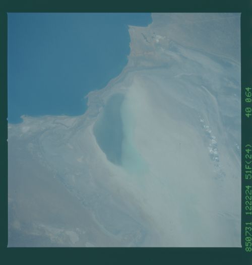
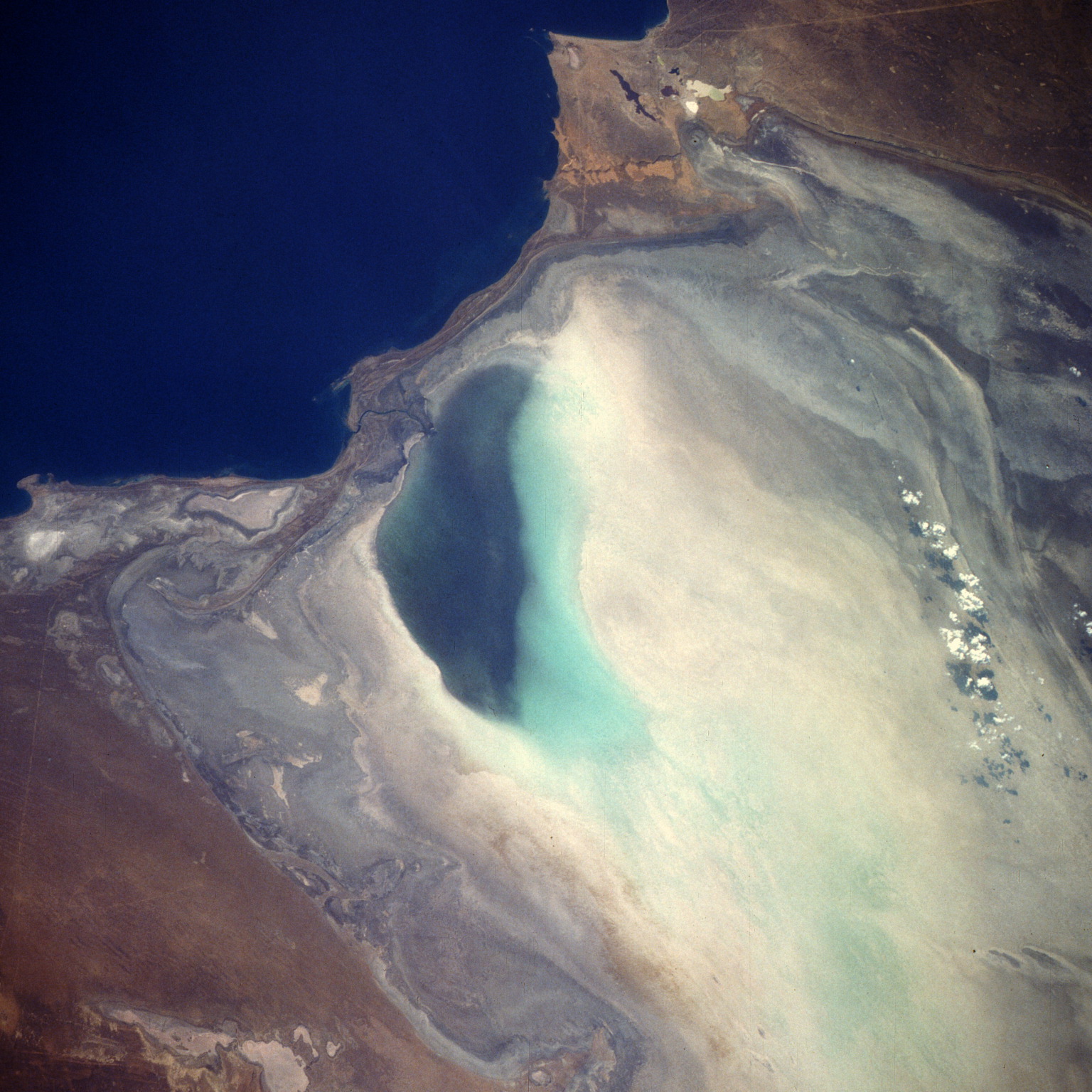
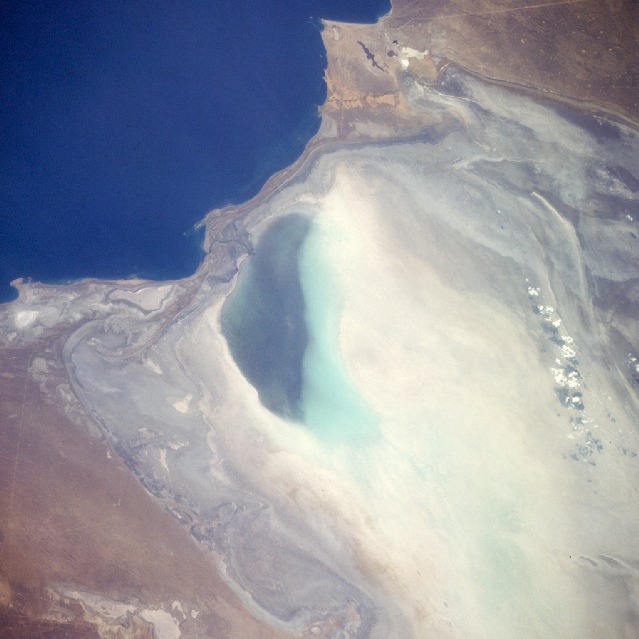
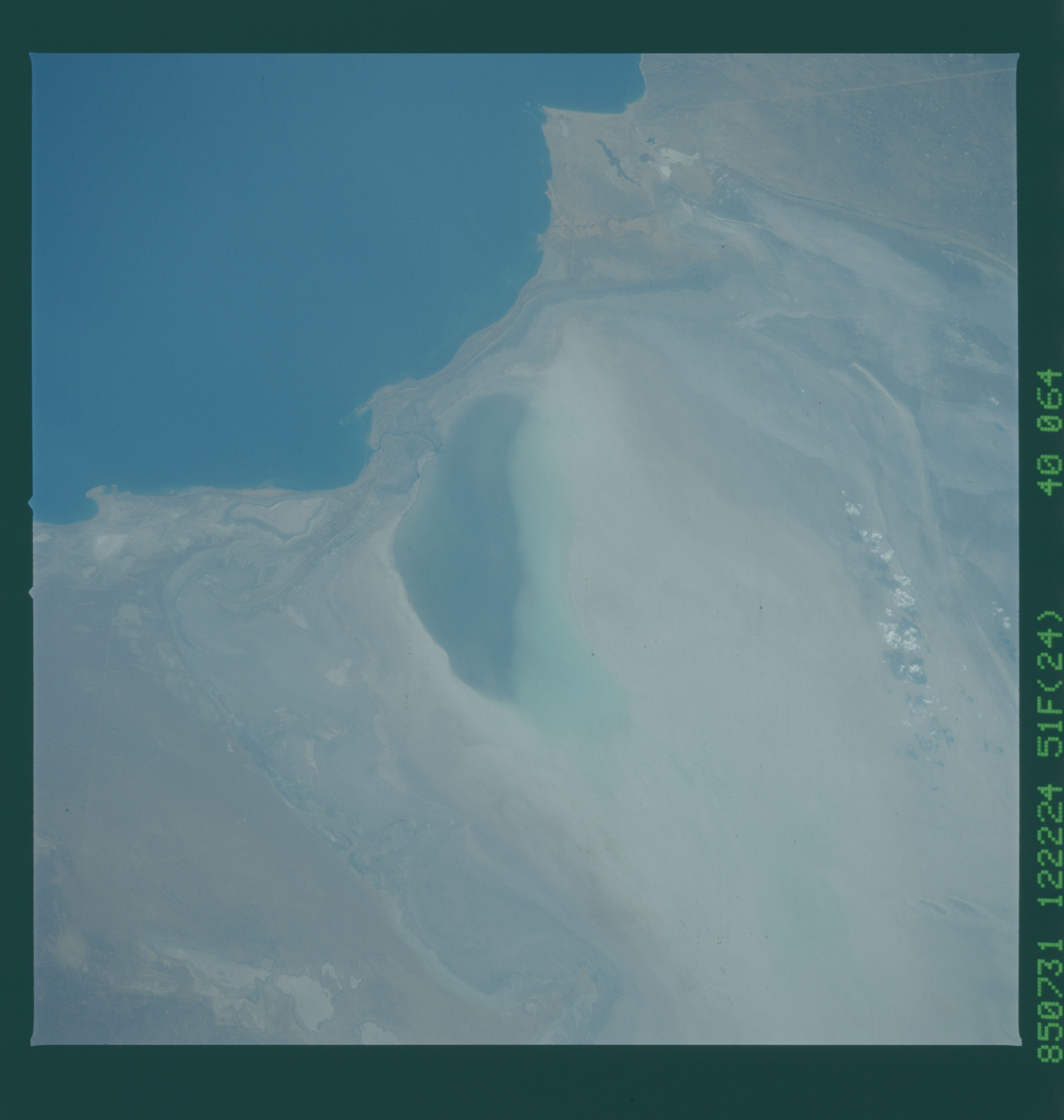
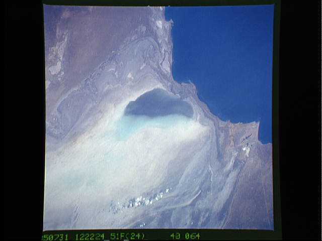
Image Caption: STS51F-040-0064 Kara-Bogaz Gol, Turkmenistan August 1985
This northwest-looking, low-oblique photograph shows the nearly empty basin of Kara-Bogaz Gol, an arm of the Caspian Sea. The average elevation of the deep blue Caspian Sea is 92 feet (28 meters) below sea level. The average elevation of Kara-Bogaz Gol, which acts as a natural evaporation basin--draining water from the Caspian Sea and depositing salts along the shore of the basin--is 102 feet (31 meters) below sea level. In 1979, the government built a dike across the narrow strip of land that separates the sea and the basin. In the 1980s, the low water levels in the Caspian Sea--caused by the diversion of water upstream on the Volga River (the sea's main source of water) for numerous government projects--allowed only a small amount of water into Kara-Bogaz Gol. The climate of this region is semiarid, but lack of precipitation during some years can cause desert-like conditions, resulting in even lower water levels in the sea. This photograph shows that much of the Kara-Bogaz Gol basin is void of water, except near its western end.
This northwest-looking, low-oblique photograph shows the nearly empty basin of Kara-Bogaz Gol, an arm of the Caspian Sea. The average elevation of the deep blue Caspian Sea is 92 feet (28 meters) below sea level. The average elevation of Kara-Bogaz Gol, which acts as a natural evaporation basin--draining water from the Caspian Sea and depositing salts along the shore of the basin--is 102 feet (31 meters) below sea level. In 1979, the government built a dike across the narrow strip of land that separates the sea and the basin. In the 1980s, the low water levels in the Caspian Sea--caused by the diversion of water upstream on the Volga River (the sea's main source of water) for numerous government projects--allowed only a small amount of water into Kara-Bogaz Gol. The climate of this region is semiarid, but lack of precipitation during some years can cause desert-like conditions, resulting in even lower water levels in the sea. This photograph shows that much of the Kara-Bogaz Gol basin is void of water, except near its western end.
