STS51F-38-45
| NASA Photo ID | STS51F-38-45 |
| Focal Length | 100mm |
| Date taken | 1985.08.02 |
| Time taken | 21:48:57 GMT |
Resolutions offered for this image:
3946 x 3946 pixels 639 x 639 pixels 5700 x 5900 pixels 500 x 518 pixels 640 x 480 pixels
3946 x 3946 pixels 639 x 639 pixels 5700 x 5900 pixels 500 x 518 pixels 640 x 480 pixels
Cloud masks available for this image:
Spacecraft nadir point: 32.7° N, 112.1° W
Photo center point: 33.0° N, 115.5° W
Photo center point by machine learning:
Photo center point: 33.0° N, 115.5° W
Photo center point by machine learning:
Nadir to Photo Center: West
Spacecraft Altitude: 173 nautical miles (320km)
Country or Geographic Name: | USA-CALIFORNIA |
Features: | IMPERIAL VALLEY |
| Features Found Using Machine Learning: | |
Cloud Cover Percentage: | 20 (11-25)% |
Sun Elevation Angle: | 56° |
Sun Azimuth: | 251° |
Camera: | Hasselblad |
Focal Length: | 100mm |
Camera Tilt: | 50 degrees |
Format: | 5017: Kodak, natural color positive, Ektachrome, X Professional, ASA 64, standard base |
Film Exposure: | Normal |
| Additional Information | |
| Width | Height | Annotated | Cropped | Purpose | Links |
|---|---|---|---|---|---|
| 3946 pixels | 3946 pixels | No | No | Earth From Space collection | Download Image |
| 639 pixels | 639 pixels | No | No | Earth From Space collection | Download Image |
| 5700 pixels | 5900 pixels | No | No | Download Image | |
| 500 pixels | 518 pixels | No | No | Download Image | |
| 640 pixels | 480 pixels | No | No | Download Image |
Download Packaged File
Download a Google Earth KML for this Image
View photo footprint information
Download a GeoTIFF for this photo
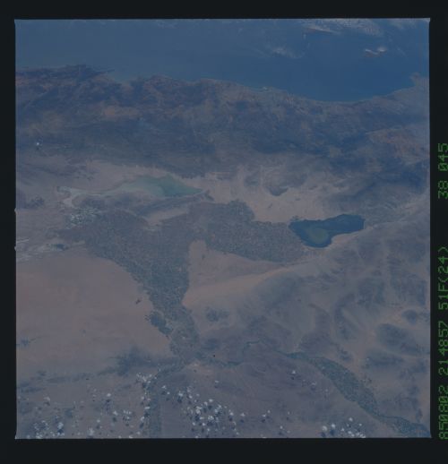
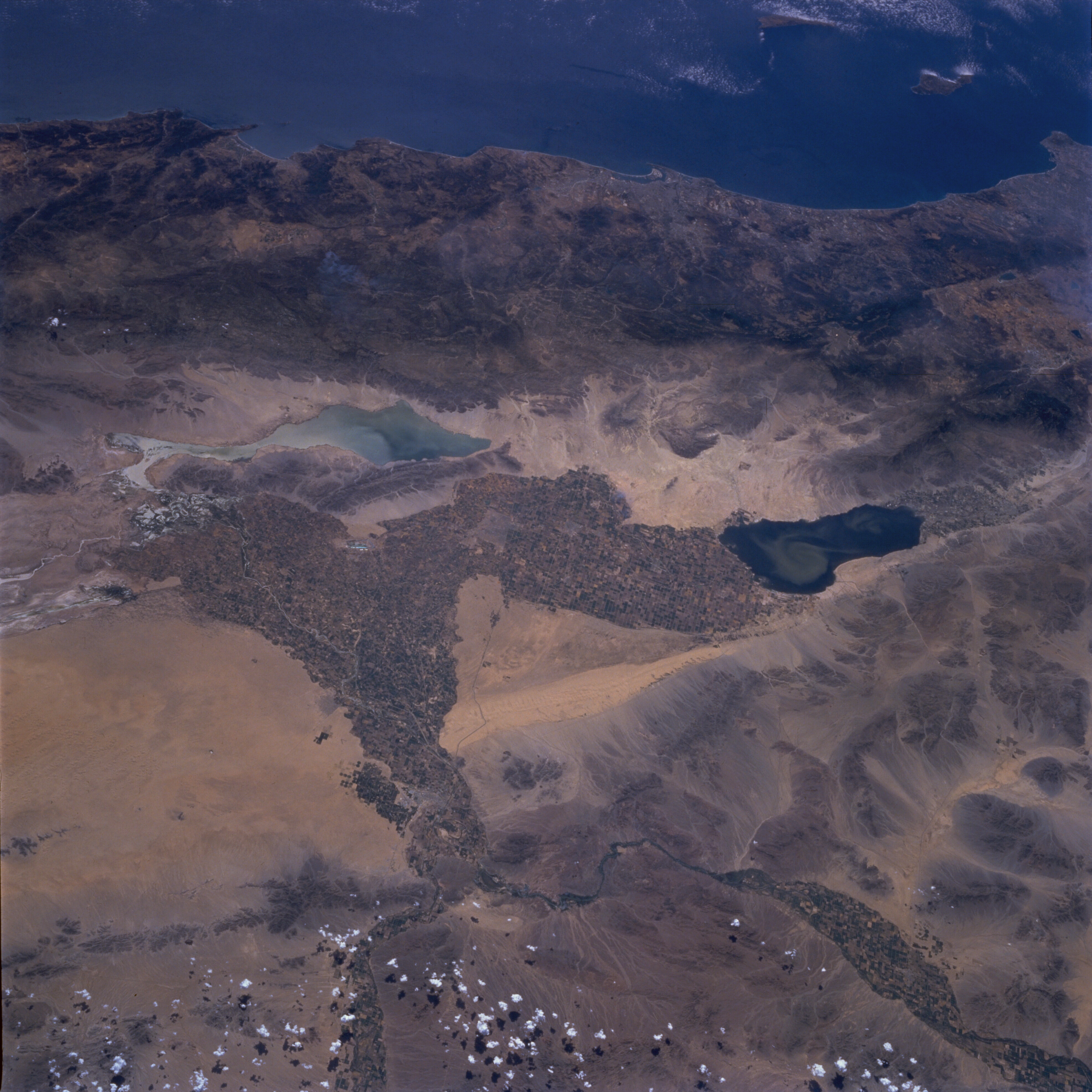
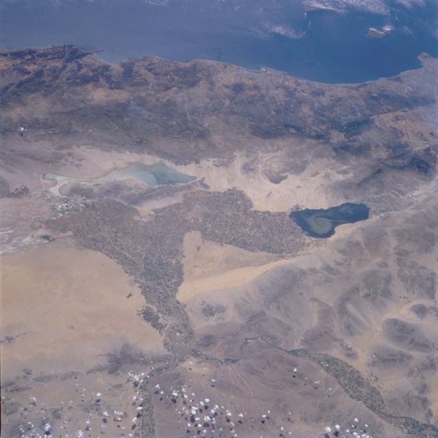
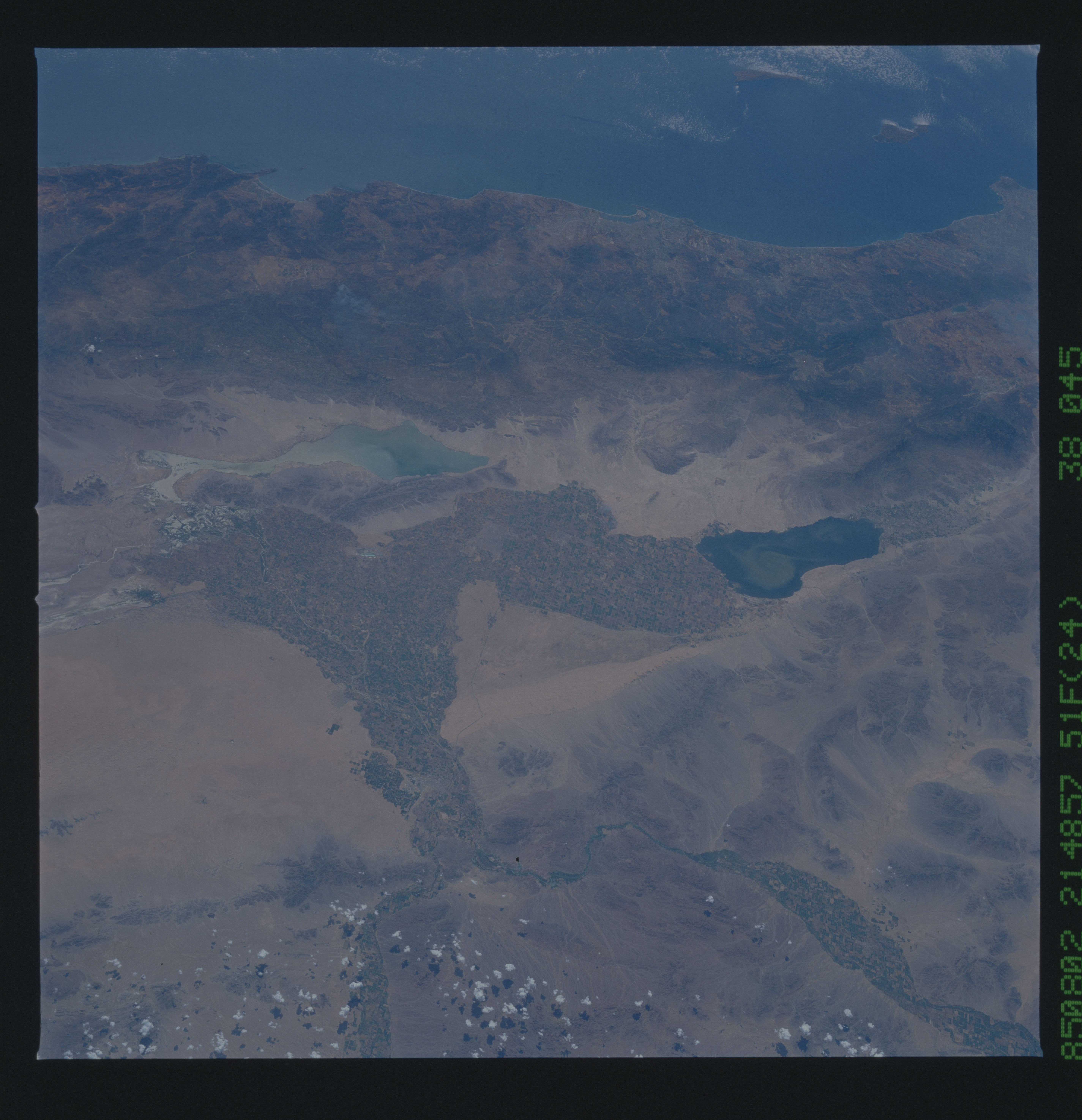
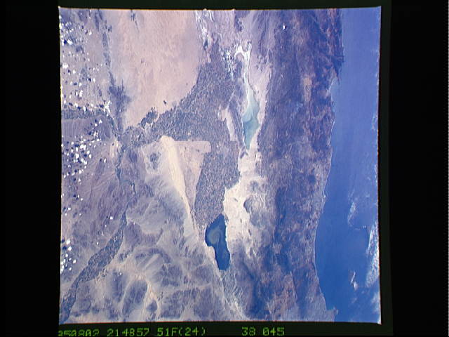
Image Caption: STS51F-038-0045 Southern California, U.S.A., and Northwestern Mexico August 1985
The irrigated agricultural field patterns stand out in marked contrast to the naturally nonvegetated desert region of the southwestern United States and northwestern Mexico. This view provides a rather rare opportunity to observe a manmade boundary between the two countries. (Look for the abrupt changes in agricultural field sizes and the regular field orientation that creates an east-west line along the southern edge of the California Imperial Valley.) Two rivers, the Colorado and the Gila, are the major sources of water for this arid region. The Colorado River enters this photograph from the northeast, and the Gila River enters from the east; both rivers flow generally south-southwest. Two sizable lakes (the Salton Sea in southern California and Laguna Salada in Mexico) are observed. A swirling sediment plume, probably created by surface winds, is seen in the Salton Sea. A well-defined area of distinctive sand dunes, called the Sand Hills, is located just to the east of the field patterns in the Imperial Valley. Several fragmented mountain ranges trend in a southeast-northwest direction along the southern California and northern Baja California coasts.
The irrigated agricultural field patterns stand out in marked contrast to the naturally nonvegetated desert region of the southwestern United States and northwestern Mexico. This view provides a rather rare opportunity to observe a manmade boundary between the two countries. (Look for the abrupt changes in agricultural field sizes and the regular field orientation that creates an east-west line along the southern edge of the California Imperial Valley.) Two rivers, the Colorado and the Gila, are the major sources of water for this arid region. The Colorado River enters this photograph from the northeast, and the Gila River enters from the east; both rivers flow generally south-southwest. Two sizable lakes (the Salton Sea in southern California and Laguna Salada in Mexico) are observed. A swirling sediment plume, probably created by surface winds, is seen in the Salton Sea. A well-defined area of distinctive sand dunes, called the Sand Hills, is located just to the east of the field patterns in the Imperial Valley. Several fragmented mountain ranges trend in a southeast-northwest direction along the southern California and northern Baja California coasts.
