STS51F-37-59
| NASA Photo ID | STS51F-37-59 |
| Focal Length | 250mm |
| Date taken | 1985.08.05 |
| Time taken | 06:59:34 GMT |
Cloud masks available for this image:
Spacecraft nadir point: 18.1° S, 45.4° E
Photo center point: 16.0° S, 46.5° E
Photo center point by machine learning:
Photo center point: 16.0° S, 46.5° E
Photo center point by machine learning:
Nadir to Photo Center: Northeast
Spacecraft Altitude: 166 nautical miles (307km)
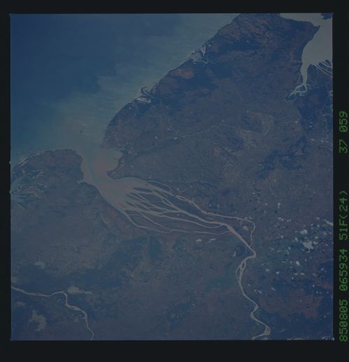
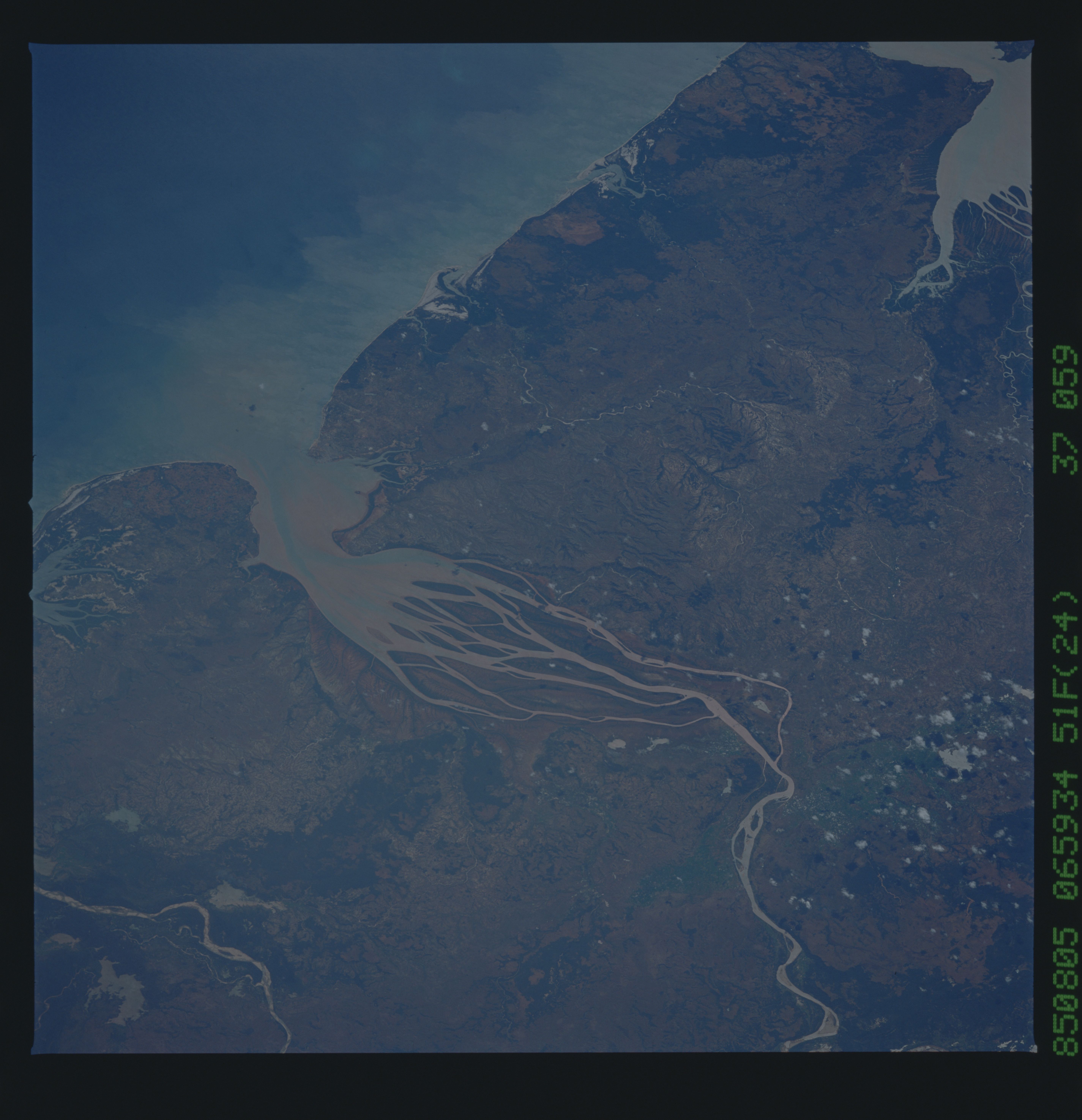
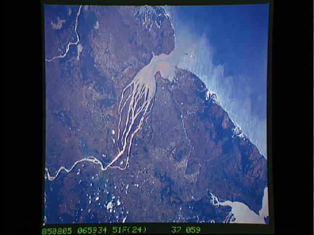
Country or Geographic Name: | MADAGASCAR |
Features: | BETSIBOKA RIVER |
| Features Found Using Machine Learning: | |
Cloud Cover Percentage: | 5 (1-10)% |
Sun Elevation Angle: | 43° |
Sun Azimuth: | 42° |
Camera: | Hasselblad |
Focal Length: | 250mm |
Camera Tilt: | 41 degrees |
Format: | 5017: Kodak, natural color positive, Ektachrome, X Professional, ASA 64, standard base |
Film Exposure: | Normal |
| Additional Information | |
| Width | Height | Annotated | Cropped | Purpose | Links |
|---|---|---|---|---|---|
| 5700 pixels | 5900 pixels | No | No | Download Image | |
| 500 pixels | 518 pixels | No | No | Download Image | |
| 640 pixels | 480 pixels | No | No | Download Image |
Download Packaged File
Download a Google Earth KML for this Image
View photo footprint information
Download a GeoTIFF for this photo
Image Caption: Once covered with thick, green tropical foliage, the island of Madagascar now rates as one of the world's most man-devastated lands. With huge amounts of its forests cleared, vast quantities of eroded soil pour into the Betsiboka Estuary, clogging the river's path to the Indian Ocean.
