STS51F-31-69
| NASA Photo ID | STS51F-31-69 |
| Focal Length | 100mm |
| Date taken | 1985.07.31 |
| Time taken | 09:17:32 GMT |
Resolutions offered for this image:
3978 x 3970 pixels 640 x 638 pixels 5700 x 5900 pixels 500 x 518 pixels 640 x 480 pixels
3978 x 3970 pixels 640 x 638 pixels 5700 x 5900 pixels 500 x 518 pixels 640 x 480 pixels

Cloud masks available for this image:
Spacecraft nadir point: 30.1° N, 88.5° E
Photo center point: 25.0° N, 90.5° E
Photo center point by machine learning:
Photo center point: 25.0° N, 90.5° E
Photo center point by machine learning:
Nadir to Photo Center: South
Spacecraft Altitude: 172 nautical miles (319km)
Country or Geographic Name: | BANGLADESH |
Features: | MONSOON |
| Features Found Using Machine Learning: | |
Cloud Cover Percentage: | 70 (51-75)% |
Sun Elevation Angle: | 46° |
Sun Azimuth: | 265° |
Camera: | Hasselblad |
Focal Length: | 100mm |
Camera Tilt: | High Oblique |
Format: | 5017: Kodak, natural color positive, Ektachrome, X Professional, ASA 64, standard base |
Film Exposure: | Normal |
| Additional Information | |
| Width | Height | Annotated | Cropped | Purpose | Links |
|---|---|---|---|---|---|
| 3978 pixels | 3970 pixels | No | No | Earth From Space collection | Download Image |
| 640 pixels | 638 pixels | No | No | Earth From Space collection | Download Image |
| 5700 pixels | 5900 pixels | No | No | Download Image | |
| 500 pixels | 518 pixels | No | No | Download Image | |
| 640 pixels | 480 pixels | No | No | Download Image |
Download Packaged File
Download a Google Earth KML for this Image
View photo footprint information
Download a GeoTIFF for this photo
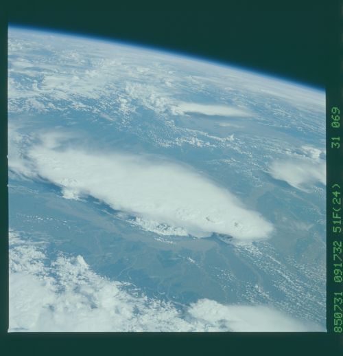
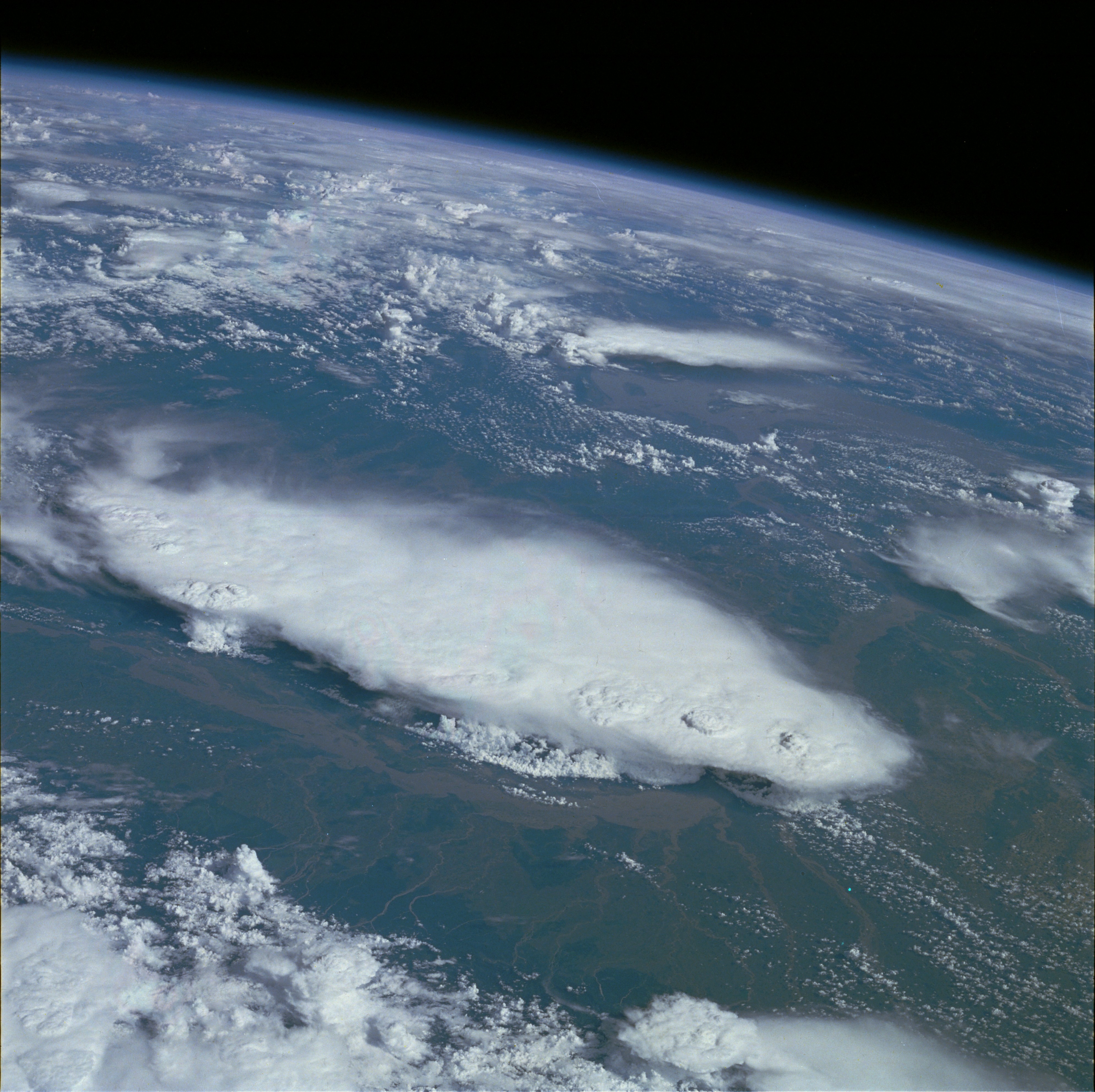
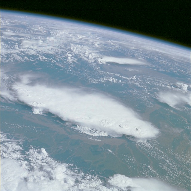
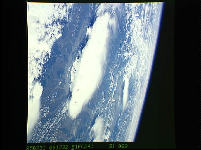
Image Caption: STS51F-31-69 Monsoonal Thunderstorms, Bangladesh and India July 1985
This magnificent, high-oblique photograph was taken from above the eastern Himalaya Mountains looking southeast across the floodplain of the Brahmaputra River and the cloud-covered Khasi Hills into the Bay of Bengal. A well-developed cluster of mature monsoonal thunderstorms over the Khasi Hills (center of photograph) can be seen. A variety of meteorological phenomena are visible, such as overshooting thunderstorm tops, towers, squall lines, and areas of probable high-speed downdrafts or microbursts. Just to the north of the cloud-covered Khasi Hills, the Brahmaputra River can be seen in flood stage. During some years of exceedingly heavy monsoonal rainfall, the width of the river in flood can expand to over 50 miles (80 kilometers) in certain locations. Within the Khasi Hills region are locations where annual rainfall totals are among the highest in the world, exceeding 500 inches (1300 centimeters) per year. In appreciating the great amount of rainfall per year, it is further useful to realize that almost all of the rainfall occurs between late May and mid-September.
This magnificent, high-oblique photograph was taken from above the eastern Himalaya Mountains looking southeast across the floodplain of the Brahmaputra River and the cloud-covered Khasi Hills into the Bay of Bengal. A well-developed cluster of mature monsoonal thunderstorms over the Khasi Hills (center of photograph) can be seen. A variety of meteorological phenomena are visible, such as overshooting thunderstorm tops, towers, squall lines, and areas of probable high-speed downdrafts or microbursts. Just to the north of the cloud-covered Khasi Hills, the Brahmaputra River can be seen in flood stage. During some years of exceedingly heavy monsoonal rainfall, the width of the river in flood can expand to over 50 miles (80 kilometers) in certain locations. Within the Khasi Hills region are locations where annual rainfall totals are among the highest in the world, exceeding 500 inches (1300 centimeters) per year. In appreciating the great amount of rainfall per year, it is further useful to realize that almost all of the rainfall occurs between late May and mid-September.
