STS51D-35-36
| NASA Photo ID | STS51D-35-36 |
| Focal Length | 100mm |
| Date taken | 1985.04.15 |
| Time taken | 14:47:20 GMT |
Resolutions offered for this image:
5700 x 5900 pixels 483 x 500 pixels 640 x 480 pixels 463 x 453 pixels 600 x 592 pixels
5700 x 5900 pixels 483 x 500 pixels 640 x 480 pixels 463 x 453 pixels 600 x 592 pixels

Cloud masks available for this image:
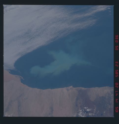
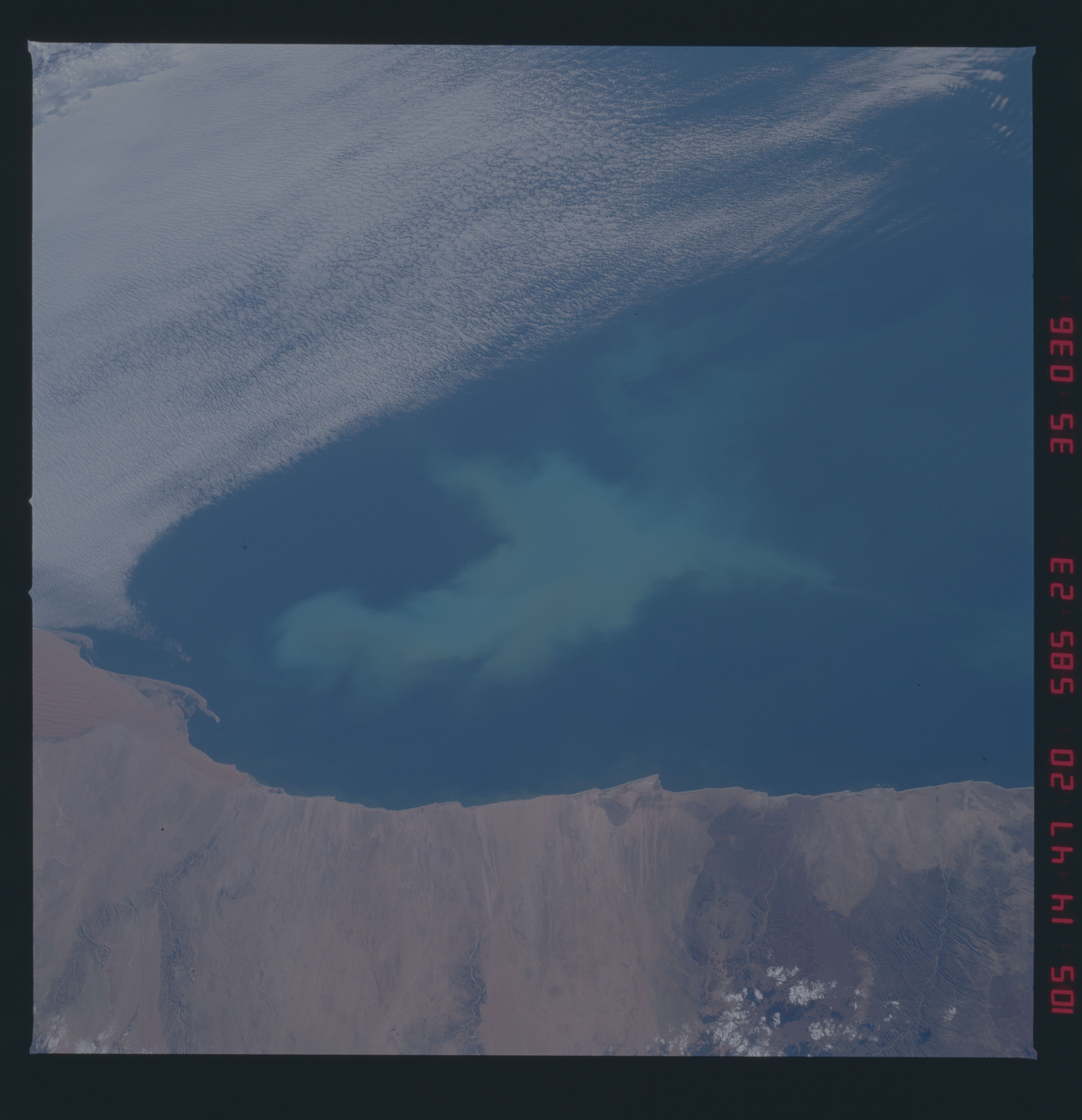
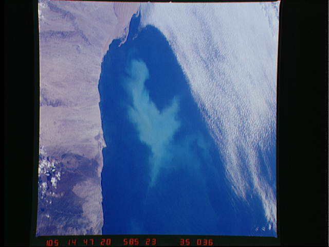
Spacecraft nadir point: 20.1° S, 15.2° E
Photo center point: 22.0° S, 14.0° E
Photo center point by machine learning:
Photo center point: 22.0° S, 14.0° E
Photo center point by machine learning:
Nadir to Photo Center: Southwest
Spacecraft Altitude: 233 nautical miles (432km)
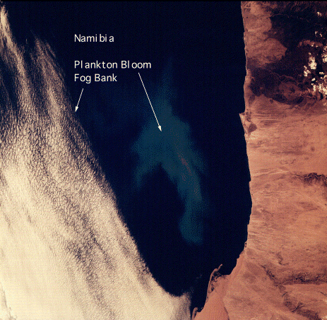
Country or Geographic Name: | NAMIBIA |
Features: | PLANKTON BLOOM |
| Features Found Using Machine Learning: | |
Cloud Cover Percentage: | 30 (26-50)% |
Sun Elevation Angle: | 26° |
Sun Azimuth: | 292° |
Camera: | Hasselblad |
Focal Length: | 100mm |
Camera Tilt: | 30 degrees |
Format: | 5017: Kodak, natural color positive, Ektachrome, X Professional, ASA 64, standard base |
Film Exposure: | Normal |
| Additional Information | |
| Width | Height | Annotated | Cropped | Purpose | Links |
|---|---|---|---|---|---|
| 5700 pixels | 5900 pixels | No | No | Download Image | |
| 483 pixels | 500 pixels | No | No | Download Image | |
| 640 pixels | 480 pixels | No | No | Download Image | |
| 463 pixels | 453 pixels | Yes | No | Download Image | |
| 600 pixels | 592 pixels | Download Image |
Download Packaged File
Download a Google Earth KML for this Image
View photo footprint information
Download a GeoTIFF for this photo
Image Caption: none
