STS51B-53-93
| NASA Photo ID | STS51B-53-93 |
| Focal Length | 250mm |
| Date taken | 1985.05.05 |
| Time taken | 00:41:08 GMT |
Cloud masks available for this image:
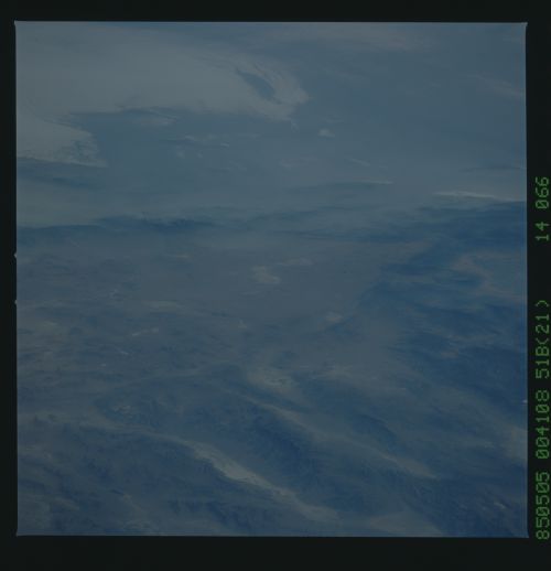
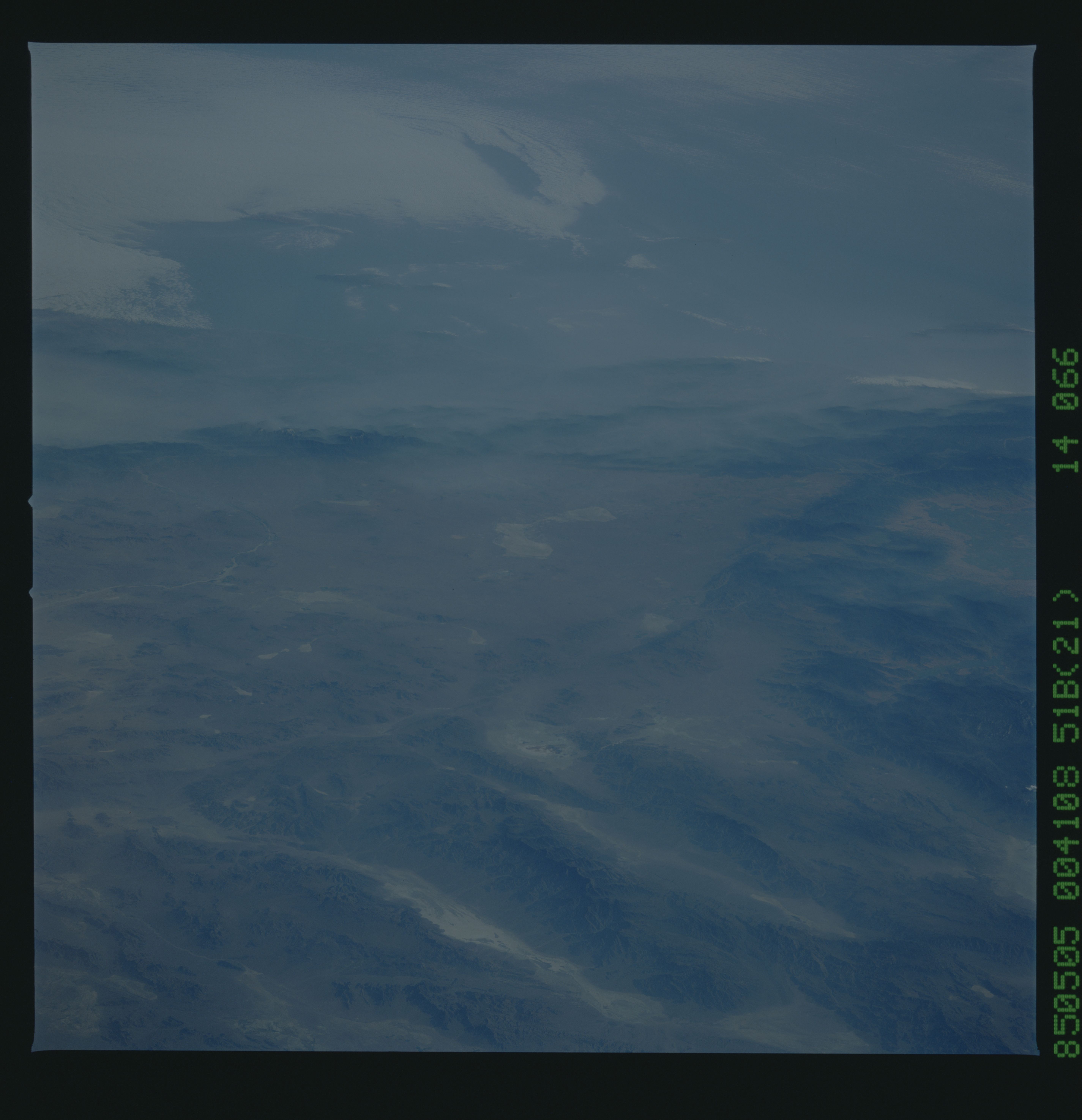
Spacecraft nadir point: 40.9° N, 113.0° W
Photo center point: 35.0° N, 117.5° W
Photo center point by machine learning:
Photo center point: 35.0° N, 117.5° W
Photo center point by machine learning:
Nadir to Photo Center: Southwest
Spacecraft Altitude: 196 nautical miles (363km)
Country or Geographic Name: | USA-CALIFORNIA |
Features: | MOJAVE DESERT |
| Features Found Using Machine Learning: | |
Cloud Cover Percentage: | 30 (26-50)% |
Sun Elevation Angle: | 19° |
Sun Azimuth: | 274° |
Camera: | Hasselblad |
Focal Length: | 250mm |
Camera Tilt: | Low Oblique |
Format: | 5017: Kodak, natural color positive, Ektachrome, X Professional, ASA 64, standard base |
Film Exposure: | Normal |
| Additional Information | |
| Width | Height | Annotated | Cropped | Purpose | Links |
|---|---|---|---|---|---|
| 5700 pixels | 5900 pixels | No | No | Download Image | |
| 500 pixels | 518 pixels | No | No | Download Image |
Download Packaged File
Download a Google Earth KML for this Image
View photo footprint information
Download a GeoTIFF for this photo
Image Caption: Fig 4.x Aerosols over the Los Angeles basin This west-looking oblique view, from the Mojave Desert in the foreground, past Edwards Airforce Base (where the Shuttle often lands on the dry lake bed, center) to the LA basin and the ocean beyond, shows
Smog over Los Angeles nd Pacific
Smog over Los Angeles nd Pacific
