STS51B-53-17
| NASA Photo ID | STS51B-53-17 |
| Focal Length | 250mm |
| Date taken | 1985.__.__ |
| Time taken | GMT |
Resolutions offered for this image:
3904 x 3904 pixels 639 x 639 pixels 5700 x 5900 pixels 500 x 518 pixels
3904 x 3904 pixels 639 x 639 pixels 5700 x 5900 pixels 500 x 518 pixels

Cloud masks available for this image:
Spacecraft nadir point:
Photo center point: 34.0° N, 85.5° W
Photo center point by machine learning:
Photo center point: 34.0° N, 85.5° W
Photo center point by machine learning:
Nadir to Photo Center:
Spacecraft Altitude: nautical miles (0km)
Country or Geographic Name: | USA-ALABAMA |
Features: | WEISS RESERVOIR, GADSDEN |
| Features Found Using Machine Learning: | |
Cloud Cover Percentage: | 30 (26-50)% |
Sun Elevation Angle: | ° |
Sun Azimuth: | ° |
Camera: | Hasselblad |
Focal Length: | 250mm |
Camera Tilt: | Near Vertical |
Format: | 5017: Kodak, natural color positive, Ektachrome, X Professional, ASA 64, standard base |
Film Exposure: | Normal |
| Additional Information | |
| Width | Height | Annotated | Cropped | Purpose | Links |
|---|---|---|---|---|---|
| 3904 pixels | 3904 pixels | No | No | Earth From Space collection | Download Image |
| 639 pixels | 639 pixels | No | No | Earth From Space collection | Download Image |
| 5700 pixels | 5900 pixels | No | No | Download Image | |
| 500 pixels | 518 pixels | No | No | Download Image |
Download Packaged File
Download a Google Earth KML for this Image
View photo footprint information
Download a GeoTIFF for this photo
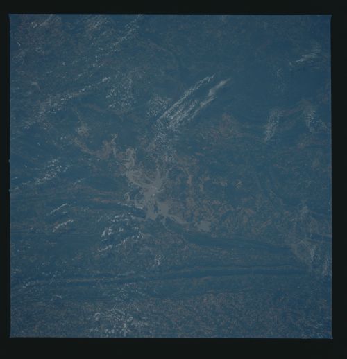
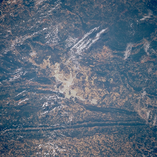
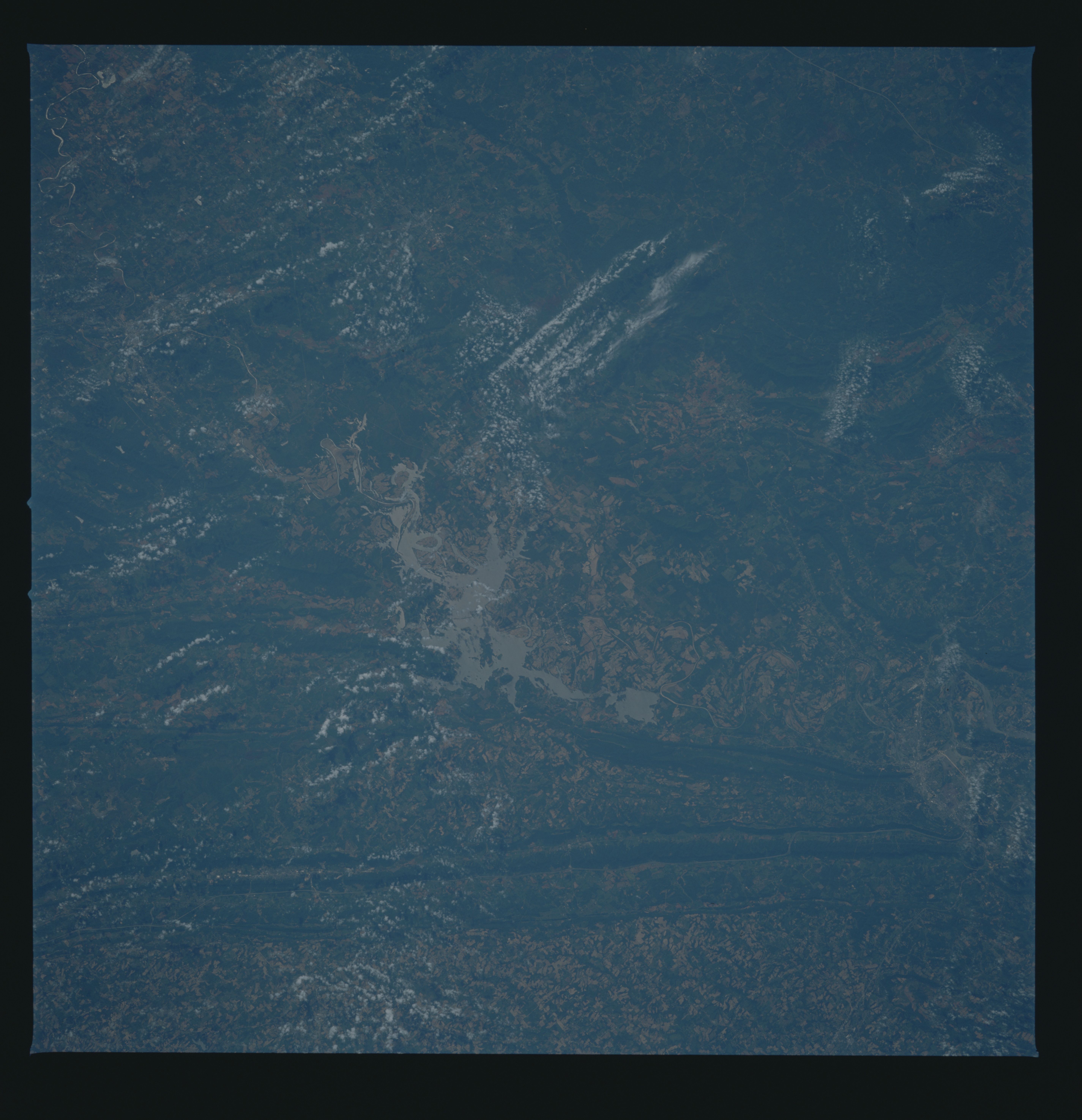
Image Caption: STS51B-53-0017 Weiss Lake, Alabama, U.S.A. May 1985
A few widely scattered clouds obscure some of the mountainous terrain in this southeast-looking photograph of northeast Alabama. Featured are light, irregular-shaped Weiss Lake, the result of damning part of the Coosa River, and Lookout Mountain immediately northwest of the lake. Visible are Gadsden, Alabama, near the apex of two northeast-southwest-trending mountain ridges (bottom right); a small segment of the Cumberland Plateau (northwest); and part of the more extensive Appalachian Mountains (southeast). Apparent are dark forested areas and lighter valleys denoting agricultural activities.
A few widely scattered clouds obscure some of the mountainous terrain in this southeast-looking photograph of northeast Alabama. Featured are light, irregular-shaped Weiss Lake, the result of damning part of the Coosa River, and Lookout Mountain immediately northwest of the lake. Visible are Gadsden, Alabama, near the apex of two northeast-southwest-trending mountain ridges (bottom right); a small segment of the Cumberland Plateau (northwest); and part of the more extensive Appalachian Mountains (southeast). Apparent are dark forested areas and lighter valleys denoting agricultural activities.
