STS51B-46-96
| NASA Photo ID | STS51B-46-96 |
| Focal Length | 250mm |
| Date taken | 1985.05.02 |
| Time taken | 14:35:25 GMT |
Cloud masks available for this image:
Spacecraft nadir point: 54.9° N, 18.5° E
Photo center point: 54.5° N, 20.0° E
Photo center point by machine learning:
Photo center point: 54.5° N, 20.0° E
Photo center point by machine learning:
Nadir to Photo Center: East
Spacecraft Altitude: 197 nautical miles (365km)
Country or Geographic Name: | RUSSIAN FEDERATION |
Features: | KALININGRAD |
| Features Found Using Machine Learning: | |
Cloud Cover Percentage: | 60 (51-75)% |
Sun Elevation Angle: | 30° |
Sun Azimuth: | 252° |
Camera: | Hasselblad |
Focal Length: | 250mm |
Camera Tilt: | 25 degrees |
Format: | 5017: Kodak, natural color positive, Ektachrome, X Professional, ASA 64, standard base |
Film Exposure: | Normal |
| Additional Information | |
| Width | Height | Annotated | Cropped | Purpose | Links |
|---|---|---|---|---|---|
| 5700 pixels | 5900 pixels | No | No | Download Image | |
| 500 pixels | 518 pixels | No | No | Download Image |
Download Packaged File
Download a Google Earth KML for this Image
View photo footprint information
Download a GeoTIFF for this photo
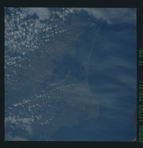
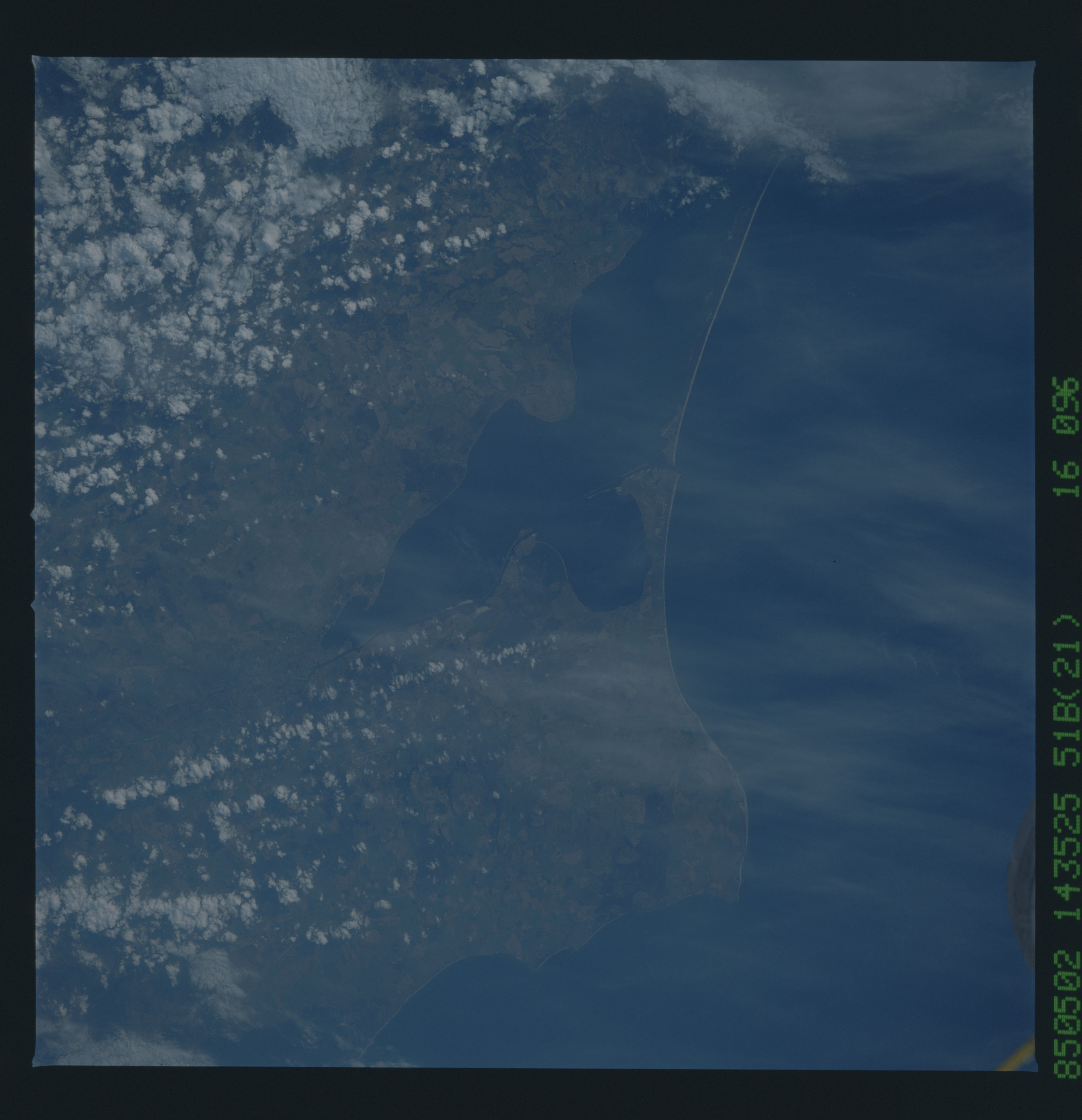
Image Caption: This near-vertical, west-looking view shows the Gulf of Danzig
and Wislany Lagoon near the major Polish port of Gdansk on the
southern Baltic Sea coast. The Russian port city of Kaliningrad
(1) is also visible. Ice free during the winter months, both
Gdansk, just off the top center of the view, and Kaliningrad are
major ports. Kaliningrad was the coronation city of all of the
kings of Prussia. Hitler's demand that Gdansk (Danzig) be re-
turned to Gernany in 1939 was the immediate cause of the German
invasion of Poland and thus the start of World War II. (STS51B-
46-096)
