STS51B-46-5
| NASA Photo ID | STS51B-46-5 |
| Focal Length | 250mm |
| Date taken | 1985.05.02 |
| Time taken | 03:43:40 GMT |

Cloud masks available for this image:
Spacecraft nadir point: 46.8° N, 114.7° E
Photo center point: 43.0° N, 117.5° E
Photo center point by machine learning:
Photo center point: 43.0° N, 117.5° E
Photo center point by machine learning:
Nadir to Photo Center: Southeast
Spacecraft Altitude: 195 nautical miles (361km)
Country or Geographic Name: | CHINA |
Features: | LAKE DALAI |
| Features Found Using Machine Learning: | |
Cloud Cover Percentage: | 30 (26-50)% |
Sun Elevation Angle: | 57° |
Sun Azimuth: | 164° |
Camera: | Hasselblad |
Focal Length: | 250mm |
Camera Tilt: | Low Oblique |
Format: | 5017: Kodak, natural color positive, Ektachrome, X Professional, ASA 64, standard base |
Film Exposure: | Normal |
| Additional Information | |
| Width | Height | Annotated | Cropped | Purpose | Links |
|---|---|---|---|---|---|
| 5700 pixels | 5900 pixels | No | No | Download Image | |
| 500 pixels | 518 pixels | No | No | Download Image |
Download Packaged File
Download a Google Earth KML for this Image
View photo footprint information
Download a GeoTIFF for this photo
Image Caption:
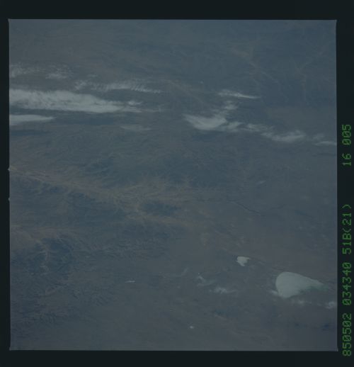
Easterm Mongolian Plateau
An east-looking panoramic view depicts the Eastern Monglian Pla-
teau as it merges into the southern portion of the Greater
Khingam Range. Note the streams as they branch to the east from
the plateau cutting deep gorges, or cantuns, through the moun-
tains. The main channel is the Hsi-La-Mu-Lun River (1) as it
flows eastward to the Manchurian Plain. Vegetation in the South-
ern Greater Khingam is not as extensive as it is to the north,
but areas of forest can be seen on the higher, steeper slopes of
the range. A large salt playa (1) called Dalai Lake can be seen
at the lower right of the view. (51B-46-005, 006, 007)
