STS51B-38-52
| NASA Photo ID | STS51B-38-52 |
| Focal Length | 250mm |
| Date taken | 1985.__.__ |
| Time taken | GMT |
Resolutions offered for this image:
3904 x 3904 pixels 639 x 639 pixels 5700 x 5900 pixels 500 x 518 pixels
3904 x 3904 pixels 639 x 639 pixels 5700 x 5900 pixels 500 x 518 pixels
Cloud masks available for this image:
Spacecraft nadir point:
Photo center point: 46.5° N, 95.5° W
Photo center point by machine learning:
Photo center point: 46.5° N, 95.5° W
Photo center point by machine learning:
Nadir to Photo Center:
Spacecraft Altitude: nautical miles (0km)
Country or Geographic Name: | USA-MINNESOTA |
Features: | OTTER TAIL LAKE |
| Features Found Using Machine Learning: | |
Cloud Cover Percentage: | 10 (1-10)% |
Sun Elevation Angle: | ° |
Sun Azimuth: | ° |
Camera: | Hasselblad |
Focal Length: | 250mm |
Camera Tilt: | Near Vertical |
Format: | 5017: Kodak, natural color positive, Ektachrome, X Professional, ASA 64, standard base |
Film Exposure: | Normal |
| Additional Information | |
| Width | Height | Annotated | Cropped | Purpose | Links |
|---|---|---|---|---|---|
| 3904 pixels | 3904 pixels | No | No | Earth From Space collection | Download Image |
| 639 pixels | 639 pixels | No | No | Earth From Space collection | Download Image |
| 5700 pixels | 5900 pixels | No | No | Download Image | |
| 500 pixels | 518 pixels | No | No | Download Image |
Download Packaged File
Download a Google Earth KML for this Image
View photo footprint information
Download a GeoTIFF for this photo
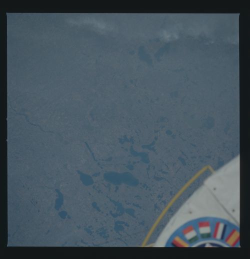
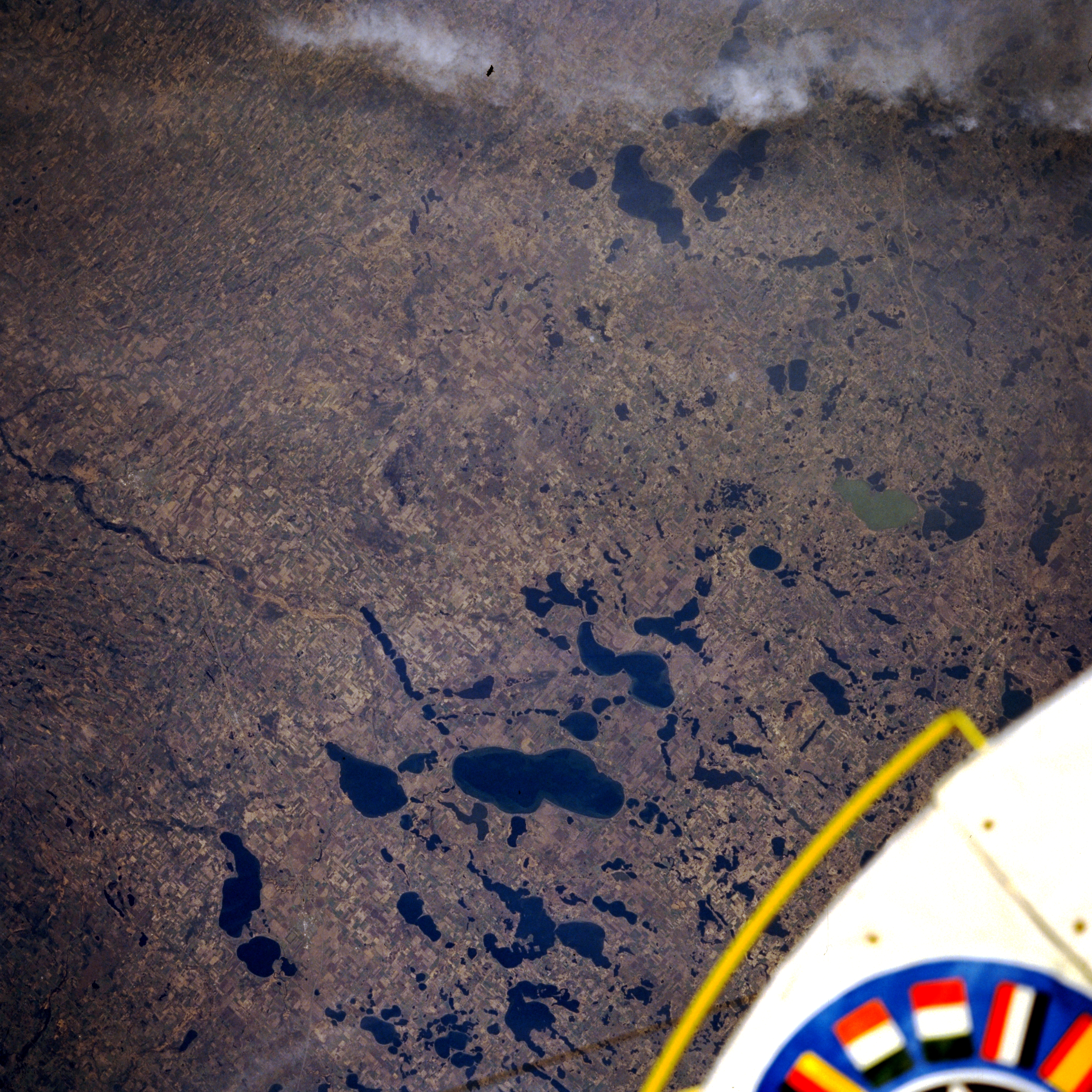
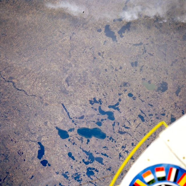
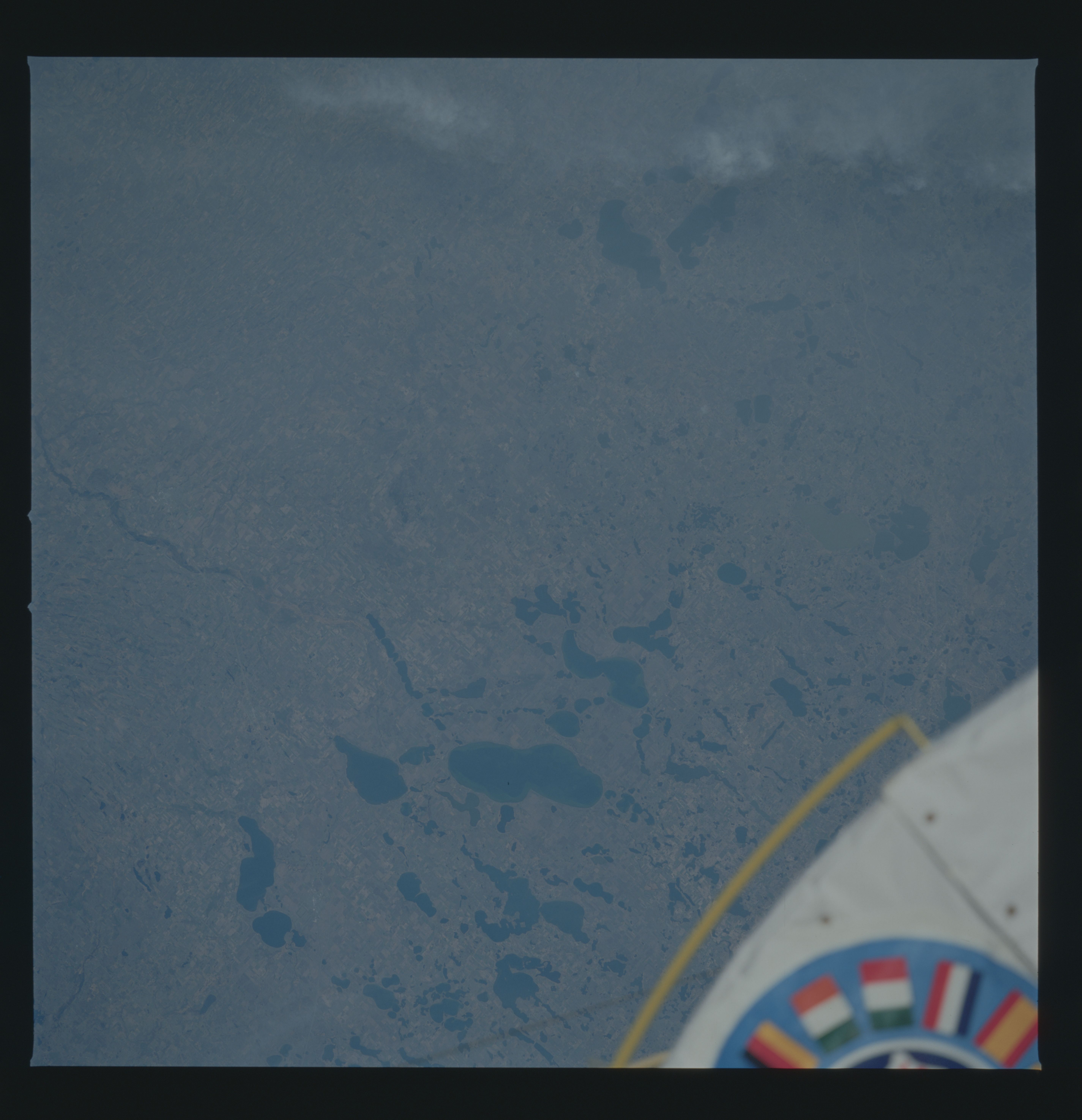
Image Caption: STS51B-038-0052 Otter Tail Lake, Minnesota, U.S.A. May 1985
Otter Tail Lake [12 miles (19 kilometers) long] is the largest of the lakes featured in this southeast-looking, low-oblique photograph of west-central Minnesota. These lakes were formed more than 10 000 years ago as glaciers from the last ice age retreated northward. Visible are light green Christina Lake (right center of the photograph) and Miltona Lake and Ida Lake (near top center), north of Alexandria (not discernible). Excellent fishing in area lakes brings visitors from all over the United States to this region.
Otter Tail Lake [12 miles (19 kilometers) long] is the largest of the lakes featured in this southeast-looking, low-oblique photograph of west-central Minnesota. These lakes were formed more than 10 000 years ago as glaciers from the last ice age retreated northward. Visible are light green Christina Lake (right center of the photograph) and Miltona Lake and Ida Lake (near top center), north of Alexandria (not discernible). Excellent fishing in area lakes brings visitors from all over the United States to this region.
