STS51B-35-28

| NASA Photo ID | STS51B-35-28 |
| Focal Length | 100mm |
| Date taken | 1985.05.01 |
| Time taken | 12:31:57 GMT |
Cloud masks available for this image:
Spacecraft nadir point: 54.2° N, 6.4° E
Photo center point: 53.0° N, 4.0° E
Photo center point by machine learning:
Photo center point: 53.0° N, 4.0° E
Photo center point by machine learning:
Nadir to Photo Center: Southwest
Spacecraft Altitude: 196 nautical miles (363km)
Country or Geographic Name: | NETHERLANDS |
Features: | NORTH SEA |
| Features Found Using Machine Learning: | |
Cloud Cover Percentage: | 60 (51-75)% |
Sun Elevation Angle: | 49° |
Sun Azimuth: | 202° |
Camera: | Hasselblad |
Focal Length: | 100mm |
Camera Tilt: | Near Vertical |
Format: | 5017: Kodak, natural color positive, Ektachrome, X Professional, ASA 64, standard base |
Film Exposure: | Normal |
| Additional Information | |
| Width | Height | Annotated | Cropped | Purpose | Links |
|---|---|---|---|---|---|
| 5700 pixels | 5900 pixels | No | No | Download Image | |
| 500 pixels | 518 pixels | No | No | Download Image |
Download Packaged File
Download a Google Earth KML for this Image
View photo footprint information
Download a GeoTIFF for this photo
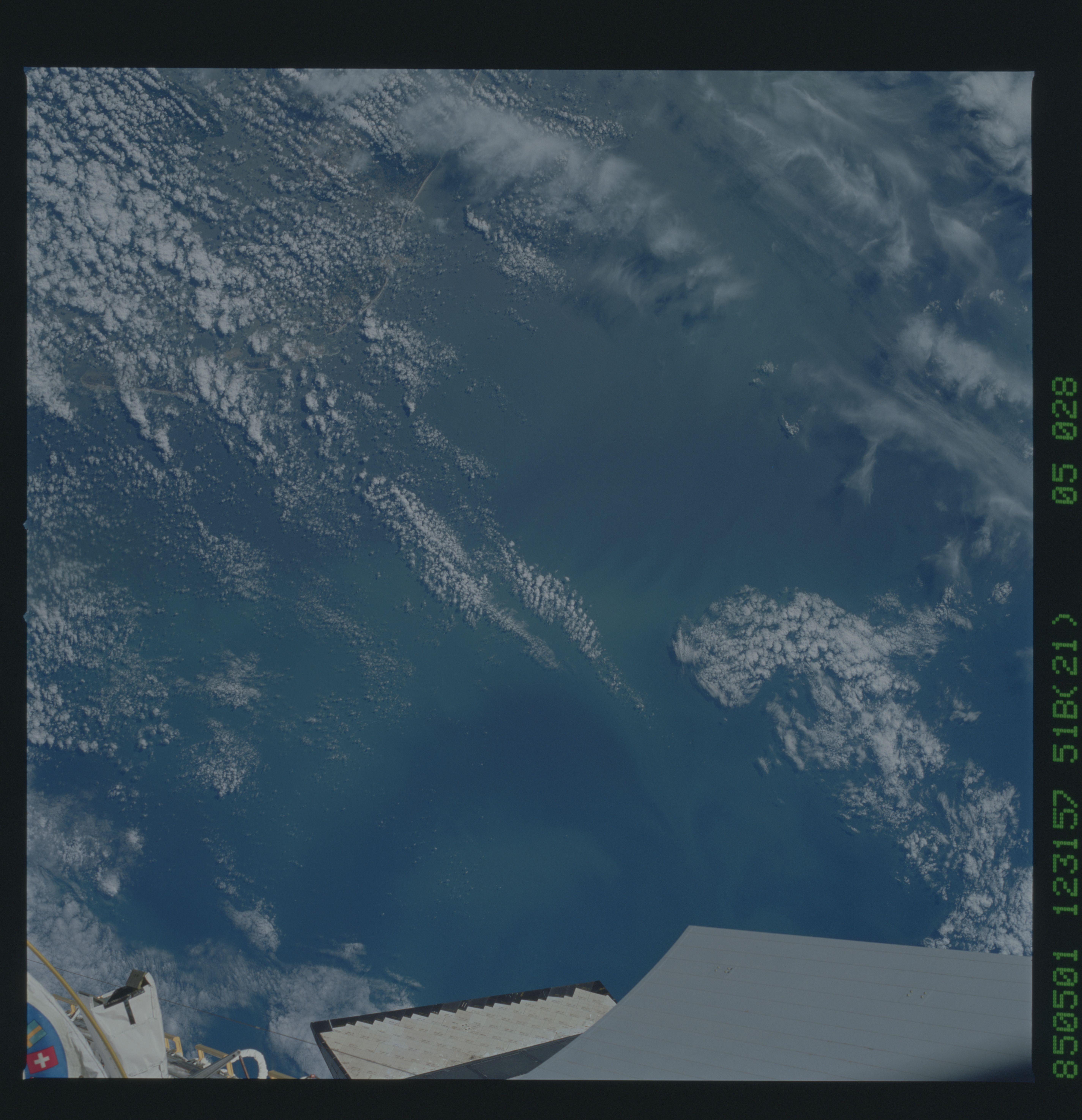
Image Caption: This near vertical photograph was taken of the Dutch coast from
an altitude of 363 km (196 n.mi.) using a Hasselblad camera
equipped with a 100 mm lens. Distance across the photograph is
approximately 200 km (108 n.mi). Turbid coastal waters appear to
delineate a large eddy (center top of the photo) located about 50
km offshore of the coast of The Netherlands (bottom right portion
of the photo). (S51B-35-028)
