STS51B-33-32
| NASA Photo ID | STS51B-33-32 |
| Focal Length | 100mm |
| Date taken | 1985.__.__ |
| Time taken | GMT |
Resolutions offered for this image:
3904 x 3904 pixels 639 x 639 pixels 5700 x 5900 pixels 500 x 518 pixels
3904 x 3904 pixels 639 x 639 pixels 5700 x 5900 pixels 500 x 518 pixels
Cloud masks available for this image:
Spacecraft nadir point:
Photo center point: 44.5° N, 75.0° W
Photo center point by machine learning:
Photo center point: 44.5° N, 75.0° W
Photo center point by machine learning:
Nadir to Photo Center:
Spacecraft Altitude: nautical miles (0km)
Country or Geographic Name: | USA-NEW YORK |
Features: | ADIRONDACK MOUNTAINS |
| Features Found Using Machine Learning: | |
Cloud Cover Percentage: | 0 (no clouds present) |
Sun Elevation Angle: | ° |
Sun Azimuth: | ° |
Camera: | Hasselblad |
Focal Length: | 100mm |
Camera Tilt: | Near Vertical |
Format: | 5017: Kodak, natural color positive, Ektachrome, X Professional, ASA 64, standard base |
Film Exposure: | Normal |
| Additional Information | |
| Width | Height | Annotated | Cropped | Purpose | Links |
|---|---|---|---|---|---|
| 3904 pixels | 3904 pixels | No | No | Earth From Space collection | Download Image |
| 639 pixels | 639 pixels | No | No | Earth From Space collection | Download Image |
| 5700 pixels | 5900 pixels | No | No | Download Image | |
| 500 pixels | 518 pixels | No | No | Download Image |
Download Packaged File
Download a Google Earth KML for this Image
View photo footprint information
Download a GeoTIFF for this photo
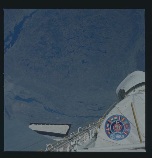
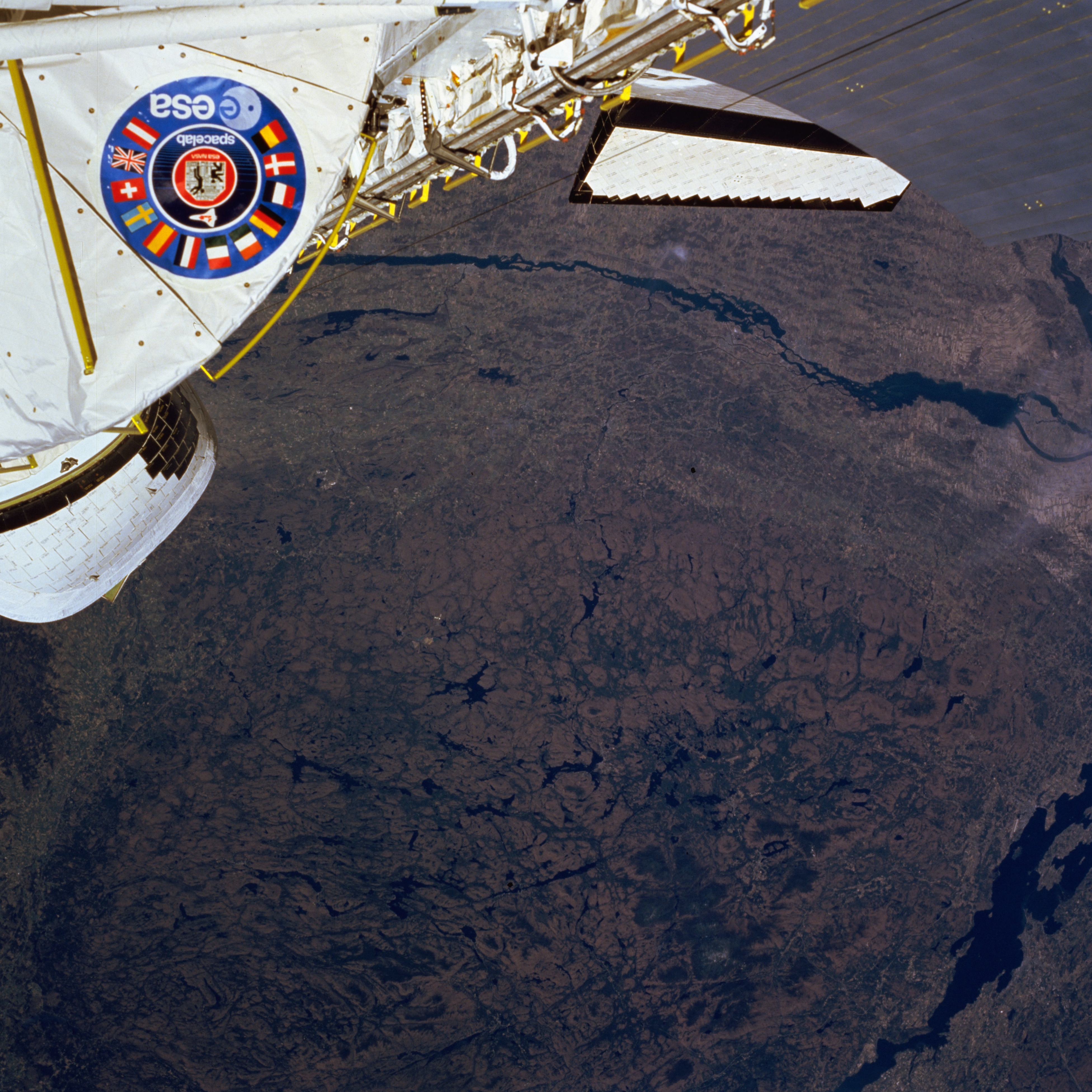
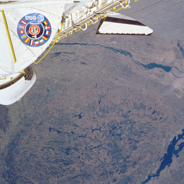
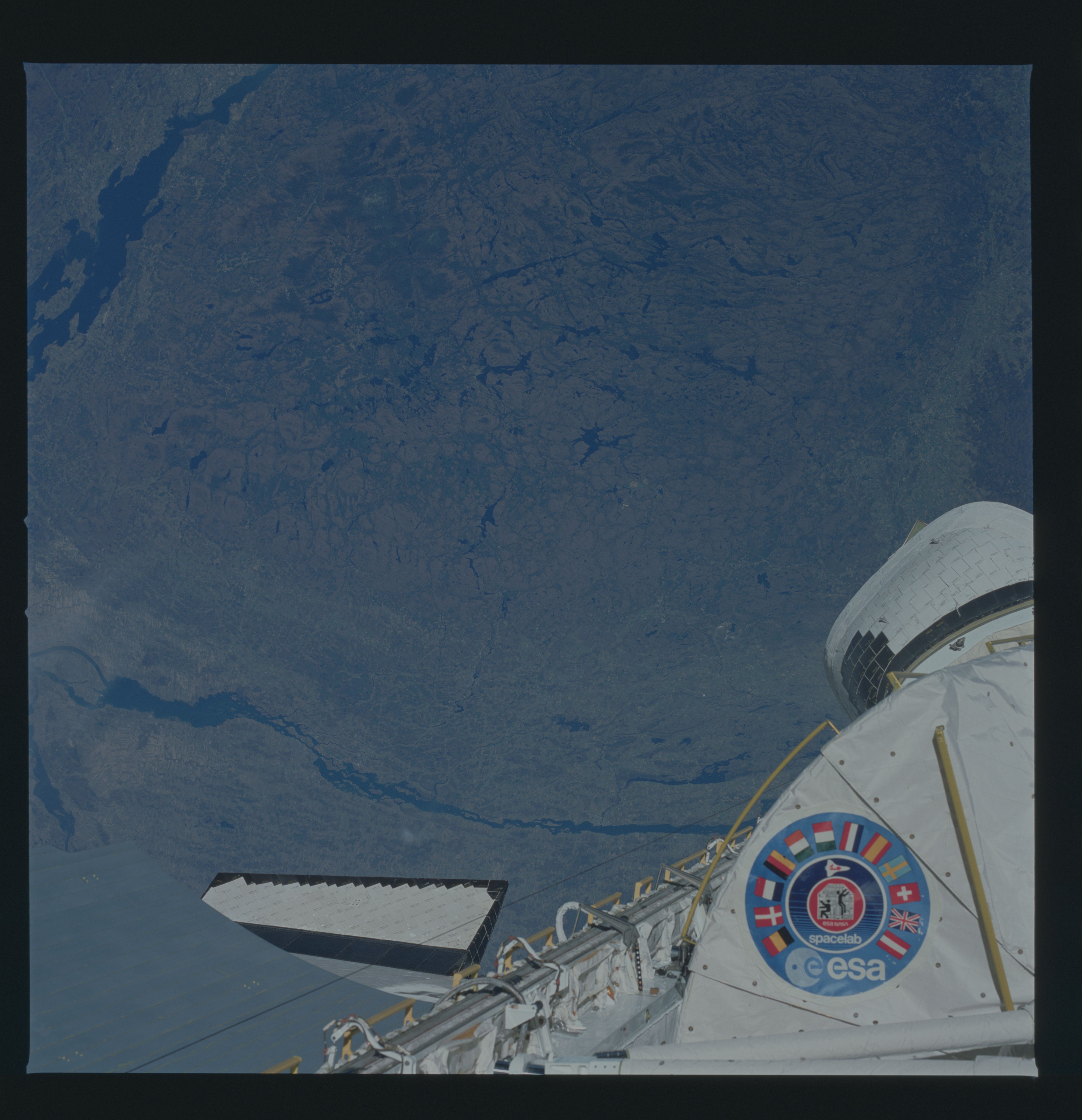
Image Caption: STS51B-33-0032 St. Lawrence River, Adirondack Mountains, New York May 1985
With the Space Shuttle covering the upper portions of the image, the rugged Adirondack Mountains are visible in this northwest-looking view. The Adirondacks are considered a part of the Laurentian Plateau of eastern Canada. The mountain range is bordered to the east by Lake Champlain and the Hudson River Valley (lower left); to the south by the Mohawk River Valley; to the west by the Black River Valley (lower left); and to the north by the St. Lawrence River lowland. Composed chiefly of metamorphic rocks, the Adirondacks were formed as igneous rocks (mainly granite), and intruded upward. Subsequent faulting of the earth's crust and surface erosion, particularly by glaciers, gives the mountains their rugged topography. The glaciers, the last of which occurred over 10000 years ago, have carved scenic gorges, waterfalls, and numerous lakes throughout the range. The Adirondacks are the source of the Hudson and Ausable Rivers. The mountain range continues to rise about three millimeters a year. The region is a year-around resort and recreational area.
With the Space Shuttle covering the upper portions of the image, the rugged Adirondack Mountains are visible in this northwest-looking view. The Adirondacks are considered a part of the Laurentian Plateau of eastern Canada. The mountain range is bordered to the east by Lake Champlain and the Hudson River Valley (lower left); to the south by the Mohawk River Valley; to the west by the Black River Valley (lower left); and to the north by the St. Lawrence River lowland. Composed chiefly of metamorphic rocks, the Adirondacks were formed as igneous rocks (mainly granite), and intruded upward. Subsequent faulting of the earth's crust and surface erosion, particularly by glaciers, gives the mountains their rugged topography. The glaciers, the last of which occurred over 10000 years ago, have carved scenic gorges, waterfalls, and numerous lakes throughout the range. The Adirondacks are the source of the Hudson and Ausable Rivers. The mountain range continues to rise about three millimeters a year. The region is a year-around resort and recreational area.
