STS51B-31-60
| NASA Photo ID | STS51B-31-60 |
| Focal Length | 100mm |
| Date taken | 1985.04.30 |
| Time taken | 08:59:54 GMT |

Cloud masks available for this image:
Spacecraft nadir point: 46.0° N, 43.9° E
Photo center point: 45.5° N, 50.5° E
Photo center point by machine learning:
Photo center point: 45.5° N, 50.5° E
Photo center point by machine learning:
Nadir to Photo Center: East
Spacecraft Altitude: 195 nautical miles (361km)
Country or Geographic Name: | KAZAKHSTAN |
Features: | CASPIAN SEA, VOLGA RIVER |
| Features Found Using Machine Learning: | |
Cloud Cover Percentage: | 40 (26-50)% |
Sun Elevation Angle: | 58° |
Sun Azimuth: | 179° |
Camera: | Hasselblad |
Focal Length: | 100mm |
Camera Tilt: | Low Oblique |
Format: | 5017: Kodak, natural color positive, Ektachrome, X Professional, ASA 64, standard base |
Film Exposure: | Normal |
| Additional Information | |
| Width | Height | Annotated | Cropped | Purpose | Links |
|---|---|---|---|---|---|
| 5700 pixels | 5900 pixels | No | No | Download Image | |
| 500 pixels | 518 pixels | No | No | Download Image | |
| 816 pixels | 885 pixels | Shuttle-Mir Book | Download Image |
Download Packaged File
Download a Google Earth KML for this Image
View photo footprint information
Download a GeoTIFF for this photo
Image Caption:
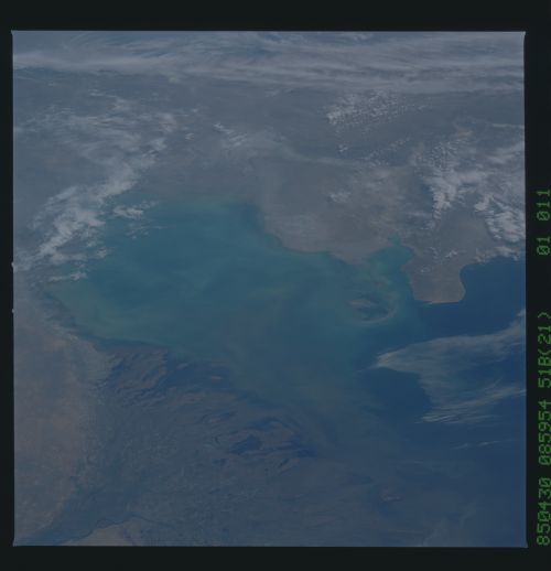
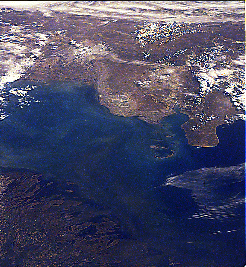
Northern Caspian coastline. The great gulf of the northeast
Caspian Sea (center) is bluer, the northwest browner as a result
of sediment delivered by the Volga River, the great delta of
which occupies the entire bottom of the scene. Salt flats and
ancient shorelines can be seen on the opposite (eastern) side
between clouds. (51B-31-060)
