STS51B-147-16
| NASA Photo ID | STS51B-147-16 |
| Focal Length | 250mm |
| Date taken | 1985.__.__ |
| Time taken | GMT |
Cloud masks available for this image:
Spacecraft nadir point:
Photo center point: 39.5° N, 91.3° W
Photo center point by machine learning:
Photo center point: 39.5° N, 91.3° W
Photo center point by machine learning:
Nadir to Photo Center:
Spacecraft Altitude: nautical miles (0km)
Country or Geographic Name: | USA-MISSOURI |
Features: | MISSISSIPPI R, ILLINOIS R |
| Features Found Using Machine Learning: | |
Cloud Cover Percentage: | 0 (no clouds present) |
Sun Elevation Angle: | ° |
Sun Azimuth: | ° |
Camera: | Linhof |
Focal Length: | 250mm |
Camera Tilt: | Near Vertical |
Format: | 5017: Kodak, natural color positive, Ektachrome, X Professional, ASA 64, standard base |
Film Exposure: | Normal |
| Additional Information | |
| Width | Height | Annotated | Cropped | Purpose | Links |
|---|---|---|---|---|---|
| 5184 pixels | 4096 pixels | No | No | Earth From Space collection | Download Image |
| 640 pixels | 505 pixels | No | No | Earth From Space collection | Download Image |
| 640 pixels | 480 pixels | No | No | ISD 1 | Download Image |
Download Packaged File
Download a Google Earth KML for this Image
View photo footprint information
Download a GeoTIFF for this photo
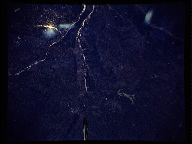
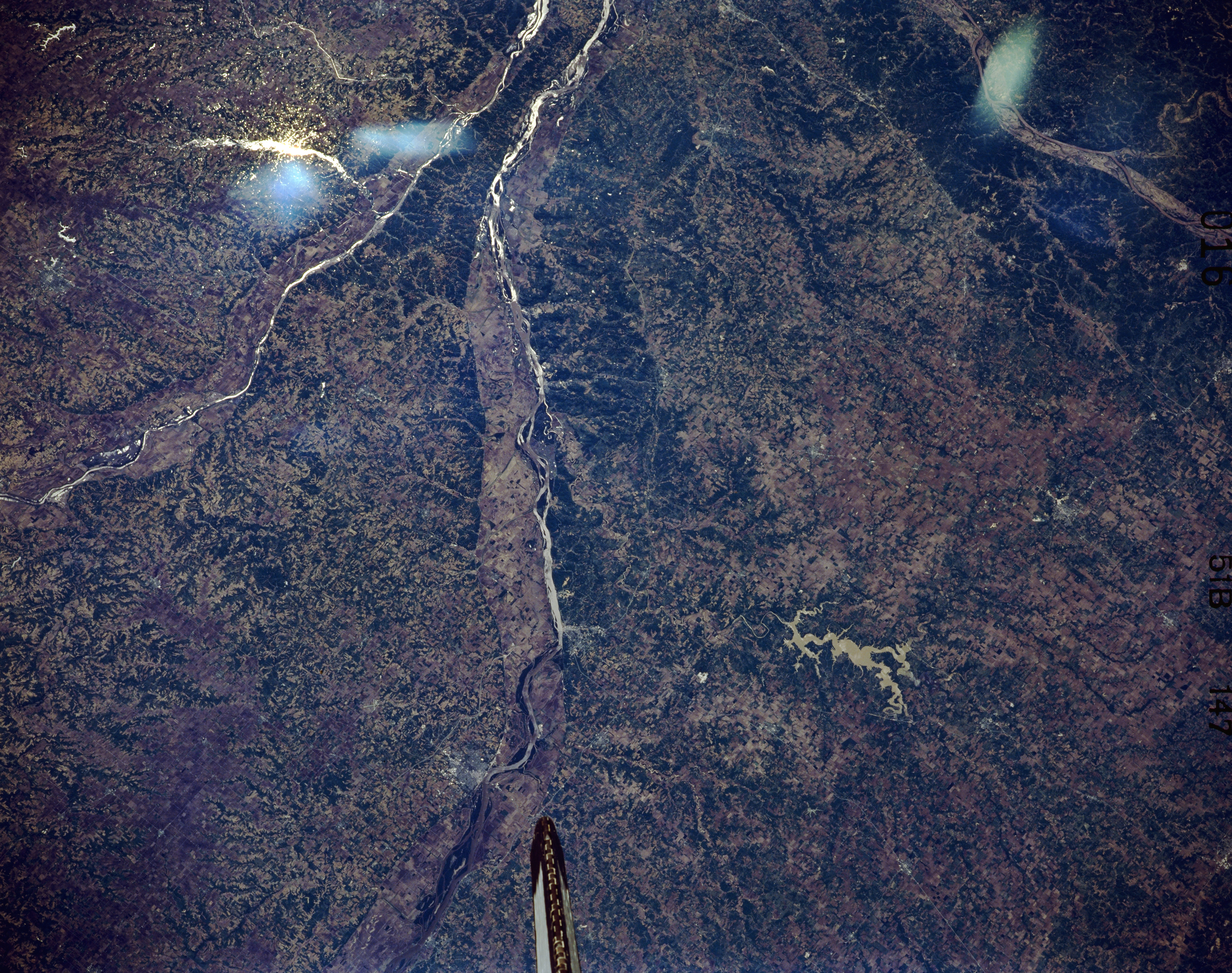
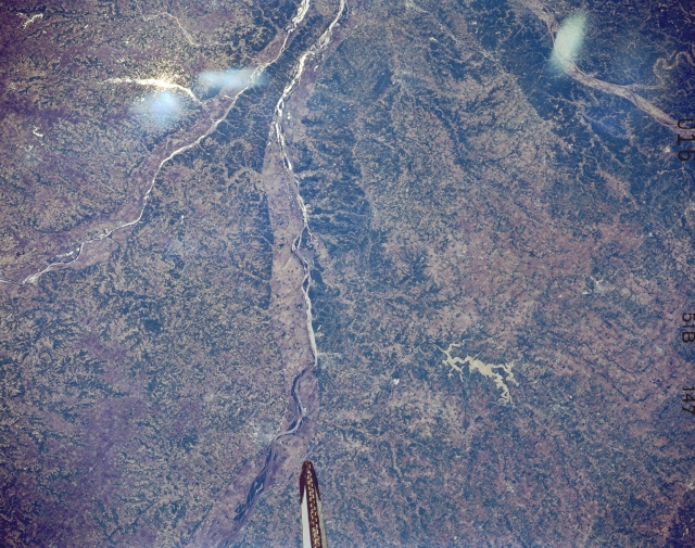
Image Caption: STS51B-147-0016 Mississippi River, Illinois May 1985
This panoramic south-looking view shows the Mississippi River entering the scene to the left of the bottom center (north) near Canton, Missouri. The Mississippi River exits the scene just to the north of where the Illinois River enters the Mississippi River at the top center of the image. This part of the middle Mississippi River is a rich grain and livestock area, a part of the Great Corn Belt Region of the Midwestern United States. The Illinois River can be seen entering the scene at the left center of the image. The Missouri River and the extreme northeastern portion of the Ozark Plateau of east central Missouri are visible in the top right quadrant of the image. In the bottom right quarter of the image, the Clarence Cannon Reservoir, a recreational lake on the Salt River, is discernible. The streaks visible in the upper left and upper right portions of the image are caused by the glare of the sun on the Space Shuttle window.
This panoramic south-looking view shows the Mississippi River entering the scene to the left of the bottom center (north) near Canton, Missouri. The Mississippi River exits the scene just to the north of where the Illinois River enters the Mississippi River at the top center of the image. This part of the middle Mississippi River is a rich grain and livestock area, a part of the Great Corn Belt Region of the Midwestern United States. The Illinois River can be seen entering the scene at the left center of the image. The Missouri River and the extreme northeastern portion of the Ozark Plateau of east central Missouri are visible in the top right quadrant of the image. In the bottom right quarter of the image, the Clarence Cannon Reservoir, a recreational lake on the Salt River, is discernible. The streaks visible in the upper left and upper right portions of the image are caused by the glare of the sun on the Space Shuttle window.
