STS51B-146-158
| NASA Photo ID | STS51B-146-158 |
| Focal Length | 250mm |
| Date taken | 1985.__.__ |
| Time taken | GMT |
Cloud masks available for this image:
Spacecraft nadir point:
Photo center point: 45.3° N, 73.2° W
Photo center point by machine learning:
Photo center point: 45.3° N, 73.2° W
Photo center point by machine learning:
Nadir to Photo Center:
Spacecraft Altitude: nautical miles (0km)
Country or Geographic Name: | CANADA-Q |
Features: | MONTREAL, ST. LAWRENCE R. |
| Features Found Using Machine Learning: | |
Cloud Cover Percentage: | 10 (1-10)% |
Sun Elevation Angle: | ° |
Sun Azimuth: | ° |
Camera: | Linhof |
Focal Length: | 250mm |
Camera Tilt: | Low Oblique |
Format: | 5017: Kodak, natural color positive, Ektachrome, X Professional, ASA 64, standard base |
Film Exposure: | Normal |
| Additional Information | |
| Width | Height | Annotated | Cropped | Purpose | Links |
|---|---|---|---|---|---|
| 5184 pixels | 4096 pixels | No | No | Earth From Space collection | Download Image |
| 640 pixels | 505 pixels | No | No | Earth From Space collection | Download Image |
| 640 pixels | 480 pixels | No | No | ISD 1 | Download Image |
Download Packaged File
Download a Google Earth KML for this Image
View photo footprint information
Download a GeoTIFF for this photo
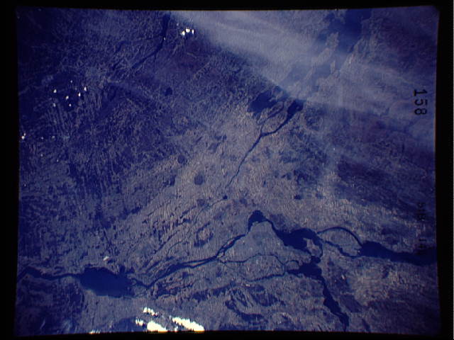
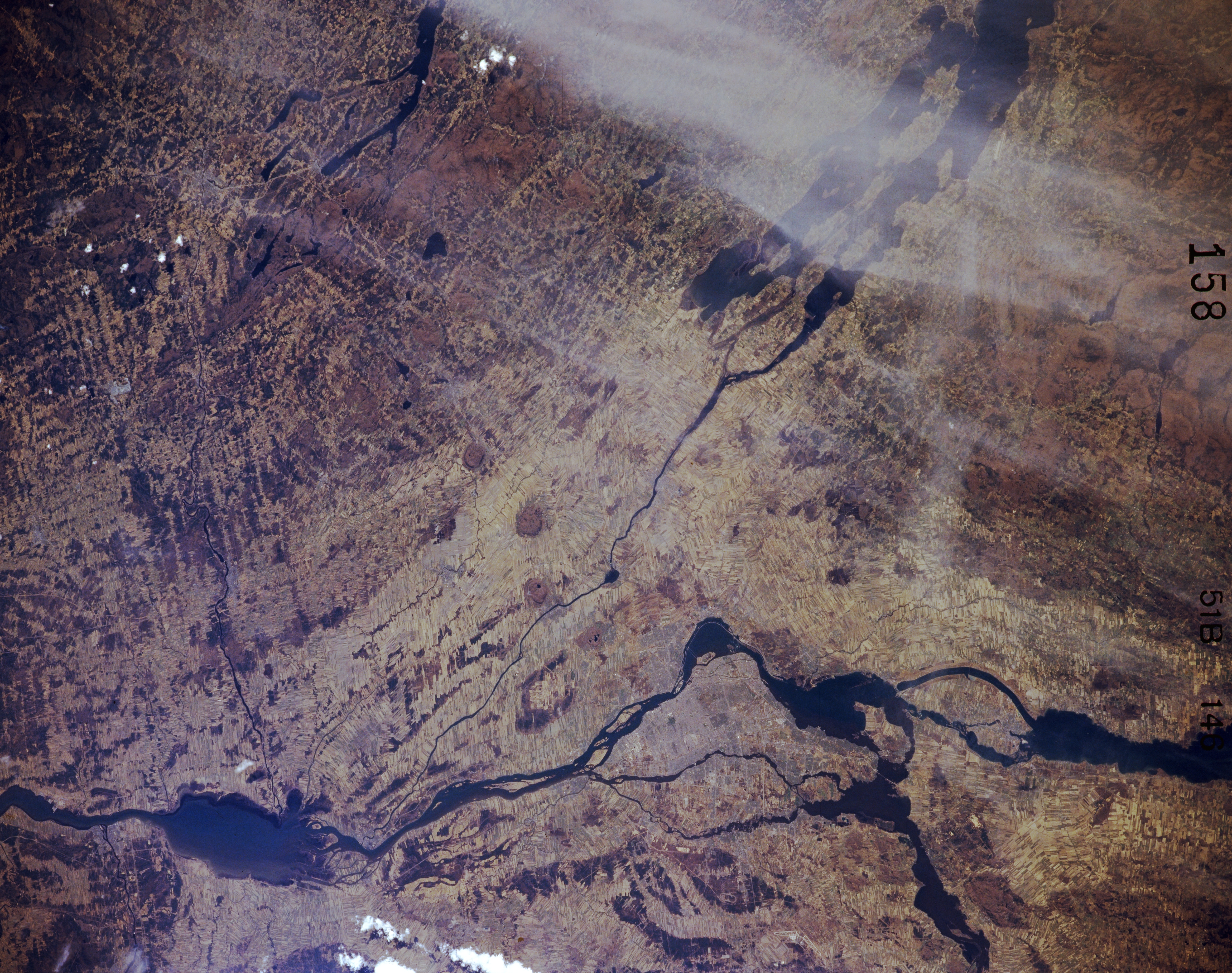
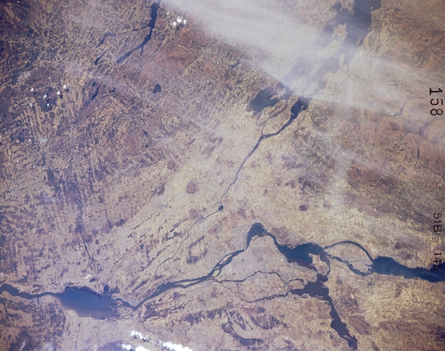
Image Caption: STS51B-146-158 St. Lawrence River, Quebec, Canada May 1985
A complex network of several waterways and rivers converge on the St. Lawrence River in the vicinity of Montreal (just below the center of the image). Except for a few bridges, the urban infrastructure of Montreal is not obvious on this small scale image. The Ottawa River enters the St. Lawrence River west of Montreal (lower edge, right of center). The St. Lawrence River extends across the entire picture from Lake St. Francis (lower right edge of image) to northeast of St. Peter Lake (dark, oval shaped feature, lower left). The large water body partially obscured by wispy clouds at the top edge of the image is Lake Champlain.
A complex network of several waterways and rivers converge on the St. Lawrence River in the vicinity of Montreal (just below the center of the image). Except for a few bridges, the urban infrastructure of Montreal is not obvious on this small scale image. The Ottawa River enters the St. Lawrence River west of Montreal (lower edge, right of center). The St. Lawrence River extends across the entire picture from Lake St. Francis (lower right edge of image) to northeast of St. Peter Lake (dark, oval shaped feature, lower left). The large water body partially obscured by wispy clouds at the top edge of the image is Lake Champlain.
