STS51A-45-58
| NASA Photo ID | STS51A-45-58 |
| Focal Length | 250mm |
| Date taken | 1984.11.__ |
| Time taken | GMT |
Resolutions offered for this image:
4096 x 4096 pixels 640 x 640 pixels 5700 x 5900 pixels 483 x 500 pixels 640 x 480 pixels
4096 x 4096 pixels 640 x 640 pixels 5700 x 5900 pixels 483 x 500 pixels 640 x 480 pixels
Cloud masks available for this image:
Spacecraft nadir point:
Photo center point: 18.6° S, 63.2° W
Photo center point by machine learning:
Photo center point: 18.6° S, 63.2° W
Photo center point by machine learning:
Nadir to Photo Center:
Spacecraft Altitude: nautical miles (0km)
Country or Geographic Name: | BOLIVIA |
Features: | RIO GRANDE |
| Features Found Using Machine Learning: | |
Cloud Cover Percentage: | 15 (11-25)% |
Sun Elevation Angle: | ° |
Sun Azimuth: | ° |
Camera: | Hasselblad |
Focal Length: | 250mm |
Camera Tilt: | Low Oblique |
Format: | 6017: Kodak Ektachrome 64, 220 Roll Format |
Film Exposure: | Normal |
| Additional Information | |
| Width | Height | Annotated | Cropped | Purpose | Links |
|---|---|---|---|---|---|
| 4096 pixels | 4096 pixels | No | No | Earth From Space collection | Download Image |
| 640 pixels | 640 pixels | No | No | Earth From Space collection | Download Image |
| 5700 pixels | 5900 pixels | No | No | Download Image | |
| 483 pixels | 500 pixels | No | No | Download Image | |
| 640 pixels | 480 pixels | No | No | Download Image |
Download Packaged File
Download a Google Earth KML for this Image
View photo footprint information
Download a GeoTIFF for this photo
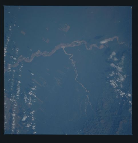
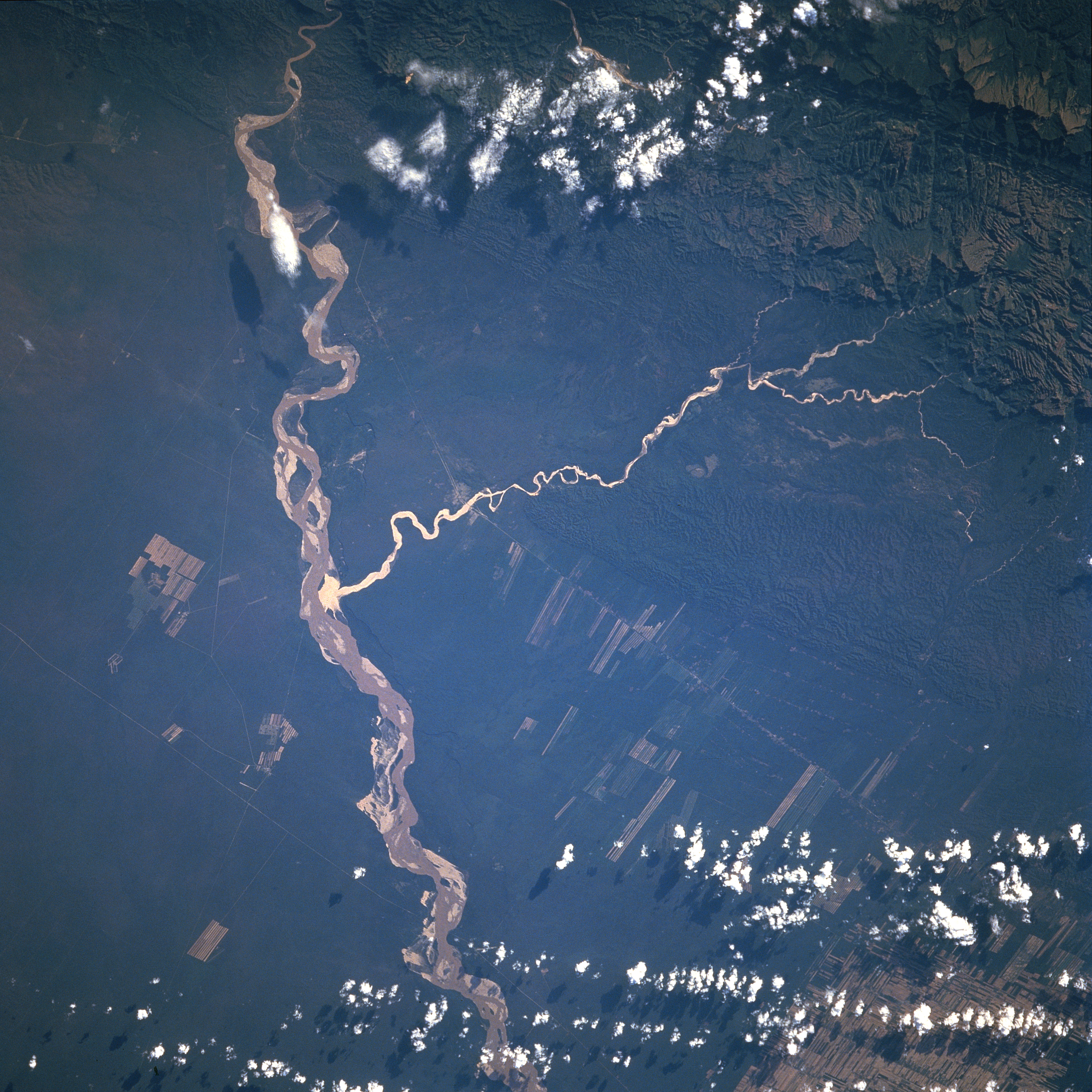
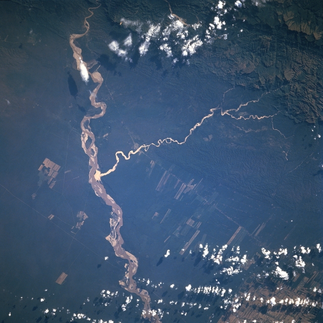
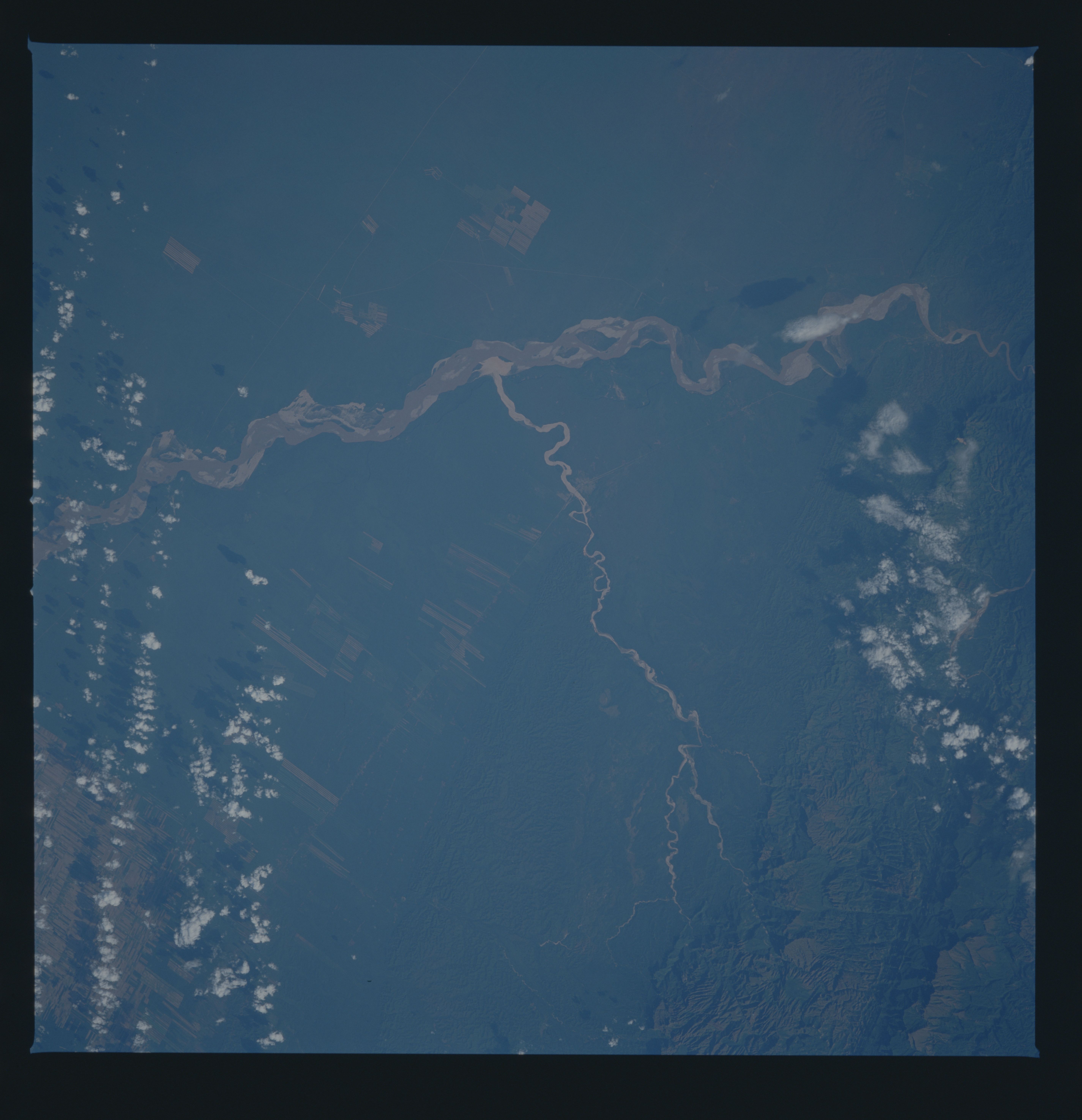
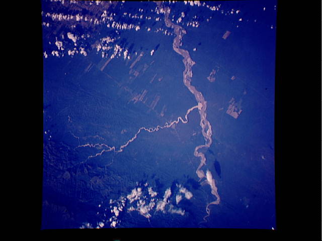
Image Caption: STS51A-45-0058 Grande (Guapay) River, Bolivia November 1984
The Grande River, also known as the Guapay River, is visible as a sinuous, light-colored feature that gradually bends southwestward in south central Bolivia. Numerous sand bars (highly reflective features) within the river help to establish the width of this broad floodplain. Notice the short flowing but highly silted tributary stream (also highly reflective, white-colored) that joins the much larger Grande River as it drains southeast and has built up a light colored delta at it's mouth. The thin, straight (light-colored) lines are mainly a pipeline and a railroad right-of-way (diagonally crossing the image). The angular, elongated, and multicolored patterns shows the distribution of the widely spaced farmlands in this lowland region south of Santa Cruz (not in this picture). Cultivated fields are partially visible (although clouds obscure some of the agricultural fields) in the lower right corner of the image. The upper right corner of the picture shows a limited section of the rugged, sparsely populated and forested foothills of the Andes Mountains.
The Grande River, also known as the Guapay River, is visible as a sinuous, light-colored feature that gradually bends southwestward in south central Bolivia. Numerous sand bars (highly reflective features) within the river help to establish the width of this broad floodplain. Notice the short flowing but highly silted tributary stream (also highly reflective, white-colored) that joins the much larger Grande River as it drains southeast and has built up a light colored delta at it's mouth. The thin, straight (light-colored) lines are mainly a pipeline and a railroad right-of-way (diagonally crossing the image). The angular, elongated, and multicolored patterns shows the distribution of the widely spaced farmlands in this lowland region south of Santa Cruz (not in this picture). Cultivated fields are partially visible (although clouds obscure some of the agricultural fields) in the lower right corner of the image. The upper right corner of the picture shows a limited section of the rugged, sparsely populated and forested foothills of the Andes Mountains.
