STS51A-34-40
| NASA Photo ID | STS51A-34-40 |
| Focal Length | 250mm |
| Date taken | 1984.11.10 |
| Time taken | 11:33:57 GMT |
Resolutions offered for this image:
5700 x 5900 pixels 483 x 500 pixels 640 x 480 pixels 1256 x 1290 pixels 4096 x 4064 pixels 463 x 453 pixels
5700 x 5900 pixels 483 x 500 pixels 640 x 480 pixels 1256 x 1290 pixels 4096 x 4064 pixels 463 x 453 pixels

Cloud masks available for this image:
Spacecraft nadir point: 16.3° S, 46.0° E
Photo center point: 16.0° S, 46.5° E
Photo center point by machine learning:
Photo center point: 16.0° S, 46.5° E
Photo center point by machine learning:
Nadir to Photo Center: Northeast
Spacecraft Altitude: 169 nautical miles (313km)
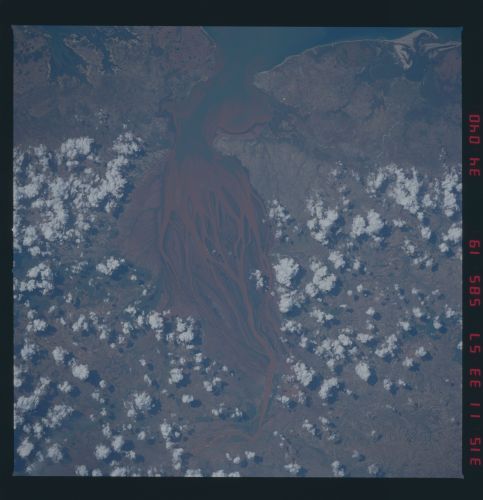
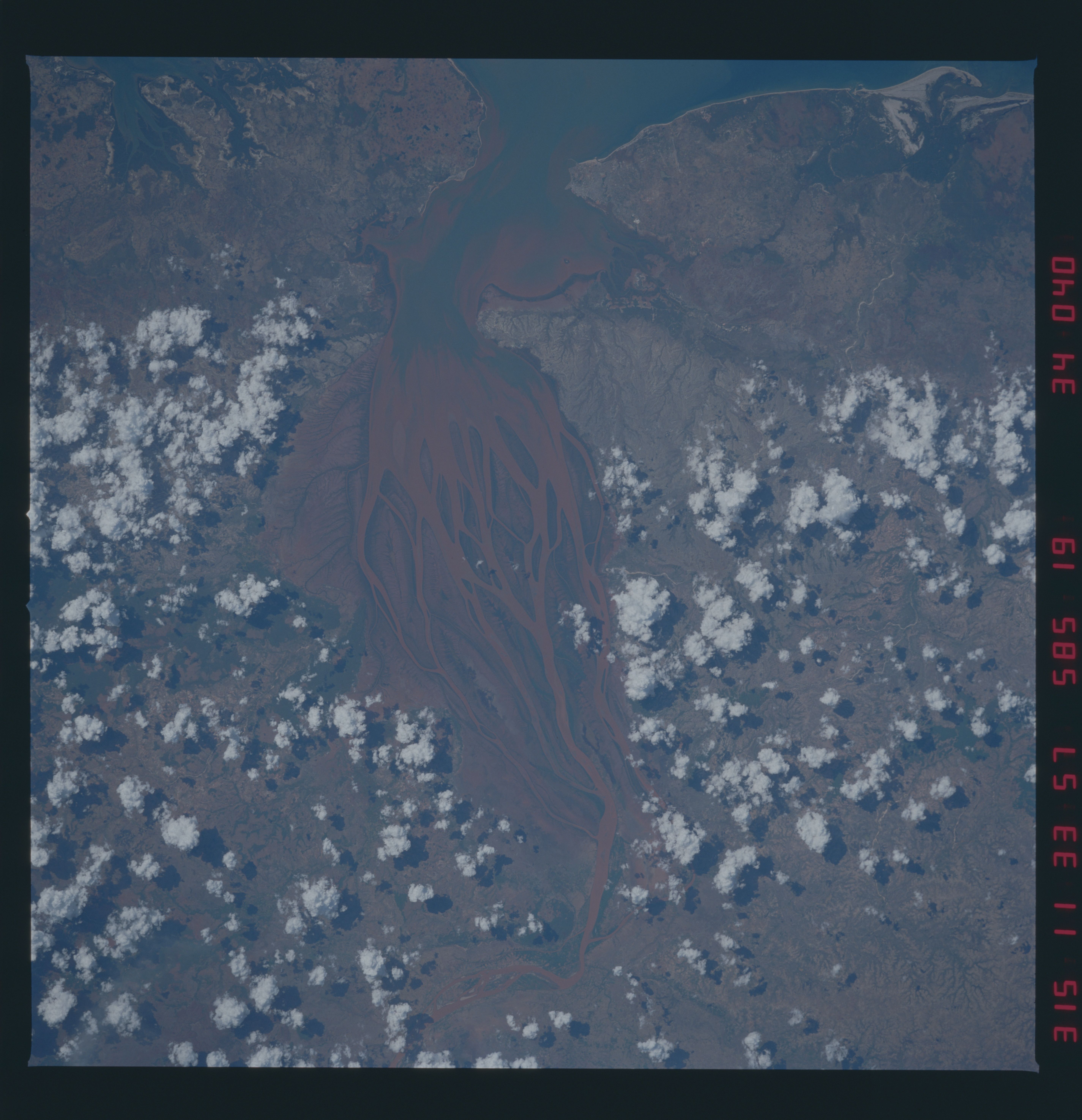
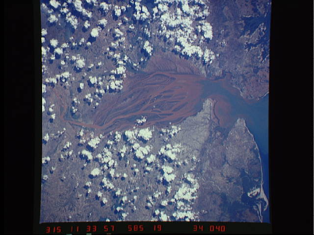
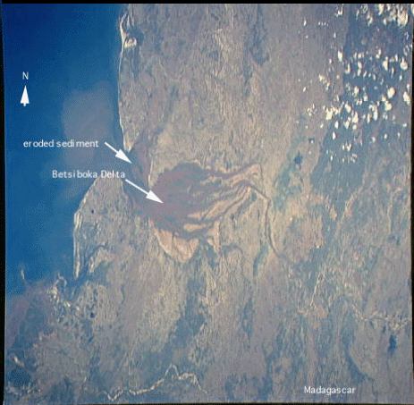
Country or Geographic Name: | MADAGASCAR |
Features: | BETSIBOKA R. DELTA |
| Features Found Using Machine Learning: | |
Cloud Cover Percentage: | 25 (11-25)% |
Sun Elevation Angle: | 48° |
Sun Azimuth: | 262° |
Camera: | Hasselblad |
Focal Length: | 250mm |
Camera Tilt: | 12 degrees |
Format: | 6017: Kodak Ektachrome 64, 220 Roll Format |
Film Exposure: | Normal |
| Additional Information | |
| Width | Height | Annotated | Cropped | Purpose | Links |
|---|---|---|---|---|---|
| 5700 pixels | 5900 pixels | No | No | Download Image | |
| 483 pixels | 500 pixels | No | No | Download Image | |
| 640 pixels | 480 pixels | No | No | Download Image | |
| 1256 pixels | 1290 pixels | No | No | Download Image | |
| 4096 pixels | 4064 pixels | No | No | Download Image | |
| 463 pixels | 453 pixels | Yes | No | Download Image |
Download Packaged File
Download a Google Earth KML for this Image
View photo footprint information
Download a GeoTIFF for this photo
Image Caption: Madagascar Betsiboka R. Delta
